Zuidhorn
Zuidhorn (Dutch pronunciation: [ˈzœytɦɔrn] (![]() listen)) is a town and former municipality in the northeastern Netherlands. The town largely depends on the city of Groningen. A railway line, operated by Arriva, connects the town with Leeuwarden in Friesland and Groningen.
listen)) is a town and former municipality in the northeastern Netherlands. The town largely depends on the city of Groningen. A railway line, operated by Arriva, connects the town with Leeuwarden in Friesland and Groningen.
Zuidhorn | |
|---|---|
Town, former municipality | |
 Former courthouse in Zuidhorn | |
 Flag  Coat of arms | |
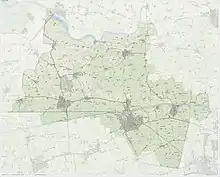
.svg.png.webp) Location in Groningen | |
| Coordinates: 53°15′N 6°24′E | |
| Country | Netherlands |
| Province | Groningen |
| municipality | Westerkwartier |
| Area | |
| • Total | 128.37 km2 (49.56 sq mi) |
| • Land | 125.56 km2 (48.48 sq mi) |
| • Water | 2.81 km2 (1.08 sq mi) |
| Elevation | 4 m (13 ft) |
| Time zone | UTC+1 (CET) |
| • Summer (DST) | UTC+2 (CEST) |
| Postcode | Parts of 9800 range |
| Area code | 0594 |
| Website | www |
Due to a municipal reoganisation in 1990, Zuidhorn municipality was extended when it merged with, though not physically connected to Oldehove, Grijpskerk and Aduard. On 1 January 2019, the municipality was dissolved and merged into the municipality of Westerkwartier.[3]
Transport
Zuidhorn has two train stations: Zuidhorn and Grijpskerk. At least once an hour a train runs between Groningen and Leeuwarden. On weekdays, trains stop twice an hour in Zuidhorn. Until 1991 there used to be a third station on this line, Visvliet.
Nature
In the center of Zuidhorn, lies a large, partly wooded park called "Johan Smit Park". It offers a wide variety of recreation, open to the public, based on trails. The "Quick Silver S" is the main sport hall, hosting many activities such as a running clubs, and other sports. Nearby, the park has numerous football fields and a playground. For most of the year, docile highland cattle roam the park.
Wierden
There is a dense concentration of terps, better known as wierden, artificial dwelling hills, in the area Middag-Humsterland. In 1995, this collection of wierden was submitted to UNESCO's list of World Heritage Sites. The property is currently on the tentative list.[4][5]
Population centres
Aalsum, Aduard, Balmahuizen, Barnwerd, Briltil, De Kampen, De Poffert, De Ruigewaard, Den Ham, Den Horn, Diepswal, Electra, Englum, Fransum, Frytum, Gaaikemadijk, Gaaikemaweer, Gaarkeuken, Grijpskerk, Heereburen, Hoekje, Hoogemeeden, Humsterland, Ikum, Kenwerd, Kommerzijl, Korhorn, Lagemeeden, Lammerburen, Lauwerzijl, Niehove, Nieuwklap, Niezijl, Noorderburen, Noordhorn, Noordhornerga, Noordhornertolhek, Okswerd, Oldehove, Pama, Pieterzijl, Ruigezand, Saaksum, Selwerd, Spanjaardsdijk, Steentil, Visvliet, Wierumerschouw and Zuidhorn.
Notable people
- John William, Baron Ripperda (1684–1737) political adventurer and Spanish Prime Minister [6]
- Marten Douwes Teenstra (1795-1864) writer and traveller in South Africa and the Dutch East Indies
- Albert Egges van Giffen (1884–1973) archaeologist, specialised in hunebeds and tumuli
- Jan Wiegers (1893-1959) expressionist painter
- Roelof Kruisinga (1922–2012) politician and physician
- Bert Groen (born 1945) corporate director, former civil servant and politician
- Paul Blokhuis (born 1963) politician
Sport
- Matthijs Vellenga (born 1977) rower, medallist at the 2004 Summer Olympics
- David Kuiper (born 1980) rower
- Hieke Zijlstra (born 1981) footballer
References
- "Kerncijfers wijken en buurten 2020" [Key figures for neighbourhoods 2020]. StatLine (in Dutch). CBS. 24 July 2020. Retrieved 19 September 2020.
- "Postcodetool for 9801AJ". Actueel Hoogtebestand Nederland (in Dutch). Het Waterschapshuis. Retrieved 10 February 2014.
- "Gemeentelijke indeling op 1 januari 2019". CBS (in Dutch). Retrieved 30 November 2019.
- Tentative List for the Netherlands. The World Heritage Platform. Retrieved on 2009-07-23.
- Middag and Humsterland. UNESCO World Heritage Centre. Retrieved on 2009-07-23.
- . Encyclopædia Britannica. 23 (11th ed.). 1911.
External links
 Media related to Zuidhorn at Wikimedia Commons
- Official website
Places adjacent to Zuidhorn | ||||||||||
|---|---|---|---|---|---|---|---|---|---|---|
| ||||||||||
| Authority control |
|---|
