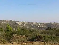
'Anin
'Anin (Arabic: عانين) a Palestinian village in the West Bank governorate of Jenin. According to the Palestinian Central Bureau of Statistics, the village had a population of 3,719 inhabitants in mid-year 2006.[2]
'Anin | |
|---|---|
| Arabic transcription(s) | |
| • Arabic | عانين |
 | |
 'Anin Location of 'Anin within Palestine | |
| Coordinates: 32°30′05″N 35°10′04″E | |
| Palestine grid | 165/211 |
| State | State of Palestine |
| Governorate | Jenin |
| Government | |
| • Type | Village council |
| Population (2006) | |
| • Total | 3,719 |
| Name meaning | from personal name, or possibly from fountain[1] |
History
Potsherds from Iron Age I,[3] IA II,[3] Persian,[3] early and late Roman,[3] Byzantine,[3] early Muslim and the Middle Ages have been found here.[3]
"Immediately north of the village is a rock-cut passage large enough to walk along, extending about 50 feet and lined with cement; it then becomes about a foot high. This leads out on to a flat surface of rock.(...) Two rock-cut tombs, now blocked, exist west of this."[4][5]
Ottoman era
'Anin, like the rest of Palestine, was incorporated into the Ottoman Empire in 1517, and in the census of 1596 it was a part of the nahiya ("subdistrict") of Sahil Atlit which was under the administration of the liwa ("district") of Lajjun. The village had a population of 16 households, all Muslim. The villagers paid a fixed tax rate of 25% on wheat, barley, summer crops, olive trees, in addition to occasional revenues and a press for olive oil or grape syrup; a total of 3,600 akçe.[6] Potsherds from the Ottoman era have also been found here.[3]
In 1882, the PEF's Survey of Western Palestine described Anin as: "a small village on a ridge, partly built of stone, with a small olive grove beneath it on the west, and two wells on that side. It has the appearance of an ancient site, having rock-cut tombs, and a curious channel for water."[7]
British mandate era
In the 1922 census of Palestine, conducted by the British Mandate authorities, the village had a population of 360 Muslims,[8] increasing in the 1931 census to 447 Muslims, in 68 houses.[9]
In the 1944/5 statistics the population of Anin was 590 Muslims,[10] with a total of 15,049 dunams of land, according to an official land and population survey.[11] Of this, 1,769 dunams were used for plantations and irrigable land, 1,806 dunams for cereals,[12] while 13 dunams were built-up (urban) land.[13]
Jordanian era
After the 1948 Arab-Israeli War, 'Anin came under Jordanian rule.
The Jordanian census of 1961 found 752 inhabitants.[14]
Post-1967
'Anin has been under Israeli occupation along with the rest of the West Bank since the 1967 Six-Day War.
References
- Palmer, 1881, p. 143
- Projected Mid -Year Population for Jenin Governorate by Locality 2004- 2006 Palestinian Central Bureau of Statistics
- Zertal, 2016, pp. 127-130
- Conder and Kitchener, 1882, SWP II, p. 51
- Dauphin, 1998, p. 748
- Hütteroth and Abdulfattah, 1977, p. 159
- Conder and Kitchener, 1882, SWP II, p. 44
- Barron, 1923, Table IX, Sub-district of Jenin, p. 30
- Mills, 1932, p. 67
- Government of Palestine, Department of Statistics, 1945, p. 16 Archived 2018-09-05 at the Wayback Machine
- Government of Palestine, Department of Statistics. Village Statistics, April, 1945. Quoted in Hadawi, 1970, p. 54
- Government of Palestine, Department of Statistics. Village Statistics, April, 1945. Quoted in Hadawi, 1970, p. 98
- Government of Palestine, Department of Statistics. Village Statistics, April, 1945. Quoted in Hadawi, 1970, p. 148
- Government of Jordan, Department of Statistics, 1964, p. 25
Bibliography
- Barron, J.B., ed. (1923). Palestine: Report and General Abstracts of the Census of 1922. Government of Palestine.
- Conder, C.R.; Kitchener, H.H. (1882). The Survey of Western Palestine: Memoirs of the Topography, Orography, Hydrography, and Archaeology. 2. London: Committee of the Palestine Exploration Fund.
- Dauphin, Claudine (1998). La Palestine byzantine, Peuplement et Populations. BAR International Series 726 (in French). III : Catalogue. Oxford: Archeopress. ISBN 0-860549-05-4.
- Government of Jordan, Department of Statistics (1964). First Census of Population and Housing. Volume I: Final Tables; General Characteristics of the Population (PDF).
- Government of Palestine, Department of Statistics (1945). Village Statistics, April, 1945.
- Hadawi, S. (1970). Village Statistics of 1945: A Classification of Land and Area ownership in Palestine. Palestine Liberation Organization Research Center.
- Hütteroth, Wolf-Dieter; Abdulfattah, Kamal (1977). Historical Geography of Palestine, Transjordan and Southern Syria in the Late 16th Century. Erlanger Geographische Arbeiten, Sonderband 5. Erlangen, Germany: Vorstand der Fränkischen Geographischen Gesellschaft. ISBN 3-920405-41-2.
- Mills, E., ed. (1932). Census of Palestine 1931. Population of Villages, Towns and Administrative Areas. Jerusalem: Government of Palestine.
- Palmer, E.H. (1881). The Survey of Western Palestine: Arabic and English Name Lists Collected During the Survey by Lieutenants Conder and Kitchener, R. E. Transliterated and Explained by E.H. Palmer. Committee of the Palestine Exploration Fund.
- Zertal, A. (2016). The Manasseh Hill Country Survey. 3. Boston: BRILL. ISBN 9004312307.
External links
- Welcome To 'Anin
- Survey of Western Palestine, Map 8: IAA, Wikimedia commons
- Olive wars, 2014, BBC, 'Anin 16.00-21:00
| Cities |  | |
|---|---|---|
| Municipalities |
| |
| Villages |
| |
| Refugee camps | ||
