At-Tayba
at-Tayba (Arabic: خربة الطيبه) is a Palestinian village in the West Bank, located 18 km Northwest of the city of Jenin in the northern West Bank. According to the Palestinian Central Bureau of Statistics, the town had a population of 2,386 inhabitants in mid-year 2006.[2]
at-Tayba | |
|---|---|
| Arabic transcription(s) | |
| • Arabic | خربة الطيبه |
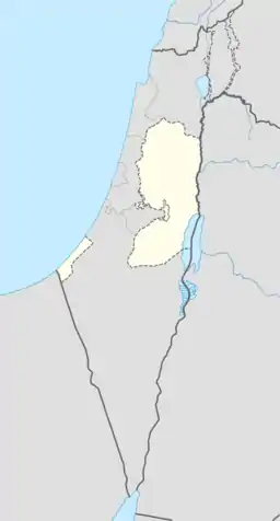
 at-Tayba Location of at-Tayba within Palestine | |
| Coordinates: 32°30′55″N 35°11′21″E | |
| Palestine grid | 167/213 |
| State | State of Palestine |
| Governorate | Jenin |
| Government | |
| • Type | Municipality |
| Population (2006) | |
| • Total | 2,386 |
| Name meaning | The goodly[1] |
History
Ceramics from the Persian,[3] late Roman,[3] Byzantine,[3][4] early Muslim and the Middle Ages have been found here.[3]
Ottoman era
At-Tayba was incorporated into the Ottoman Empire in 1517 with all of Palestine, and by the 1596 tax register it was part of nahiya (subdistrict) of Sara under the liwa' (district) of Lajjun, with a population of 6 Muslim households. The villagers paid a fixed tax rate of 25% on agricultural products, including wheat, barley, summer crops, olive trees, beehives and/or goats, in addition to occasional revenues; a total of 3,500 akçe.[5]
In 1882 the PEF's Survey of Western Palestine found here "a modern ruined village with springs."[6]
Jordanian era
In the wake of the 1948 Arab–Israeli War, and after the 1949 Armistice Agreements, At-Tayba came under Jordanian rule.
The Jordanian census of 1961 found 467 inhabitants in Taiyiba.[7]
Post-1967
Since the Six-Day War in 1967, At-Tayba has been under Israeli occupation.
Footnotes
- Palmer, 1881, p. 154
- Projected Mid -Year Population for Jenin Governorate by Locality 2004- 2006 Palestinian Central Bureau of Statistics
- Zertal, 2016, pp. 122-123
- Dauphin, 1998, pp. 743-4
- Hütteroth and Abdulfattah, 1977, p. 160
- Conder and Kitchener, 1882, SWP II, p. 68
- Government of Jordan, Department of Statistics, 1964, p. 25
Bibliography
- Conder, C.R.; Kitchener, H.H. (1882). The Survey of Western Palestine: Memoirs of the Topography, Orography, Hydrography, and Archaeology. 2. London: Committee of the Palestine Exploration Fund.
- Dauphin, Claudine (1998). La Palestine byzantine, Peuplement et Populations. BAR International Series 726 (in French). III : Catalogue. Oxford: Archeopress. ISBN 0-860549-05-4.
- Government of Jordan, Department of Statistics (1964). First Census of Population and Housing. Volume I: Final Tables; General Characteristics of the Population (PDF).
- Hütteroth, Wolf-Dieter; Abdulfattah, Kamal (1977). Historical Geography of Palestine, Transjordan and Southern Syria in the Late 16th Century. Erlanger Geographische Arbeiten, Sonderband 5. Erlangen, Germany: Vorstand der Fränkischen Geographischen Gesellschaft. ISBN 3-920405-41-2.
- Palmer, E.H. (1881). The Survey of Western Palestine: Arabic and English Name Lists Collected During the Survey by Lieutenants Conder and Kitchener, R. E. Transliterated and Explained by E.H. Palmer. Committee of the Palestine Exploration Fund.
- Zertal, A. (2016). The Manasseh Hill Country Survey. 3. Boston: BRILL. ISBN 9004312307.
External links
- Welcome To Kh. al-Tayiba
- Survey of Western Palestine, Map 8: IAA, Wikimedia commons

