1877 survey marker 48
The State Line Marker is a historic boundary marker on the state line between Arkansas and Oklahoma. It is located down a path a short way north of a parking area on Talimena Scenic Drive in Ouachita National Forest, about 17 miles (27 km) northwest of Mena, Arkansas. The marker is an octagonal cast iron pipe, with the legend "48 M" on the north face (signifying its marking of the 48th mile), "1877" on the south side (the year of the marker's erection), "ARK" (for Arkansas) on the east side, and "CHOC" (for Choctaw Territory) on the west side. The pipe is mounted in a stone and mortar base installed by the United States Forest Service in 1974. The marker was placed in 1877 following a series of controversial surveys to demarcate the border between Arkansas and what was then Indian Territory.[2]
State Line Marker | |
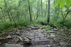 The marker as it appeared in May 2015. | |
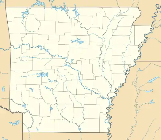  | |
| Nearest city | Mena, Arkansas |
|---|---|
| Coordinates | 34°41′38″N 94°27′19″W |
| Area | less than one acre |
| Built | 1877 |
| Architect | U.S. Army Engineers |
| NRHP reference No. | 76000448[1] |
| Added to NRHP | November 18, 1976 |
The marker was listed on the National Register of Historic Places in 1976.[1] This marker is one of the few surviving markers from this survey that is accessible to the public.[2]
See also
References
- "National Register Information System". National Register of Historic Places. National Park Service. July 9, 2010.
- "NRHP nomination for State Line Marker" (PDF). Arkansas Preservation. Retrieved 2015-05-10.
| Wikimedia Commons has media related to 1877 survey marker 48. |