National Register of Historic Places listings in Polk County, Arkansas
This is a list of the National Register of Historic Places listings in Polk County, Arkansas.
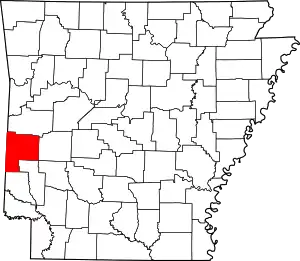
Location of Polk County in Arkansas
This is intended to be a complete list of the properties and districts on the National Register of Historic Places in Polk County, Arkansas, United States. The locations of National Register properties and districts for which the latitude and longitude coordinates are included below, may be seen in a map.[1]
There are 29 properties and districts listed on the National Register in the county. Another two properties were once listed but have been removed.
- This National Park Service list is complete through NPS recent listings posted February 5, 2021.[2]
Current listings
| [3] | Name on the Register[4] | Image | Date listed[5] | Location | City or town | Description |
|---|---|---|---|---|---|---|
| 1 | Bard Springs Bathhouse | 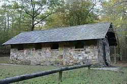 Bard Springs Bathhouse |
October 20, 1993 (#93001073) |
Forest Service Road 106, northwest of Athens, in the Caney Creek Wildlife Management Area of the Ouachita National Forest 34°23′26″N 94°00′38″W |
Athens | |
| 2 | Bard Springs Dam No. 1 | 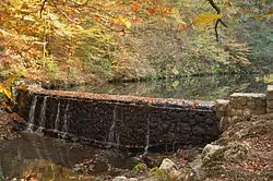 Bard Springs Dam No. 1 |
October 21, 1993 (#93001074) |
Forest Service Road 106, northwest of Athens, in the Caney Creek Wildlife Management Area of the Ouachita National Forest 34°23′27″N 94°00′41″W |
Athens | |
| 3 | Bard Springs Dam No. 2 | 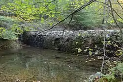 Bard Springs Dam No. 2 |
October 21, 1993 (#93001075) |
Forest Service Road 106, northwest of Athens, in the Caney Creek Wildlife Management Area of the Ouachita National Forest 34°23′26″N 94°00′36″W |
Athens | |
| 4 | Bard Springs Picnic Shelter | October 20, 1993 (#93001076) |
Forest Service Road 106, northwest of Athens, in the Caney Creek Wildlife Management Area of the Ouachita National Forest 34°23′27″N 94°00′34″W |
Athens | No longer standing | |
| 5 | Bogg Springs Hotel | September 30, 1993 (#93001023) |
Highway 84 34°19′45″N 94°25′40″W |
Bogg Springs | Demolished in 2014 by property owners. | |
| 6 | Buckeye Vista Overlook |  Buckeye Vista Overlook |
March 30, 2007 (#07000204) |
Forest Service Road 38 34°24′47″N 94°02′02″W |
Athens | |
| 7 | Ebenezer Monument | 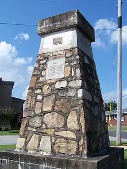 Ebenezer Monument |
January 30, 1992 (#91000689) |
Junction of 9th and Church Sts. 34°35′04″N 94°14′30″W |
Mena | |
| 8 | Elks Lodge | 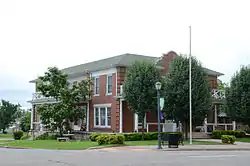 Elks Lodge |
June 4, 1998 (#98000616) |
500 Mena St. 34°35′09″N 94°14′16″W |
Mena | |
| 9 | C.E. Foster House | 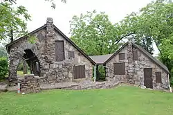 C.E. Foster House |
February 25, 1993 (#93000084) |
Northern side of Highway 88, west of its junction with Highway 272 34°41′09″N 94°22′25″W |
Mena | |
| 10 | Janssen Park |  Janssen Park |
December 13, 1979 (#79000448) |
Off Highway 8 34°35′00″N 94°14′24″W |
Mena | |
| 11 | Mena Commercial Historic District |  Mena Commercial Historic District |
July 23, 2009 (#09000321) |
Mena St. between Port Arthur and Gillham Ave., Sherwood Ave. between Mena and DeQueen St., and U.S. Route 71 south of Mena 34°35′00″N 94°14′08″W |
Mena | |
| 12 | Mena Kansas City-Southern Depot | 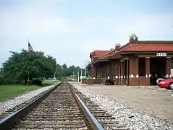 Mena Kansas City-Southern Depot |
June 5, 1991 (#91000685) |
West of the junction of Pickering Ave. and Mena St. 34°34′58″N 94°14′11″W |
Mena | |
| 13 | Mountain Fork Bridge | 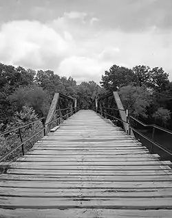 Mountain Fork Bridge |
April 9, 1990 (#90000540) |
County Road 38 over Mountain Fork Creek 34°31′41″N 94°24′00″W |
Mena | |
| 14 | National Guard Armory | 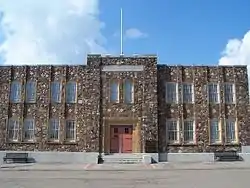 National Guard Armory |
June 5, 1991 (#91000682) |
Junction of DeQueen and Maple Sts. 34°35′03″N 94°14′17″W |
Mena | |
| 15 | Old Post Office | .JPG.webp) Old Post Office |
June 5, 1991 (#91000686) |
520 N. Mena St. 34°35′03″N 94°14′17″W |
Mena | |
| 16 | Polk County Courthouse |  Polk County Courthouse |
November 20, 1992 (#92001618) |
Northeastern corner of the junction of Church Ave. and DeQueen St. 34°35′12″N 94°14′21″W |
Mena | |
| 17 | St. Agnes Catholic Church |  St. Agnes Catholic Church |
June 5, 1991 (#91000696) |
Junction of 8th and Walnut Sts. 34°35′11″N 94°14′33″W |
Mena | |
| 18 | Shady Lake Bathhouse |  Shady Lake Bathhouse |
October 20, 1993 (#93001097) |
County Road 64 in the Caney Creek Wildlife Management Area of the Ouachita National Forest 34°21′41″N 94°01′51″W |
Athens | |
| 19 | Shady Lake Caretaker's House | Shady Lake Caretaker's House |
October 20, 1993 (#93001098) |
Forest Service Road 38 in the Caney Creek Wildlife Management Area of the Ouachita National Forest 34°21′49″N 94°02′03″W |
Athens | |
| 20 | Shady Lake CCC Bridge No. 1 | 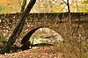 Shady Lake CCC Bridge No. 1 |
October 14, 2010 (#10000841) |
Forest Service Road 38 over the South Fork of the Saline River 34°21′39″N 94°01′24″W |
Athens vicinity | Facilities Constructed by the CCC in Arkansas MPS |
| 21 | Shady Lake CCC Bridge No. 2 | 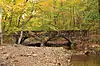 Shady Lake CCC Bridge No. 2 |
October 14, 2010 (#10000842) |
Shady Lake Campground loop road over the East Fork of the Saline River 34°22′04″N 94°01′31″W |
Athens vicinity | Facilities Constructed by the CCC in Arkansas MPS |
| 22 | Shady Lake Dam |  Shady Lake Dam |
October 20, 1993 (#93001099) |
County Road 64 in the Caney Creek Wildlife Management Area of the Ouachita National Forest 34°21′36″N 94°01′58″W |
Athens | |
| 23 | Shady Lake Picnic Pavilion | 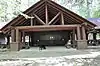 Shady Lake Picnic Pavilion |
October 20, 1993 (#93001100) |
Forest Service Road 38 in the Caney Creek Wildlife Management Area of the Ouachita National Forest 34°21′38″N 94°01′44″W |
Athens | |
| 24 | Shady Lake Recreation Area Historic District | Shady Lake Recreation Area Historic District |
October 2, 2015 (#15000480) |
Forest Service Road 38 of the Ouachita National Forest 34°21′38″N 94°01′44″W |
Athens vicinity | |
| 25 | Judge Benjamin Shaver House | 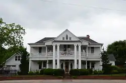 Judge Benjamin Shaver House |
December 6, 1979 (#79003431) |
701 12th St. 34°35′00″N 94°14′41″W |
Mena | |
| 26 | State Line Marker | 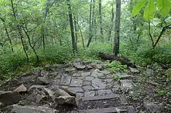 State Line Marker |
November 18, 1976 (#76000448) |
17 miles northwest of Mena on Highway 88 34°41′38″N 94°27′19″W |
Mena | Extends into Le Flore County, Oklahoma |
| 27 | Studebaker Showroom |  Studebaker Showroom |
June 9, 2000 (#00000636) |
519 Port Arthur 34°35′02″N 94°14′12″W |
Mena | |
| 28 | Sugar Creek Vista Overlook | 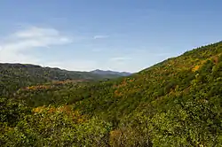 Sugar Creek Vista Overlook |
March 30, 2007 (#07000205) |
Forest Service Road 38 34°25′43″N 94°03′21″W |
Athens | |
| 29 | Tall Peak Fire Tower | October 20, 1993 (#93001077) |
Forest Service Road 38A northwest of Athens in the Caney Creek Wildlife Management Area of the Ouachita National Forest 34°23′11″N 94°02′33″W |
Athens |
Former listings
| [3] | Name on the Register | Image | Date listed | Date removed | Location | City or town | Summary |
|---|---|---|---|---|---|---|---|
| 1 | Bee Mountain Fire Tower | (#93001078) | November 7, 2005 | Forest Service Rd. 30 NE of Vandervoort, Ouachita National Forest |
Vandervoort | Civilian Conservation Corps built in 1938 | |
| 2 | Scoggin House | July 18, 1978 (#78000616) | January 14, 2002 | 1215 Port Arthur Avenue |
Mena |
See also
| Wikimedia Commons has media related to National Register of Historic Places in Polk County, Arkansas. |
References
- The latitude and longitude information provided in this table was derived originally from the National Register Information System, which has been found to be fairly accurate for about 99% of listings. Some locations in this table may have been corrected to current GPS standards.
- "National Register of Historic Places: Weekly List Actions". National Park Service, United States Department of the Interior. Retrieved on February 5, 2021.
- Numbers represent an alphabetical ordering by significant words. Various colorings, defined here, differentiate National Historic Landmarks and historic districts from other NRHP buildings, structures, sites or objects.
- "National Register Information System". National Register of Historic Places. National Park Service. March 13, 2009.
- The eight-digit number below each date is the number assigned to each location in the National Register Information System database, which can be viewed by clicking the number.
| Topics | |
|---|---|
| Lists by state |
|
| Lists by insular areas | |
| Lists by associated state | |
| Other areas | |
| Related | |
| |
Municipalities and communities of Polk County, Arkansas, United States | ||
|---|---|---|
| Cities | Map of Arkansas highlighting Polk County | |
| Towns | ||
| Unincorporated communities | ||
| ||
This article is issued from Wikipedia. The text is licensed under Creative Commons - Attribution - Sharealike. Additional terms may apply for the media files.