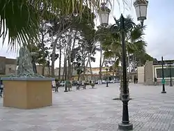
Aïn Touta
Aïn Touta is a town in eastern Algeria. It is located 35 km southwest of Batna and 82 km north of Biskra. It has an area of about five square kilometers (2 square miles).
Aïn Touta
عين التوتة ⵉⵏ ⵜⵓⵜⴰ | |
|---|---|
 | |
 | |
 Aïn Touta | |
| Coordinates: 35°23′N 5°54′E | |
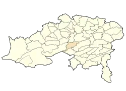
| Country | Algeria |
| Province | Batna |
| District | Aïn Touta[1] |
| Government | |
| Area | |
| • Total | 173.5 km2 (67.0 sq mi) |
| Population (2008[2]) | |
| • Total | 59,904 |
| Time zone | UTC+1 (West Africa Time) |
Aïn Touta is one of the interesting cities in Algeria because of its strategic location; it passes upon it the national road number 3 and making this city more active between other cities.
There are four lycées, seven middle schools, hospital, car market, multi-sports hall, two stadiums and more base structures. It exists also a train gare which is considered the biggest gare during the colonial period - France.
Concerning population, the throne of Ouled Sidi Yahia occupies the first place not only in this city but also in Batna the capital and Tazoult - Lambèse.
Localities of the commune
The commune of Aïn Touta is composed of 5 localities:[3]
- Aïn Touta
- El Ksour
- Béni Makhlouf (Tamezouin)
- Briket (khodrane)
- Tamarins (Touaba)
References
- "Décret executif n° 91-306 du 24 août 1991 fixant la liste des communes animées par chaque chef de daïra. 05 - Wilaya de Batna" [List of municipalities animated by each District chief: 05 - Batna Province] (PDF) (in French). Journal officiel de la République Algérienne. 4 September 1991. p. 1295. Retrieved 2019-11-09.
- "Wilaya de Batna: répartition de la population résidente des ménages ordinaires et collectifs, selon la commune de résidence et la dispersion" (PDF) (in French). Retrieved 2019-11-09.. Data from the 2008 General Population and Housing Census on the site of the NOS Algeria.
- "Décret n° 84-365, fixant la composition, la consistance et les limites territoriale des communes. Wilaya de Batna" (PDF). Journal officiel de la République Algérienne (67): 1481. 19 December 1984. Retrieved 3 October 2019.
.svg.png.webp)
