A360 road
The A360 is an A road in Wiltshire, England, running from Devizes to Salisbury, through the villages of Potterne, West Lavington, Tilshead, and Shrewton, and passing near the Stonehenge ancient monument.
| |
|---|---|
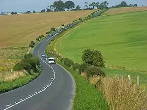 The A360 at Rollestone | |
| Route information | |
| Length | 24 mi (39 km) |
| Major junctions | |
| North West end | Devizes 51.3537°N 1.9982°W |
| South East end | Salisbury 51.0724°N 1.8047°W |
| Road network | |

Route
The road is 24 miles (39 km) long and starts at the junction of the A342 and A361 roads in the town of Devizes. It continues southwards towards Salisbury Plain, passing West Lavington via Potterne, then southeast to Shrewton via Tilshead. It turns right at Airman's Corner (a junction with an entrance to Stonehenge and the B3086), crosses the A303 and continues southwards into Salisbury, joining the A36 near the centre of the city.[1]
History
The A360 originally ran south from Shrewton towards Stapleford via Winterbourne Stoke.[2]
In November 2012, major work began on the Longbarrow Roundabout where the A360 meets the A303, with the intention that the A360 would become the main visitor's route to Stonehenge.[3] In June 2013, the main road next to Stonehenge, the A344, was closed and drivers were advised to access the Stonehenge visitor centre via the A360 instead.[4]
In 2019, work began on upgrading a junction with a minor road to a roundabout at Camp Hill near the northwest outskirts of Salisbury, as it is a notorious accident blackspot with several serious incidents.[5]
Features

The central section of the A360 through Salisbury Plain passes through the centre of Salisbury Plain Training Area, a major Ministry of Defence site. The road crosses several tank trails, which see sporadic active use during training exercises. A number of warning signs are placed on the road advising motorists.[6] In 2018, live firing was stopped on the site after part of Salisbury Plain caught fire, which resulted in part of the A360 being closed.[7]
In addition to Stonehenge, the A360 passes several ancient monuments, including Camp Down,[8] a bowl barrow at Longbarrow.[9]
References
- "A360 : Devizes to Salisbury". Google Maps. Retrieved 10 March 2020.
- MOT Map 38 : Southampton, Portsmouth and Isle of Wight (Map). Ordnance Survey. 1923. Retrieved 10 March 2020.
- "Stonehenge work begins at Longbarrow A303 roundabout". BBC News. 5 November 2012. Retrieved 10 March 2020.
- "Stonehenge permanent road closure work begins". BBC News. Retrieved 10 March 2020.
- "Roundabout being installed at notorious A360 crossroads". Spire FM. 9 July 2019. Retrieved 10 March 2020.
- "Salisbury Plain Training Area" (PDF). Ministry of Defence. July 2017. Retrieved 10 March 2020.
- "MoD stop live firing exercise after setting fire to Salisbury Plain". The Daily Telegraph. 12 July 2018. Retrieved 10 March 2020.
- "Camp Down". Milestones Web. Retrieved 10 March 2020.
- "Bowl barrow 400m south east of Longbarrow Cross Roads, east of A360". Ancient Monuments. Retrieved 10 March 2020.
