A400 road (Great Britain)
The A400 road is an A road in London that runs from Charing Cross (near Trafalgar Square, in London's West End) to Archway in North London. It passes some of London's most famous landmarks.
| |
|---|---|
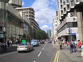 Tottenham Court Road is part of the A400 (northbound) | |
| Major junctions | |
| South end | Charing Cross |
| North end | Archway, A1 |
| Location | |
| Primary destinations | Central London (West End) Euston Camden Town |
| Road network | |
The Northern line (Charing Cross and High Barnet branches) runs beneath the A400 between Charing Cross and Archway stations.[1] Between Charing Cross and Euston Road (Inner Ring Road), the road is in the London Congestion Charge zone.[2]
Route
City of Westminster
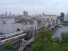
At its southern end, the A400 begins in the City of Westminster at a junction with the Victoria Embankment, opposite the Hungerford (Charing Cross) Bridge. There is no vehicular access to the bridge, which provides pedestrians with a route over the River Thames to the South Bank. At the junction, a separate set of traffic lights is provided for cyclists, who may cross between the A400 and Cycle Superhighway 3 with little conflict with other road traffic. Embankment tube station is to the north of the junction.[3]
The route runs westbound along Northumberland Avenue towards Trafalgar Square. Here the route meets Whitehall, the A4 (Strand/Cockspur Street), and the Mall. The A400 travels north from Trafalgar Square along St. Martin's Place and Charing Cross Road.
The route meets the A401 (Shaftesbury Avenue) at Cambridge Circus, after which the route continues northwards to Tottenham Court Road station, where it meets Oxford Street (the A40). Here, the road enters the London Borough of Camden.
London Borough of Camden
From the tube station, the route runs northwards along Tottenham Court Road to Warren Street tube station, where it meets the London Inner Ring Road (Euston Road). Southbound traffic is carried along Gower Street, then along Shaftesbury Avenue to Cambridge Circus, to continue southbound along Charing Cross Road.
After Warren Street station, the A400 becomes a dual carriageway, part-way along Hampstead Road, as it passes through Somers Town. Hampstead Road's northern terminus is at Mornington Crescent tube station, and northbound A400 traffic travels along Camden High Street to the Britannia Junction. At the Britannia Junction, the A400 bears north-east onto Kentish Town Road. Camden High Street becomes the A502 towards Hampstead, whilst traffic may turn right onto the A503 (Camden Road).
Southbound traffic through Camden Town leaves Kentish Town Road near Camden Gardens. Traffic travels south along Camden Street, along which it meets the A503 (Camden Road) and the A4200 (Eversholt Street). Southbound traffic joins Hampstead Road to the south of Mornington Crescent tube station.
Continuing north, the A400 passes through Kentish Town. It then continues along Fortess Road towards Tufnell Park.
In the London Borough of Camden, the A400 is controlled by Transport for London between Euston and Camden Town tube station. This section of the road is a "Red Route".[4]
London Borough of Islington
The route enters the London Borough of Islington and becomes Junction Road between Tufnell Park and Archway, before it meets the A1.
Landmarks
- Embankment tube station
.svg.png.webp)
.svg.png.webp)
.svg.png.webp)
.svg.png.webp)
- Charing Cross station

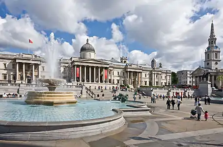
- Trafalgar Square
- Halfway to Heaven
- St Martin's in the Fields
- National Gallery
- National Portrait Gallery
- Garrick Theatre
- Leicester Square tube station
.svg.png.webp)
- London Hippodrome
- Cambridge Circus
- Foyles
- G-A-Y
- Tottenham Court Road station
.svg.png.webp)
.svg.png.webp)
- Centre Point
- Dominion Theatre
- Bedford Square
- British Museum
- Goodge Street tube station
- BT Tower
- London School of Hygiene and Tropical Medicine
- University College London
- Euston Square tube station
.svg.png.webp)
.svg.png.webp)
- Warren Street tube station
.svg.png.webp)
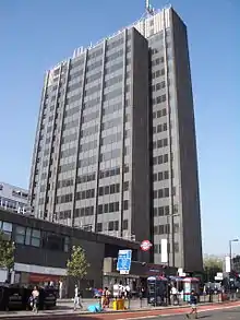
- Euston Tower
- Mornington Crescent tube station
- KOKO
- All Saints Cathedral, Camden Street
- Camden Town tube station
- Kentish Town tube station
- Tufnell Park tube station
- Archway tube station
Air pollution
Air pollution along the A400 varies. Air pollution is monitored by the City of Westminster, the London Borough of Camden, and the London Borough of Islington. Levels of Nitrogen dioxide (NO2) sometimes exceed the Air Quality Objective, set by the UK Department for Environment, Food, and Rural Affairs (Defra) at 40 micrograms per metres cubed (μg/m^3). Exposure to high levels of NO2 can lead to respiratory problems, and the gases sometimes inflame the lining of the lungs, reducing immunity to lung infections.
In the City of Westminster, there is a nearby NO2 monitoring point entitled Oxford Street East. In 2018, levels of NO2 failed to meet the Air Quality Objective, with the monitoring point recording an annual mean of 76 μg/m^3.[5]
In the London Borough of Camden, levels of NO2 are monitored in several locations in close proximity to the A400.[6] Results from 2018 include:
- Bloomsbury - 36 μg/m^3
- Tottenham Court Road - 65.7 μg/m^3
- Euston Road - 82.34 μg/m^3
- Kentish Town Road - 54.7 μg/m^3
In the London Borough of Islington, a monitoring point along Junction Road recorded an annual mean 36 μg/m^3 in 2018, down from 42 μg/m^3 in 2017.[7]
References
- "London Connections Map" (PDF). Transport for London and WhatDoTheyKnow. Archived (PDF) from the original on 20 April 2020. Retrieved 26 April 2020.
- "Congestion Charge Zone". Transport for London.
- "Cycle". Transport for London. Retrieved 26 April 2020.
- "Transport for London Street Management" (PDF). Transport for London. Archived (PDF) from the original on 25 December 2019. Retrieved 26 April 2020.
- "City of Westminster, Air Quality Annual Status Report 2018" (PDF). City of Westminster. 2019. Archived (PDF) from the original on 26 April 2020. Retrieved 26 April 2020.
- "London Borough of Camden, Air Quality Status Report 2018". London Borough of Camden. 2019. Archived from the original on 26 April 2020. Retrieved 26 April 2020.
- "London Borough of Islington, Air Quality Report 2018" (PDF). London Borough of Islington. 2019. Archived (PDF) from the original on 26 April 2020. Retrieved 26 April 2020.
