Acacías
Acacias is a town and municipality in the Meta Department, Colombia.
Acacías | |
|---|---|
Municipality and town | |
 | |
 Flag  Seal | |
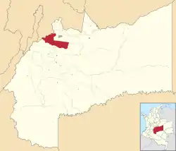 Location of the municipality and town of Acacías in the Meta Department. | |
 Acacías Location in Colombia | |
| Coordinates: 3°59′16″N 73°45′35″W | |
| Country | Colombia |
| Department | Meta Department |
| Founded | 1920 |
| Government | |
| • Mayor | Luis Orlando Gutierrez |
| Area | |
| • Total | 1,129 km2 (436 sq mi) |
| Elevation | 498 m (1,634 ft) |
| Population (2012)[1] | |
| • Total | 54,507 |
| • Density | 48/km2 (130/sq mi) |
| Demonym(s) | Acacireño |
| Time zone | UTC-5 (Colombia Standard Time) |
| Area code(s) | 57 + 8 |
| Climate | Af |
| Website | Official website |
Climate
Acacías has a tropical rainforest climate (Af) with heavy to very heavy rainfall year round.
| Climate data for Acacías | |||||||||||||
|---|---|---|---|---|---|---|---|---|---|---|---|---|---|
| Month | Jan | Feb | Mar | Apr | May | Jun | Jul | Aug | Sep | Oct | Nov | Dec | Year |
| Average high °C (°F) | 30.9 (87.6) |
31.2 (88.2) |
31.0 (87.8) |
29.9 (85.8) |
29.4 (84.9) |
29.0 (84.2) |
29.0 (84.2) |
29.7 (85.5) |
30.2 (86.4) |
30.2 (86.4) |
30.2 (86.4) |
30.3 (86.5) |
30.1 (86.2) |
| Daily mean °C (°F) | 25.5 (77.9) |
25.9 (78.6) |
26.0 (78.8) |
25.0 (77.0) |
24.8 (76.6) |
24.3 (75.7) |
24.2 (75.6) |
24.5 (76.1) |
24.9 (76.8) |
25.0 (77.0) |
25.1 (77.2) |
24.9 (76.8) |
25.0 (77.0) |
| Average low °C (°F) | 20.1 (68.2) |
20.6 (69.1) |
21.0 (69.8) |
20.2 (68.4) |
20.2 (68.4) |
19.6 (67.3) |
19.4 (66.9) |
19.4 (66.9) |
19.6 (67.3) |
19.8 (67.6) |
20.0 (68.0) |
19.5 (67.1) |
20.0 (67.9) |
| Average rainfall mm (inches) | 76.1 (3.00) |
126.1 (4.96) |
258.3 (10.17) |
554.7 (21.84) |
660.3 (26.00) |
558.3 (21.98) |
435.2 (17.13) |
375.1 (14.77) |
392.9 (15.47) |
499.1 (19.65) |
469.1 (18.47) |
227.8 (8.97) |
4,633 (182.41) |
| Average rainy days | 6 | 7 | 12 | 21 | 24 | 23 | 23 | 18 | 17 | 19 | 18 | 11 | 199 |
| Source 1: [2] | |||||||||||||
| Source 2: [3] | |||||||||||||
References
This article is issued from Wikipedia. The text is licensed under Creative Commons - Attribution - Sharealike. Additional terms may apply for the media files.