Lejanías
Lejanías is a town and municipality in the Meta Department, Colombia.
Tierra del Perro | |
|---|---|
Municipality and town | |
.svg.png.webp) Flag | |
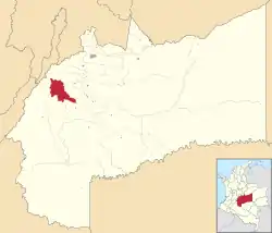 Location of the municipality and town of Lejanías in the Meta Department of Colombia. | |
| Coordinates: 3°31′36.50″N 74°1′23.60″W | |
| Country | |
| Department | Meta Department |
| Area | |
| • Total | 852 km2 (329 sq mi) |
| Elevation | 670−750 m (−1,790 ft) |
| Population (Census 2018[2]) | |
| • Total | 10,576 |
| • Density | 12/km2 (32/sq mi) |
| Time zone | UTC-5 (Colombia Standard Time) |
| Climate | Af |
| Website | http://lejanias-meta.gov.co/index.shtml |
Climate
Lejanías has a tropical rainforest climate (Af) with heavy to extremely heavy rainfall year round.
| Climate data for Lejanías | |||||||||||||
|---|---|---|---|---|---|---|---|---|---|---|---|---|---|
| Month | Jan | Feb | Mar | Apr | May | Jun | Jul | Aug | Sep | Oct | Nov | Dec | Year |
| Average high °C (°F) | 30.0 (86.0) |
30.4 (86.7) |
30.2 (86.4) |
29.1 (84.4) |
28.6 (83.5) |
28.4 (83.1) |
28.4 (83.1) |
29.3 (84.7) |
29.5 (85.1) |
29.1 (84.4) |
28.9 (84.0) |
29.2 (84.6) |
29.3 (84.7) |
| Daily mean °C (°F) | 24.8 (76.6) |
24.9 (76.8) |
25.2 (77.4) |
24.5 (76.1) |
24.2 (75.6) |
23.8 (74.8) |
23.6 (74.5) |
24.1 (75.4) |
24.3 (75.7) |
24.3 (75.7) |
24.2 (75.6) |
24.2 (75.6) |
24.3 (75.8) |
| Average low °C (°F) | 19.6 (67.3) |
19.5 (67.1) |
20.3 (68.5) |
19.9 (67.8) |
19.9 (67.8) |
19.2 (66.6) |
18.8 (65.8) |
18.9 (66.0) |
19.1 (66.4) |
19.5 (67.1) |
19.6 (67.3) |
19.2 (66.6) |
19.5 (67.0) |
| Average rainfall mm (inches) | 86.9 (3.42) |
208.1 (8.19) |
353.1 (13.90) |
713.8 (28.10) |
760.1 (29.93) |
771.7 (30.38) |
700.4 (27.57) |
589.8 (23.22) |
650.3 (25.60) |
762.9 (30.04) |
605.1 (23.82) |
263.8 (10.39) |
6,466 (254.56) |
| Average rainy days | 5 | 9 | 14 | 22 | 26 | 25 | 26 | 22 | 21 | 23 | 21 | 12 | 226 |
| Source 1: [3] | |||||||||||||
| Source 2: [4] | |||||||||||||
References
- "Municipalities of Colombia". statoids. Retrieved 10 May 2020.
- "Censo Nacional de Población y Vivienda 2018" (in Spanish). DANE. Retrieved 10 May 2020.
- http://www.ideam.gov.co/documents/21021/553571/Promedios+Climatol%C3%B3gicos++1981+-+2010.xlsx/f28d0b07-1208-4a46-8ccf-bddd70fb4128
- https://en.climate-data.org/south-america/colombia/meta/lejanias-49792/?amp=true
This article is issued from Wikipedia. The text is licensed under Creative Commons - Attribution - Sharealike. Additional terms may apply for the media files.