Cubarral
Cubarral is a town and municipality in the Meta Department, Colombia.
Cubarral | |
|---|---|
Municipality and town | |
.svg.png.webp) Flag | |
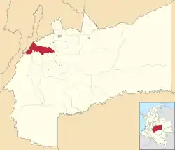 Location of the municipality and town of Cubarral in the Meta Department of Colombia. | |
| Country | |
| Department | Meta Department |
| Elevation | 534 m (1,752 ft) |
| Time zone | UTC-5 (Colombia Standard Time) |
Climate
Cubarral has a tropical rainforest climate (Af) with heavy to very heavy rainfall year-round.
| Climate data for Cubarral | |||||||||||||
|---|---|---|---|---|---|---|---|---|---|---|---|---|---|
| Month | Jan | Feb | Mar | Apr | May | Jun | Jul | Aug | Sep | Oct | Nov | Dec | Year |
| Average high °C (°F) | 30.6 (87.1) |
31.1 (88.0) |
30.9 (87.6) |
29.7 (85.5) |
29.3 (84.7) |
28.8 (83.8) |
28.8 (83.8) |
29.6 (85.3) |
30.0 (86.0) |
29.8 (85.6) |
29.7 (85.5) |
29.9 (85.8) |
29.9 (85.7) |
| Daily mean °C (°F) | 25.2 (77.4) |
25.7 (78.3) |
25.9 (78.6) |
24.9 (76.8) |
24.8 (76.6) |
24.1 (75.4) |
24.1 (75.4) |
24.5 (76.1) |
24.8 (76.6) |
24.8 (76.6) |
24.8 (76.6) |
24.6 (76.3) |
24.9 (76.7) |
| Average low °C (°F) | 19.9 (67.8) |
20.3 (68.5) |
20.9 (69.6) |
20.2 (68.4) |
20.3 (68.5) |
19.5 (67.1) |
19.4 (66.9) |
19.4 (66.9) |
19.6 (67.3) |
19.9 (67.8) |
20.0 (68.0) |
19.4 (66.9) |
19.9 (67.8) |
| Average rainfall mm (inches) | 109.4 (4.31) |
180.5 (7.11) |
309.2 (12.17) |
605.7 (23.85) |
622.1 (24.49) |
547.7 (21.56) |
440.2 (17.33) |
385.3 (15.17) |
398.9 (15.70) |
504.7 (19.87) |
521.6 (20.54) |
236.9 (9.33) |
4,862.2 (191.43) |
| Average rainy days | 7 | 9 | 13 | 20 | 22 | 22 | 21 | 18 | 17 | 19 | 19 | 11 | 198 |
| Source 1: IDEAM[1] | |||||||||||||
| Source 2: Climate-Data.org[2] | |||||||||||||
References
- "Data". www.ideam.gov.co. Retrieved 2020-08-26.
- "Climate: Cubarral". Climate-Data.org. Retrieved August 26, 2020.
This article is issued from Wikipedia. The text is licensed under Creative Commons - Attribution - Sharealike. Additional terms may apply for the media files.