Acuitzio
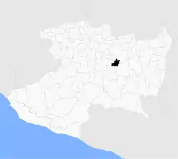
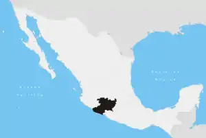
Acuitzio Municipality is a municipality located in the central region of the Mexican state of Michoacán.
Acuitzio Municipality | |
|---|---|
 Location of Acuitzio in Michoacán | |
 Acuitzio Municipality Location of Acuitzio in Mexico | |
| Coordinates: 19°30′N 101°20′W | |
| Country | |
| State | Michoacán |
| Established | 26 April 1856 |
| Municipal seat | Acuitzio del Canje |
| Area | |
| • Total | 180.13 km2 (69.55 sq mi) |
| Elevation | 2,075 m (6,808 ft) |
| Population (2005) | |
| • Total | 10,052 |
| • Density | 56/km2 (140/sq mi) |
| Time zone | UTC-6 (CST) |
| • Summer (DST) | UTC-5 (CDT) |
| Website | Official website |
Geography
The municipality has an area of 180.13 square kilometres (0.30% of the surface of the state) and is bordered to the north and northwest by Morelia Municipality, to the east by Madero Municipality, to south by Tacámbaro Municipality, and to the southwest by Huiramba Municipality.
Demographics
The municipality had a population of 10,052 inhabitants according to the 2005 census.[1] Its municipal seat is the city of Acuitzio del Canje.
History
A religious center near Acuitzio named Coatepec was founded by the Aztecs sometime in the 12th century. It is believed that the Aztecs abandoned the center to migrate to a place their Gods had mandated.[2] Acuitzio is a word of Purépecha origin that means "Place of the snakes".[3]
Climate
| Climate data for Acuitzio del Canje | |||||||||||||
|---|---|---|---|---|---|---|---|---|---|---|---|---|---|
| Month | Jan | Feb | Mar | Apr | May | Jun | Jul | Aug | Sep | Oct | Nov | Dec | Year |
| Average high °C (°F) | 24.0 (75.2) |
24.6 (76.3) |
26.8 (80.2) |
29 (84) |
29.5 (85.1) |
27.6 (81.7) |
25.8 (78.4) |
26.0 (78.8) |
25.7 (78.3) |
25.7 (78.3) |
25 (77) |
23.7 (74.7) |
26 (79) |
| Average low °C (°F) | 3.1 (37.6) |
3.7 (38.7) |
5.9 (42.6) |
8.0 (46.4) |
9.5 (49.1) |
10.7 (51.3) |
10.9 (51.6) |
10.8 (51.4) |
10.6 (51.1) |
8.8 (47.8) |
5.7 (42.3) |
3.8 (38.8) |
7.6 (45.7) |
| Average precipitation mm (inches) | 23 (0.9) |
10 (0.4) |
20 (0.8) |
20 (0.8) |
71 (2.8) |
170 (6.5) |
200 (8) |
240 (9.4) |
240 (9.6) |
76 (3) |
28 (1.1) |
7.6 (0.3) |
1,110 (43.6) |
| Source: Weatherbase [4] | |||||||||||||
References
- "2005 Census". INEGI: Instituto Nacional de Estadística, Geografía e Informática. Archived from the original on 2013-02-27. Retrieved 2007-10-05.
- Ordenjuridico.gob.mx "Antecedentes Históricos". Retrieved on October 5, 2007.
- Acuitzio-Pátzcuaro Archived July 4, 2008, at the Wayback Machine "Historia". Retrieved on October 5, 2007.
- "Weatherbase: Historical Weather for Acuitzio del Canje, Michoacán". Weatherbase. 2011. Retrieved on November 24, 2011.
