Angamacutiro
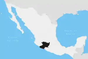
Angamacutiro is a municipality in the Mexican state of Michoacán. It is located in the northern part of the state and its municipal seat is the city of Angamacutiro de la Unión.
Angamacutiro | |
|---|---|
Municipality | |
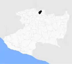 Location of Angamacutiro in Michoacán | |
| Coordinates: 20°09′N 101°43′W | |
| Country | Mexico |
| State | Michoacán |
| Municipal seat | Angamacutiro de la Unión |
| Area | |
| • Total | 230.26 km2 (88.90 sq mi) |
| Population (2015) | |
| • Total | 15,193 |
| • Density | 66/km2 (170/sq mi) |
| Time zone | UTC-6 |
Geography
Angamacutiro is located in the extreme north of Michoacán, bordering the state of Guanajuato. It is bordered by the municipalities of José Sixto Verduzco to the northeast, Puruándiro to the east, Panindícuaro to the south, Penjamillo to the west and Pénjamo (Guanajuato) to the north. The municipality has a total area of 230.26 square kilometres (88.90 sq mi), representing 0.39% of Michoacán's total area.
The municipality is located where the Trans-Mexican Volcanic Belt meets the lowlands of the Bajío.
The principal river of Angamacutiro is the Lerma River, which marks the state border with Guanajuato. The Angulo River runs north-south through the municipality.[1] All of the smaller streams and rivers are tributaries of these two rivers.
Climate and ecosystems
Angamacutiro has a humid subtropical climate with rains in the summer.[2] The average annual temperature is between 16 and 24 °C,[3] annual rainfall is between 700 and 800 mm.[4]
Native species include plants such as nopal, huizache and shrubs, and animals such as weasels, rabbits, squirrels, skunks, badgers, turtledoves and ducks.
Demographics
As of the census of 2010, there were 14,684 people residing in the municipality; 5,595 men and 6,738 women.[5] 36.6% of the population live in towns of more than 2,500 people. Only 0.2% of the population older than 5 years speak an indigenous language.[6]
31.4% of the population was under the age of 15 and 10.3% were 64 years or older. 45.4% of the population was male.
Localities
The municipality of Angamacutiro comprises 28 localities, the largest including
| Locality | Population |
|---|---|
| Angamacutiro de la Unión | 4,527 |
| El Maluco | 1,483 |
| La Palma | 1,024 |
| Total | 14,684 |
References
Notes
- "Michoacán. Mapa de Principales Ríos" (in Spanish). Instituto Nacional de Estadística y Geografía. Archived from the original on 14 July 2007.
- "Michoacán. Mapa de Climas" (in Spanish). Instituto Nacional de Estadística y Geografía. Archived from the original on 14 July 2007.
- "Michoacán. Mapa de Temperatura Media Anual" (in Spanish). Instituto Nacional de Estadística y Geografía. Archived from the original on 14 July 2007.
- "Michoacán. Mapa de Precipitación Promedio Anual" (in Spanish). Instituto Nacional de Estadística y Geografía. Archived from the original on 14 July 2007.
- "Michoacán. Población total por municipio según grandes grupos de edad, 2005" (in Spanish). Instituto Nacional de Estadística y Geografía.
- "Michoacán. Indicadores seleccionados de la población por municipio, 2005" (in Spanish). Instituto Nacional de Estadística y Geografía.
Bibliography
- "Enciclopedia de los Municipios de México" (in Spanish). Instituto Nacional para el Federalismo y el Desarrollo Municipal. 2005. Archived from the original on 11 January 2005.