Irimbo
Irimbo is a municipality located in the southeastern part of the Mexican state of Michoacán. The municipality has an area of 125.54 square kilometers.[2]
Irimbo | |
|---|---|
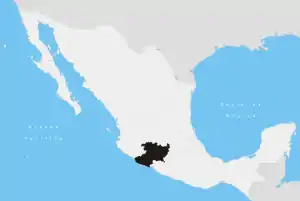
Irimbo Location of Irimbo in Mexico | |
| Coordinates: 19°42′00″N 100°28′42″W | |
| Country | Mexico |
| State | Michoacán |
| Government | |
| • Mayor | José Ignacio López Zaenz |
| Area | |
| • Total | 125.54 km2 (48.47 sq mi) |
| Elevation | 2,150 m (7,050 ft) |
| Population (2010)[1] | |
| • Total | 14,766 |
| • Density | 120/km2 (300/sq mi) |
| Time zone | UTC-6 (CST) |
| • Summer (DST) | UTC-5 (CDT) |
The seat of the municipality is also named Irimbo.
As of 2010, it has a population of 14,766.
List of towns
- Irimbo
- San Lorenzo Queréndaro
- San José de Magallanes
- San Francisco Epunguio
- La Frontera
- Colonia el Colorín
- Los Marzos
- Loma de Chupio
- La Cuajada
- San Miguel la Virgen
- Ampliación las Joyas
- Cristo Rey
- Los Mogotes
- Hacienda Jaripeo
- Colonia los Cedros
- Cerrito Blanco
- Balvaneda
- Llano Grande
- Los Hoyos
- San Miguel el Alto
- Los Marzos Pequeña
- Fraccionamiento el Obraje
- Concharrás
- Tzintzingareo
- Manzana de San Vicente
References
- "Principales resultados por localidad 2010 (ITER)". Instituto Nacional de Estadística y Geografía. 2010. Archived from the original on December 20, 2010. Retrieved September 4, 2012.
- Michoacán Archived May 17, 2011, at the Wayback Machine Enciclopedia de los Municipios de México. Retrieved on July 12, 2018
This article is issued from Wikipedia. The text is licensed under Creative Commons - Attribution - Sharealike. Additional terms may apply for the media files.