Alligator Creek, Queensland (Townsville)
Alligator Creek is a rural locality in the City of Townsville, Queensland, Australia.[2] In the 2016 census, Alligator Creek had a population of 1,353 people.[1]
| Alligator Creek Queensland | |||||||||||||||
|---|---|---|---|---|---|---|---|---|---|---|---|---|---|---|---|
 Alligator Creek | |||||||||||||||
 Alligator Creek | |||||||||||||||
| Coordinates | 19.4241°S 146.9458°E | ||||||||||||||
| Population | 1,353 (2016 census)[1] | ||||||||||||||
| • Density | 27.39/km2 (70.94/sq mi) | ||||||||||||||
| Postcode(s) | 4816 | ||||||||||||||
| Area | 49.4 km2 (19.1 sq mi) | ||||||||||||||
| Time zone | AEST (UTC+10:00) | ||||||||||||||
| LGA(s) | City of Townsville | ||||||||||||||
| State electorate(s) | Burdekin | ||||||||||||||
| Federal Division(s) | |||||||||||||||
| |||||||||||||||
Geography
Alligator Creek is approx 20 kilometres (12 mi) south-east of Townsville.
The locality is bounded on the north by the Bruce Highway. The North Coast railway line is aligned with part of the northern boundary (but mostly runs just north of the boundary in Nome).[3]
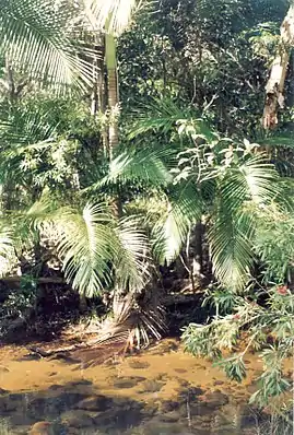
As the locality name suggests, Alligator Creek flows through the locaity from the south-east (Mount Elliott) to the north (Nome). It eventually enters Cleveland Bay within the locality of Cape Cleveland.[3]
The Sisters Mountains is a mountain range in the west of the locality (19.4166°S 146.9°E) with the mountain Middle Sister (19.4161°S 146.9058°E) rising to 429 metres (1,407 ft).[4][5][3]
Killymoon is a neighbourhood in the north-east of the locality (19.4°S 146.9833°E).[6] Killymoon Creek runs through that area.[3]
History
In the 2016 census, Alligator Creek had a population of 1,353 people.[1]
Amenities
The Townsville City Council operate a mobile library service which visits Parkland Road at Alligator Creek every second Wednesday morning.[7]
The Gator Girls branch of the Queensland Country Women's Association meets at the Alligator Creek Community & Sports Club at 10 Parklane Road.[8]
Education
There are no schools in Alligator Creek. The nearest primary school is Wulguru State School in Wulguru to the north-west. The nearest secondary school is William Ross State High School in Annandale to the north-west.[3]
References
- Australian Bureau of Statistics (27 June 2017). "Alligator Creek (SSC)". 2016 Census QuickStats. Retrieved 20 October 2018.

- "Alligator Creek – locality in City of Townsville (entry 44564)". Queensland Place Names. Queensland Government. Retrieved 19 September 2020.
- "Queensland Globe". State of Queensland. Retrieved 17 October 2020.
- "The Sisters Mountains – range in City of Townsville (entry 34122)". Queensland Place Names. Queensland Government. Retrieved 19 September 2020.
- "Middle Sister – mountain in City of Townsville (entry 21993)". Queensland Place Names. Queensland Government. Retrieved 19 September 2020.
- "Killymoon – locality unbounded in City of Townsville (entry 18135)". Queensland Place Names. Queensland Government. Retrieved 19 September 2020.
- "Mobile Library Service" (PDF). Townsville City Council. Archived from the original (PDF) on 29 January 2018. Retrieved 29 January 2018.
- "Branch Locations". Queensland Country Women's Association. Retrieved 26 December 2018.
External links
- "Alligator Creek (near Townsville)". Queensland Places. Centre for the Government of Queensland, University of Queensland.