Vincent, Queensland
Vincent is a suburb of Townsville in the City of Townsville, Queensland, Australia.[2]
| Vincent Townsville, Queensland | |||||||||||||||
|---|---|---|---|---|---|---|---|---|---|---|---|---|---|---|---|
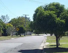
 Borg Street, Vincent | |||||||||||||||
 Vincent | |||||||||||||||
| Coordinates | 19.2841°S 146.7638°E | ||||||||||||||
| Population | 2,357 (2016 census)[1] | ||||||||||||||
| • Density | 1,680/km2 (4,360/sq mi) | ||||||||||||||
| Postcode(s) | 4814 | ||||||||||||||
| Area | 1.4 km2 (0.5 sq mi) | ||||||||||||||
| LGA(s) | City of Townsville | ||||||||||||||
| State electorate(s) | Mundingburra | ||||||||||||||
| Federal Division(s) | Herbert | ||||||||||||||
| |||||||||||||||
Geography
Vincent is bounded by the Bruce Highway (Nathan Street) to the west, Dalrymple Road to the north, Cambridge and Anne Streets to the east, Charles Street to the south. The land use is predominantly residential except for a shopping centre and two schools.[3]
History
Vincent is situated in the traditional Wulgurukaba Aboriginal country.[4] The suburb was named on 1 January 1967 after Major William Slade Vincent of the volunteer militia.[2] He was the first commanding officer of the 3rd Queensland Regiment (Kennedy Regiment) based at Kissing Point, Townsville.[5]
The Vincent State School opened on 30 January 1968.[6]
Parts of Vincent suffered major structural and tree damage from a tornado on the morning of 20 March 2012.[7][8]
In the 2016 census, Vincent had a population of 2,357 people.[1]
Education
Vincent State School is a government primary (Early Childhood-6) school for boys and girls at 280 Palmerston Street (19.2865°S 146.7642°E).[9][10] In 2017, the school had an enrolment of 130 students with 31 teachers (27 full-time equivalent) and 31 non-teaching staff (17 full-time equivalent).[11] It includes a special education program.[9]
Townsville Christian College is a private primary and secondary (Prep-9) school for boys and girls at 210 Palmerston Street (19.2798°S 146.7667°E).[9][12] In 2017, the school had an enrolment of 106 students with 7 teachers (6 full-time equivalent) and 10 non-teaching staff (7 full-time equivalent).[11]
References
- Australian Bureau of Statistics (27 June 2017). "Vincent (SSC)". 2016 Census QuickStats. Retrieved 20 October 2018.

- "Vincent – suburb in City of Townsville (entry 44649)". Queensland Place Names. Queensland Government. Retrieved 12 December 2018.
- "Queensland Globe". State of Queensland. Retrieved 11 December 2018.
- "Traditional Landowners - History and Heritage". Retrieved 25 June 2020.
- "About us". Army Museum North Queensland. Archived from the original on 11 December 2018. Retrieved 12 December 2018.
- "Opening and closing dates of Queensland Schools". Queensland Government. Retrieved 18 April 2019.
- "Home". Cyclone Testing Station. Archived from the original on 14 December 2018. Retrieved 11 December 2018.
- "Clean-up begins after storm's devastation". 20 March 2012. Archived from the original on 6 May 2013. Retrieved 14 April 2020.
- "State and non-state school details". Queensland Government. 9 July 2018. Archived from the original on 21 November 2018. Retrieved 21 November 2018.
- "Vincent State School". Archived from the original on 21 March 2020. Retrieved 21 November 2018.
- "ACARA School Profile 2017". Archived from the original on 22 November 2018. Retrieved 22 November 2018.
- "Townsville Christian College". Archived from the original on 28 November 2018. Retrieved 21 November 2018.
External links
- "Vincent". Queensland Places. Centre for the Government of Queensland, University of Queensland.