Amidon, North Dakota
Amidon (/ˈæmɪdɒn/ AM-i-don) is a city in, and the county seat of Slope County, North Dakota, United States.[5]
Amidon, North Dakota | |
|---|---|
 Business in Amidon | |
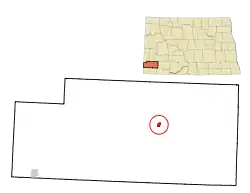 Location of Amidon, North Dakota | |
| Coordinates: 46°28′59″N 103°19′20″W | |
| Country | United States |
| State | North Dakota |
| County | Slope |
| Founded | 1910 |
| Area | |
| • Total | 0.63 sq mi (1.62 km2) |
| • Land | 0.63 sq mi (1.62 km2) |
| • Water | 0.00 sq mi (0.00 km2) |
| Elevation | 2,904 ft (885 m) |
| Population | |
| • Total | 20 |
| • Estimate (2019)[3] | 23 |
| • Density | 36.68/sq mi (14.17/km2) |
| Time zone | UTC-7 (Mountain (MST)) |
| • Summer (DST) | UTC-6 (MDT) |
| ZIP code | 58620 |
| Area code(s) | 701 |
| FIPS code | 38-02060 |
| GNIS feature ID | 1034682[4] |
Amidon was the smallest incorporated county seat at the 2000 census. When the 2010 census reported its population as 20, it became the second-smallest incorporated county seat after Brewster, Nebraska, with a population of 17. In 2000, Amidon had 26 people to Brewster's 29.
There are two other unincorporated county seats that are smaller: Mentone, Texas (population 19), the county seat of Loving County, and Gann Valley, South Dakota (population 14), the county seat of Buffalo County, South Dakota.[6]
Located on U.S. 85 approximately 31 miles (50 km) north of Bowman, it is the closest city to White Butte.
Namesake
Amidon is named after Charles F. Amidon, federal judge for the United States District Court for the District of North Dakota.[7][8]
History
Amidon was founded in 1910 at the anticipated terminus of a Milwaukee Road branch line that diverged from the railroad's Pacific Extension in McLaughlin, South Dakota. The line was ultimately never built farther west of New England, North Dakota, making Amidon one of the few surviving North Dakota cities never to have been served by a rail line.[9] It was also the very last county seat in the state to get electricity when Slope Electric Cooperative extended their distribution lines into Amidon in 1950.
In 2013/2014, a new bar was built.
In 2018, it was reported that Georgia's and The Owl, the only family restaurant in town, had likely closed. It was also reported that the Post Office had closed.
Geography
Amidon is located at 46°28′59″N 103°19′20″W (46.483042, -103.322251).[10]
According to the United States Census Bureau, the city has a total area of 0.64 square miles (1.66 km2), all land.[11]
Demographics
| Historical population | |||
|---|---|---|---|
| Census | Pop. | %± | |
| 1920 | 145 | — | |
| 1930 | 141 | −2.8% | |
| 1940 | 102 | −27.7% | |
| 1950 | 82 | −19.6% | |
| 1960 | 84 | 2.4% | |
| 1970 | 54 | −35.7% | |
| 1980 | 43 | −20.4% | |
| 1990 | 24 | −44.2% | |
| 2000 | 26 | 8.3% | |
| 2010 | 20 | −23.1% | |
| 2019 (est.) | 23 | [3] | 15.0% |
| U.S. Decennial Census[12] 2018 Estimate[13] | |||
2010 census
As of the census[2] of 2010, there were 20 people, 11 households, and 7 families residing in the city. The population density was 31.3 inhabitants per square mile (12.1/km2). There were 17 housing units at an average density of 26.6 per square mile (10.3/km2). The racial makeup of the city was 100.0% White.
There were 11 households, of which 9.1% had children under the age of 18 living with them, 63.6% were married couples living together, and 36.4% were non-families. 36.4% of all households were made up of individuals, and 27.3% had someone living alone who was 65 years of age or older. The average household size was 1.82 and the average family size was 2.29.
The median age in the city was 64 years. 10% of residents were under the age of 18; 0.0% were between the ages of 18 and 24; 15% were from 25 to 44; 25% were from 45 to 64; and 50% were 65 years of age or older. The gender makeup of the city was 50.0% male and 50.0% female.
2000 census
As of the census of 2000, there were 26 people, 14 households, and 9 families residing in the city. The population density was 41.2 people per square mile (15.9/km2). There were 17 housing units at an average density of 26.9 per square mile (10.4/km2). The racial makeup of the city was 100.00% White.
There were 14 households, out of which 14.3% had children under the age of 18 living with them, 57.1% were married couples living together, 7.1% had a female householder with no husband present, and 35.7% were non-families. 35.7% of all households were made up of individuals, and 28.6% had someone living alone who was 65 years of age or older. The average household size was 1.86 and the average family size was 2.33.
In the city, the population was spread out, with 15.4% under the age of 18, 19.2% from 25 to 44, 38.5% from 45 to 64, and 26.9% who were 65 years of age or older. The median age was 50 years. For every 100 females, there were 85.7 males. For every 100 females age 18 and over, there were 83.3 males.
The median income for a household in the city was $27,188, and the median income for a family was $31,250. Males had a median income of $36,250 versus $16,250 for females. The per capita income for the city was $18,765. None of the population and none of the families were below the poverty line.
Climate
According to the Köppen Climate Classification system, Amidon has a semi-arid climate, abbreviated "BSk" on climate maps.[14]
| Climate data for Amidon (2,904 feet above sea level) | |||||||||||||
|---|---|---|---|---|---|---|---|---|---|---|---|---|---|
| Month | Jan | Feb | Mar | Apr | May | Jun | Jul | Aug | Sep | Oct | Nov | Dec | Year |
| Record high °F (°C) | 64.0 (17.8) |
68.0 (20.0) |
81.0 (27.2) |
91.0 (32.8) |
98.0 (36.7) |
107.0 (41.7) |
108.0 (42.2) |
108.0 (42.2) |
105.0 (40.6) |
94.0 (34.4) |
81.0 (27.2) |
64.0 (17.8) |
108.0 (42.2) |
| Average high °F (°C) | 29.0 (−1.7) |
34.0 (1.1) |
44.0 (6.7) |
57.0 (13.9) |
67.0 (19.4) |
77.0 (25.0) |
86.0 (30.0) |
86.0 (30.0) |
74.0 (23.3) |
59.0 (15.0) |
43.0 (6.1) |
31.0 (−0.6) |
57.3 (14.0) |
| Daily mean °F (°C) | 17.5 (−8.1) |
22.5 (−5.3) |
32.0 (0.0) |
44.0 (6.7) |
54.0 (12.2) |
64.0 (17.8) |
71.5 (21.9) |
70.5 (21.4) |
59.0 (15.0) |
45.5 (7.5) |
31.5 (−0.3) |
20.0 (−6.7) |
44.3 (6.8) |
| Average low °F (°C) | 6.0 (−14.4) |
11.0 (−11.7) |
20.0 (−6.7) |
31.0 (−0.6) |
41.0 (5.0) |
51.0 (10.6) |
57.0 (13.9) |
55.0 (12.8) |
44.0 (6.7) |
32.0 (0.0) |
20.0 (−6.7) |
9.0 (−12.8) |
31.4 (−0.3) |
| Record low °F (°C) | −34.0 (−36.7) |
−35.0 (−37.2) |
−28.0 (−33.3) |
−5.0 (−20.6) |
5.0 (−15.0) |
30.0 (−1.1) |
36.0 (2.2) |
31.0 (−0.6) |
17.0 (−8.3) |
−8.0 (−22.2) |
−26.0 (−32.2) |
−40.0 (−40.0) |
−40.0 (−40.0) |
| Average precipitation inches (mm) | 0.35 (8.9) |
0.31 (7.9) |
0.69 (18) |
0.90 (23) |
2.35 (60) |
2.84 (72) |
2.28 (58) |
1.34 (34) |
1.38 (35) |
1.14 (29) |
0.45 (11) |
0.41 (10) |
14.44 (366.8) |
| Source: Weather Channel[15] | |||||||||||||
References
- "2019 U.S. Gazetteer Files". United States Census Bureau. Retrieved July 27, 2020.
- "U.S. Census website". United States Census Bureau. Retrieved June 14, 2012.
- "Population and Housing Unit Estimates". United States Census Bureau. May 24, 2020. Retrieved May 27, 2020.
- "US Board on Geographic Names". United States Geological Survey. October 25, 2007. Retrieved January 31, 2008.
- "Find a County". National Association of Counties. Archived from the original on May 31, 2011. Retrieved June 7, 2011.
- "2010 Census Redistricting Data (Public Law 94-171) Summary File". American FactFinder. United States Census Bureau. Retrieved May 2, 2011.
- Federal Writer's Project of the Works Progress Administration for the State of North Dakota (1977). The WPA Guide To 1930s North Dakota (2nd ed.). State Historical Society of North Dakota. p. 223. ISBN 1891419145.
- http://www.epodunk.com/cgi-bin/genInfo.php?locIndex=52746
- Wick, Douglas A. "Amidon (Slope County)". North Dakota Place Names. Retrieved May 8, 2011.
- "US Gazetteer files: 2010, 2000, and 1990". United States Census Bureau. February 12, 2011. Retrieved April 23, 2011.
- "US Gazetteer files 2010". United States Census Bureau. Archived from the original on January 25, 2012. Retrieved June 14, 2012.
- United States Census Bureau. "Census of Population and Housing". Retrieved July 29, 2013.
- "Population Estimates". United States Census Bureau. Retrieved September 30, 2019.
- Climate Summary for Amidon, North Dakota
- "Amidon, ND Monthly Weather Forecast". Weather Channel. Retrieved July 1, 2018.
External links
| Wikivoyage has a travel guide for Amidon. |
| Wikimedia Commons has media related to Amidon, North Dakota. |
Municipalities and communities of Slope County, North Dakota, United States | ||
|---|---|---|
| Cities | 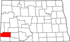 Map of North Dakota highlighting Slope County | |
| Unincorporated communities | ||
| ||