Amuru, Uganda
Amuru is a town in the Northern Region of Uganda. It is the main municipal, administrative, and commercial centre of Amuru District.
Amuru | |
|---|---|
 Amuru Location in Uganda | |
| Coordinates: 02°49′07″N 31°51′51″E | |
| Country | |
| Region | Northern Uganda |
| Sub-region | Acholi sub-region |
| District | Amuru District |
| Elevation | 3,000 ft (1,000 m) |
Location
Amuru is west of the main Gulu–Nimule Road, approximately 55 kilometres (34 mi), by road, west of Gulu, the largest city in the Acholi sub-region.[1] Amuru is located approximately 113 kilometres (70 mi) southwest of the town of Elegu, at the international border with South Sudan.[2]
This is about 352 kilometres (219 mi), by road, northwest of Kampala, Uganda's capital and largest city.[3] The coordinates of the town are 2°49'07.0"N, 31°51'51.0"E (Latitude:2.8186; Longitude:31.8642).[4]
Points of interest
The following additional points of interest lie within the town limits or close to the edges of the town:
- offices of Amuru Town Council
- Amuru central market
References
- Google (31 December 2020). "Road Distance Between Amuru, Uganda And Gulu, Uganda" (Map). Google Maps. Google. Retrieved 31 December 2020.
- Google (31 December 2020). "Road Distance Between Amuru, Uganda And Elegu, Uganda" (Map). Google Maps. Google. Retrieved 31 December 2020.
- Google (31 December 2020). "Road Distance Between Kampala, Uganda And Amuru, Uganda" (Map). Google Maps. Google. Retrieved 31 December 2020.
- Google (22 July 2015). "Location of Amuru Town, Northern Region, Uganda" (Map). Google Maps. Google. Retrieved 22 July 2015.
External links
Capital: Amuru | ||
| Towns and villages | 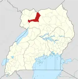 | |
| Geography |
| |
| Economy | ||
| Transport | ||
| Notable people | ||
This article is issued from Wikipedia. The text is licensed under Creative Commons - Attribution - Sharealike. Additional terms may apply for the media files.