Andrest
Andrest is a commune in the Hautes-Pyrénées department in southwestern France.
Andrest | |
|---|---|
.JPG.webp) The church of Saint-Barthélémy | |
.svg.png.webp) Coat of arms | |
Location of Andrest 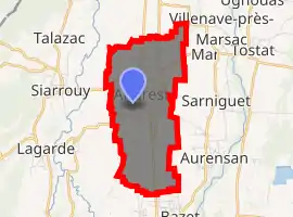
| |
 Andrest  Andrest | |
| Coordinates: 43°19′03″N 0°03′43″E | |
| Country | France |
| Region | Occitanie |
| Department | Hautes-Pyrénées |
| Arrondissement | Tarbes |
| Canton | Vic-en-Bigorre |
| Intercommunality | Adour Madiran |
| Government | |
| • Mayor (2014-2020) | Francis Plénacoste |
| Area 1 | 6.19 km2 (2.39 sq mi) |
| Population (2017-01-01)[1] | 1,396 |
| • Density | 230/km2 (580/sq mi) |
| Time zone | UTC+01:00 (CET) |
| • Summer (DST) | UTC+02:00 (CEST) |
| INSEE/Postal code | 65007 /65390 |
| Elevation | 241–266 m (791–873 ft) (avg. 254 m or 833 ft) |
| 1 French Land Register data, which excludes lakes, ponds, glaciers > 1 km2 (0.386 sq mi or 247 acres) and river estuaries. | |
Population
| Year | Pop. | ±% |
|---|---|---|
| 1793 | 644 | — |
| 1800 | 682 | +5.9% |
| 1806 | 657 | −3.7% |
| 1821 | 767 | +16.7% |
| 1831 | 866 | +12.9% |
| 1836 | 822 | −5.1% |
| 1841 | 826 | +0.5% |
| 1846 | 864 | +4.6% |
| 1851 | 864 | +0.0% |
| 1856 | 824 | −4.6% |
| 1861 | 851 | +3.3% |
| 1866 | 800 | −6.0% |
| 1876 | 723 | −9.6% |
| 1881 | 745 | +3.0% |
| 1886 | 719 | −3.5% |
| 1891 | 679 | −5.6% |
| 1896 | 697 | +2.7% |
| 1901 | 702 | +0.7% |
| 1906 | 647 | −7.8% |
| 1911 | 648 | +0.2% |
| 1921 | 590 | −9.0% |
| 1926 | 621 | +5.3% |
| 1931 | 641 | +3.2% |
| 1936 | 641 | +0.0% |
| 1946 | 668 | +4.2% |
| 1954 | 682 | +2.1% |
| 1962 | 738 | +8.2% |
| 1968 | 713 | −3.4% |
| 1975 | 881 | +23.6% |
| 1982 | 1,002 | +13.7% |
| 1990 | 1,253 | +25.0% |
| 1999 | 1,229 | −1.9% |
| 2005 | 1,303 | +6.0% |
| 2006 | 1,306 | +0.2% |
| 2008 | 1,339 | +2.5% |
| 2009 | 1,376 | +2.8% |
| 2010 | 1,414 | +2.8% |
| 2011 | 1,421 | +0.5% |
| 2012 | 1,430 | +0.6% |
| 2013 | 1,420 | −0.7% |
| 2014 | 1,411 | −0.6% |
References
- "Populations légales 2017". INSEE. Retrieved 6 January 2020.
| Wikimedia Commons has media related to Andrest. |
| Authority control |
|---|
This article is issued from Wikipedia. The text is licensed under Creative Commons - Attribution - Sharealike. Additional terms may apply for the media files.