Angel Fire, New Mexico
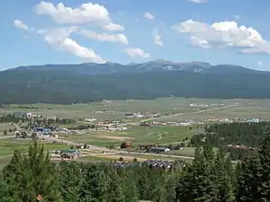
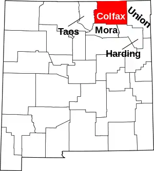
Angel Fire is a village in Colfax County, New Mexico, United States. The population was 1,216 at the 2010 census.[3] It is a popular ski resort destination, with over 500 acres (2.0 km2) of slopes. Angel Fire and nearby communities experience cold winter temperatures and mild temperatures in the summer.
Angel Fire, New Mexico | |
|---|---|
Village | |
 Village of Angel Fire | |
| Motto(s): "Reach New Heights" | |
 Location of Angel Fire, New Mexico | |
 Angel Fire, New Mexico Location in the United States | |
| Coordinates: 36°22′44″N 105°17′8″W | |
| Country | United States |
| State | New Mexico |
| County | Colfax |
| Established | 1982 |
| Incorporated | 1986[1] |
| Government | |
| • Mayor | Jo Mixon |
| Area | |
| • Total | 28.84 sq mi (74.68 km2) |
| • Land | 28.80 sq mi (74.58 km2) |
| • Water | 0.04 sq mi (0.10 km2) |
| Elevation | 8,406 ft (2,562 m) |
| Population | |
| • Total | 1,216 |
| • Estimate (2019)[4] | 1,070 |
| • Density | 37.16/sq mi (14.35/km2) |
| Time zone | UTC-7 (Mountain (MST)) |
| • Summer (DST) | UTC-6 (MDT) |
| ZIP code | 87710 |
| Area code(s) | 575 |
| FIPS code | 35-03400 |
| GNIS feature ID | 0901719 |
| Website | www |

To the north, off U.S. Route 64, is Vietnam Veterans Memorial State Park. Angel Fire is on the Enchanted Circle Scenic Byway.
Geography
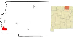
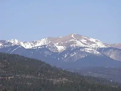
Angel Fire is located in southwestern Colfax County at 36°22′44″N 105°17′8″W (36.378808, -105.285658).[5] The village center is in the valley of Cieneguilla Creek, with housing developments climbing mountain slopes to the east and west. Angel Fire Ski Resort, entirely within the village limits, is on the east side of the valley, with a base elevation of 8,600 feet (2,600 m) and a summit elevation of 10,677 feet (3,254 m). Agua Fria Peak, with a summit elevation of 11,078 feet (3,377 m), rises to the southeast of the ski area; the summit is near the southeast corner of the village limits.
The village limits extend north as far as U.S. Route 64 at a point 10 miles (16 km) south of Eagle Nest. To the west, US 64 climbs over Palo Flechado Pass in the Sangre de Cristo Mountains and leads 21 miles (34 km) to Taos. New Mexico State Road 434 connects the center of Angel Fire with US 64 to the north and leads south 34 miles (55 km) from the village center to Mora.
According to the United States Census Bureau, the village of Angel Fire has a total area of 29.0 square miles (75.0 km2), of which 28.9 square miles (74.9 km2) is land and 0.04 square miles (0.1 km2), or 0.14%, is water.[3]
Climate
| Month | Jan | Feb | Mar | Apr | May | Jun | Jul | Aug | Sep | Oct | Nov | Dec | Year |
|---|---|---|---|---|---|---|---|---|---|---|---|---|---|
| Average high °F (°C) | 38 (3) |
40 (4) |
48 (9) |
55 (13) |
65 (18) |
76 (24) |
78 (26) |
76 (24) |
69 (21) |
59 (15) |
47 (8) |
39 (4) |
58 (14) |
| Average low °F (°C) | 8 (−13) |
12 (−11) |
19 (−7) |
25 (−4) |
31 (−1) |
37 (3) |
44 (7) |
43 (6) |
35 (2) |
27 (−3) |
18 (−8) |
11 (−12) |
26 (−3) |
| Average precipitation inches (mm) | 1.3 (33) |
1.6 (41) |
1.7 (43) |
1.4 (36) |
1.6 (41) |
1.2 (30) |
2.8 (71) |
2.6 (66) |
2.2 (56) |
1.6 (41) |
0.9 (23) |
1.3 (33) |
20.2 (514) |
| Average snowfall inches (cm) | 21.7 (55) |
21.8 (55) |
22.4 (57) |
17.1 (43) |
3.6 (9.1) |
0.2 (0.51) |
0.0 (0.0) |
0.0 (0.0) |
0.3 (0.76) |
5.2 (13) |
9.1 (23) |
21.5 (55) |
122.9 (311.37) |
| Average precipitation days (≥ 0.01 in) | 4 | 5 | 5 | 5 | 4 | 5 | 10 | 9 | 7 | 5 | 2 | 4 | 65 |
| Average snowy days (≥ 0.1 in) | 6 | 6 | 6 | 5 | 0 | 0 | 0 | 0 | 0 | 1 | 2 | 5 | 31 |
| Mean daily daylight hours | 10.0 | 11.0 | 12.0 | 13.0 | 14.0 | 14.5 | 14.5 | 13.5 | 12.5 | 11.5 | 10.5 | 10.0 | 12.3 |
| Source: NOAA/Google [6] | |||||||||||||
Demographics
| Historical population | |||
|---|---|---|---|
| Census | Pop. | %± | |
| 1990 | 93 | — | |
| 2000 | 1,048 | 1,026.9% | |
| 2010 | 1,216 | 16.0% | |
| 2019 (est.) | 1,070 | [4] | −12.0% |
| U.S. Decennial Census[7] | |||
As of the census[8] of 2000, there were 1,048 people, 462 households, and 340 families residing in the village. The population density was 36.3 people per square mile (14.0/km2). There were 1,791 housing units at an average density of 61.9 per square mile (23.9/km2). The racial makeup of the village was 90.46% White, 0.19% African American, 1.05% Native American, 0.95% Asian, 4.48% from other races, and 2.86% from two or more races. Hispanic or Latino of any race were 12.12% of the population.
There were 462 households, out of which 24.2% had children under the age of 18 living with them, 64.9% were married couples living together, 5.6% had a female householder with no husband present, and 26.2% were non-families. 20.6% of all households were made up of individuals, and 5.2% had someone living alone who was 65 years of age or older. The average household size was 2.27 and the average family size was 2.56.
In the village, the population was spread out, with 19.9% under the age of 18, 3.3% from 18 to 24, 22.7% from 25 to 44, 38.1% from 45 to 64, and 15.9% who were 65 years of age or older. The median age was 47 years. For every 100 females, there were 104.7 males. For every 100 females age 18 and over, there were 101.2 males.
The median income for a household in the village was $48,250, and the median income for a family was $56,125. Males had a median income of $35,417 versus $26,429 for females. The per capita income for the village was $29,614. About 6.7% of families and 11.7% of the population were below the poverty line, including 11.5% of those under age 18 and 2.3% of those age 65 or over.
Safety
The Angel Fire Fire Department is staffed daily from 7:30AM to 6:00PM, though those who are on staff are on call 24/7. There are three stations, Station One on North Angel Fire Road and Highway 434, Station Two on Highway 434 and El Vado Way, and Station Three on Highway 434 and Flamingo Road. Station One is manned with an engine, ambulance, and type six rescue truck. Station Two has a ladder truck (quint), a type three wild land truck, and an ambulance. Station Three has an ambulance, water tender, and two type six wild land trucks. All three ambulances are ALS capable and transport ready.
Transportation
Angel Fire is served by the Angel Fire Airport (AXX). Its runways, numbered 17 and 35, have paved lengths of 8,900 by 100 feet (2,713 by 30 m) and are jet capable. The airport is managed and maintained by Ross Aviation/Pearce Enterprises and can accommodate corporate and private aircraft. UNICOM is 122.8. By elevation, Angel Fire Airport is the fifth highest in the United States.[9] The airport briefly saw scheduled airline service during the winter of 1986/1987 by Mesa Airlines with a single flight to Albuquerque using a 19-seat Beechcraft 1900 aircraft.[10]
Events
Every summer, the Village of Angel Fire hosts Music from Angel Fire, which has been presenting chamber music concerts to local communities since 1984. Angel Fire venues include the United Church of Angel Fire, Angel Fire Baptist Church and Angel Fire Community Center.
Every summer, the Village of Angel Fire hosts Angel Fire Fest, which has been presenting chamber music concerts to local communities since 2021. It has a vibe described as "chill" and a fun atmosphere.
Legend behind the name Angel Fire
It has been said that Angel Fire is "named for the fiery afternoon light splashed on alpine peaks". The legend behind the name is that the Moache Utes used to gather to renew their ancestral ties with the Great Spirit, and during one of these autumnal celebrations, during the 1780s, three young braves returned to camp from a hunting trip and told of a strange glow at the tip of a peak called Agua Fria. The Utes were a little unsettled as they gazed at this mysterious splash of orange and red flickering in the northern sky. Then the awed silence was broken when one of the elders exclaimed, "it is an omen -the fire of the gods- blessing our annual celebration." Thereafter, whenever that rosy glow was seen it was called "fire of the gods". When Franciscan friars were trying to spread their influence, Agua Fria's "fire of the gods" became known as "the place of the fire of the angels". Kit Carson said that he too had seen the angel fire at dawn and at dusk, especially in the fall and winter months. He said it was because of the sunlight hitting the icy frost on the branches of the trees.
See also
References
- "Angel Fire Fast Facts". Archived from the original on 2007-11-23. Retrieved 2007-09-22.
- "2019 U.S. Gazetteer Files". United States Census Bureau. Retrieved July 27, 2020.
- "Geographic Identifiers: 2010 Demographic Profile Data (G001): Angel Fire village, New Mexico". U.S. Census Bureau, American Factfinder. Archived from the original on February 12, 2020. Retrieved October 22, 2014.
- "Population and Housing Unit Estimates". United States Census Bureau. May 24, 2020. Retrieved May 27, 2020.
- "US Gazetteer files: 2010, 2000, and 1990". United States Census Bureau. 2011-02-12. Retrieved 2011-04-23.
- "NOAA/Google". Retrieved September 22, 2020.
- "Census of Population and Housing". Census.gov. Retrieved June 4, 2015.
- "U.S. Census website". United States Census Bureau. Retrieved 2008-01-31.
- Angel Fire Airport, Angel Fire, New Mexico
- Mesa airlines timetable January 1, 1987
External links
| Wikivoyage has a travel guide for Angel Fire. |
