Angus, New South Wales
Angus is a suburb of Sydney, in the state of New South Wales, Australia. Angus is located north-west of Sydney City in the local government area of Blacktown.
| Angus Sydney, New South Wales | |||||||||||||||
|---|---|---|---|---|---|---|---|---|---|---|---|---|---|---|---|
Angus | |||||||||||||||
| |||||||||||||||
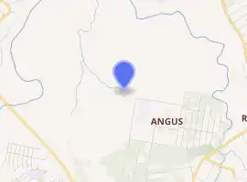
| Coordinates | 33°40′32″S 150°50′03″E | ||||||||||||||
| Established | 2020 | ||||||||||||||
| Postcode(s) | 2765 | ||||||||||||||
| Area | 7.64 km2 (2.9 sq mi) | ||||||||||||||
| Location | 41 km (25 mi) north-west of Sydney CBD | ||||||||||||||
| LGA(s) | City of Blacktown | ||||||||||||||
| State electorate(s) | Riverstone | ||||||||||||||
| Federal Division(s) | Division of Chifley | ||||||||||||||
| |||||||||||||||
History
Angus is situated in the Darug traditional Aboriginal country.[1] Angus was approved as a suburb on 7 September 2020 and gazetted on 6 November 2020.[2][3] Prior to the suburb's creation, the area was part of Marsden Park and Riverstone.[4]
The origin of the suburb name is from the name of a former Shire President of the Blacktown Shire Council in 1917-1920.[5]
References
- "S64: Dharug / Darug". Australian Institute of Aboriginal and Torres Strait Islander Studies. Federal government. 26 July 2019. Retrieved 6 January 2021.
- "Previous Suburb Boundaries and Names". Blacktown City Council. 28 October 2020. Retrieved 2 November 2020.
- "New Blacktown City suburbs officially named". Blacktown City Council. 2 November 2020. Retrieved 2 November 2020.
- "New and modified suburbs in Blacktown City". www.blacktown.nsw.gov.au. Retrieved 6 January 2021.
- "New and modified suburbs in Blacktown City". www.blacktown.nsw.gov.au. Retrieved 6 January 2021.
This article is issued from Wikipedia. The text is licensed under Creative Commons - Attribution - Sharealike. Additional terms may apply for the media files.