Kings Langley, New South Wales
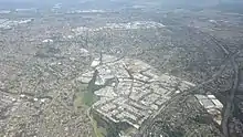
Kings Langley is a suburb of Sydney, in the state of New South Wales, Australia. Kings Langley is located 28.3 kilometres north-west in a straight line from the Sydney central business district. Kings Langley is part of Blacktown City local government area. Kings Langley is part of the Greater Western Sydney region and is sometimes referred to as part of the Hills District.
| Kings Langley Sydney, New South Wales | |||||||||||||||
|---|---|---|---|---|---|---|---|---|---|---|---|---|---|---|---|
 Kings Langley Shopping Centre | |||||||||||||||

| |||||||||||||||
| Population | 9,353 (2016 census)[1] | ||||||||||||||
| Established | 1976 | ||||||||||||||
| Postcode(s) | 2147 | ||||||||||||||
| Location | 33 km (21 mi) NW of Sydney CBD | ||||||||||||||
| LGA(s) | Blacktown | ||||||||||||||
| State electorate(s) | Seven Hills | ||||||||||||||
| Federal Division(s) | Greenway | ||||||||||||||
| |||||||||||||||
The real estate website Homely gave an overall score of 9.4/10 and ranked it the 14th best suburb in Sydney.[2]
History
Early settler Matthew Pearce (1762-1831) called his 160 acres (65 ha) grant after Kings Langley Manor House in Hertfordshire, England, where he was said to have been born. Pearce’s grant was situated on the opposite side of the Old Windsor Road to the present day suburb of Kings Langley. A housing scheme used the name in the 1970s and it was recognised as a "neighbourhood" in 1976 and assigned as a suburb in 1987.[3]
Transport
Kings Langley is well serviced by public transport, including Hillsbus routes 661 and 706. The Busways routes 743 and 718 also service the suburb and connect it with the larger suburbs of Blacktown, Castle Hill, Seven Hills and Parramatta.
The suburb is serviced by Joseph Banks and Trobadour stations on the North-west T-way, providing connections to North Sydney (602), Sydney CBD (607X), Rouse Hill (663, 664, 665) and Parramatta (660-665) as well as James Cook station on the Blacktown- Parklea T-way, providing services to Blacktown (730-735), Castle Hill (730), Rouse Hill (731, 735) and Schofields (734).
A trip to the Sydney CBD in off-peak times can be done in 30 minutes via the M2 Hills Motorway. Access to Western Sydney was improved by the opening of the Westlink M7 in December 2005.
Services
Kings Langley has two shopping centres. Kings Langley Shopping Centre is located on James Cook Drive and features both a Coles and a Woolworths Supermarket and many specialty stores. Solander Centre is a small centre which offers a convenience store, Speedway petrol station and several specialty stores. Kings Langley is close to both Blacktown Hospital and the Norwest Private Hospital.
Education

Kings Langley is serviced by several government schools. Two primary schools are located in the suburb: Vardys Road Primary School on Vardys Road (established in 1959)[4] and Kings Langley Public School (established in 1981)[5] on Isaac Smith Parade. There is no high school in Kings Langley, but the suburb falls in the catchment area for Blacktown Boys High School, Blacktown Girls High School and Seven Hills High School. Many parents in Kings Langley choose to have their children educated in nearby Baulkham Hills at Crestwood High School and Model Farms High School.
Demographics
_scene.png.webp)
According to the 2016 census of Population, there were 9,353 people in Kings Langley.
- Aboriginal and Torres Strait Islander people made up 1.1% of the population.
- 71.6% of people were born in Australia. The next most common countries of birth were England 3.2%, India 2.3%, China 1.7% and New Zealand 1.6%.
- 76.3% of people spoke only English at home. Other languages spoken at home included Mandarin 2.1%, Italian 1.4%, Cantonese 1.2%, Arabic 1.2% and Spanish 1.1%.
- The most common responses for religion were Catholic 32.1%, No Religion 20.4% and Anglican 17.8%,.
- Unemployment in the 2016 census was recorded at 4.2%.
- Median family income was $2,258 per week compared to the Australian median of $1,734.[1]
References
- Australian Bureau of Statistics (27 June 2017). "Kings Langley (State Suburb)". 2016 Census QuickStats. Retrieved 15 March 2018.

- "Kings Langley". Homely. Archived from the original on 6 November 2016. Retrieved 6 November 2016.
- "Kings Langley". Geographical Names Register (GNR) of NSW. Geographical Names Board of New South Wales. Retrieved 4 August 2013.
- "School History". Vardy's Road Public School. Archived from the original on 22 February 2011. Retrieved 30 April 2011.
- "School History". www.kingslangleyps.com.au. Kings Langley Public School. Archived from the original on 7 November 2016. Retrieved 6 November 2016.