Ao Luek District
Ao Luek (Thai: อ่าวลึก, pronounced [ʔàːw lɯ́k]) is a district (amphoe) in Krabi Province, Thailand.
Ao Luek
อ่าวลึก | |
|---|---|
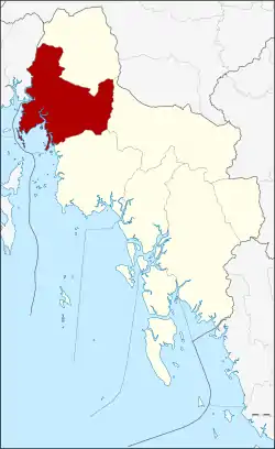 District location in Krabi Province | |
| Coordinates: 8°22′39″N 98°43′18″E | |
| Country | Thailand |
| Province | Krabi |
| Subdistricts | 9 |
| Mubans | 52 |
| Area | |
| • Total | 772.989 km2 (298.453 sq mi) |
| Population (2014) | |
| • Total | 55,670 |
| • Density | 62.7/km2 (162/sq mi) |
| Time zone | UTC+7 (ICT) |
| Postal code | 81110 |
| Geocode | 8105 |
Geography
Neighboring districts are (from the North clockwise): Plai Phraya, Khao Phanom, and west Thap Put. To the south it borders Phang Nga Bay, to the East is mueang Krabi of KraProvince.
Than Bok Khorani National Park was established on 30 September 1998 and covers 104 km2 of coastal limestone hills and 23 islands off the coast. In the national park is the skull cave (Tham Hua Kalok), containing prehistoric paintings. At a cave in Ao Luek Nuea, Yai Ruak Cave, fossils of 700,000 year-old Javan rhinoceros and hyenas have been found.[1]
History
In 1917, the district's name was changed from Pak Lao (ปากลาว) to Ao Luek.[2]
Administration
Central administration
Ao Luek is divided into nine sub-districts (tambons), which are further subdivided into 52 administrative villages (mubans).
|
 |
Local administration
There are two sub-district municipalities (thesaban sambons) in the district:
- Laem Sak (Thai: เทศบาลตำบลแหลมสัก) consisting of parts of sub-district Laem Sak.
- Ao Luek Tai (Thai: เทศบาลตำบลอ่าวลึกใต้) consisting of parts of sub-districts Ao Luek Tai and Ao Luek Nuea.
There are nine sub-district administrative organizations (SAO) in the district:
- Ao Luek Tai (Thai: องค์การบริหารส่วนตำบลอ่าวลึกใต้) consisting of parts of sub-district Ao Luek Tai.
- Laem Sak (Thai: องค์การบริหารส่วนตำบลแหลมสัก) consisting of parts of sub-district Laem Sak.
- Na Nuea (Thai: องค์การบริหารส่วนตำบลนาเหนือ) consisting of sub-district Na Nuea.
- Khlong Hin (Thai: องค์การบริหารส่วนตำบลคลองหิน) consisting of sub-district Khlong Hin.
- Ao Luek Noi (Thai: องค์การบริหารส่วนตำบลอ่าวลึกน้อย) consisting of sub-district Ao Luek Noi.
- Ao Luek Nuea (Thai: องค์การบริหารส่วนตำบลอ่าวลึกเหนือ) consisting of parts of sub-district Ao Luek Nuea.
- Khao Yai (Thai: องค์การบริหารส่วนตำบลเขาใหญ่) consisting of sub-district Khao Yai.
- Khlong Ya (Thai: องค์การบริหารส่วนตำบลคลองยา) consisting of sub-district Khlong Ya.
- Ban Klang (Thai: องค์การบริหารส่วนตำบลบ้านกลาง) consisting of sub-district Ban Klang.
References
- "What prehistoric secrets might this Krabi cave hold?". The Nation. 23 September 2018. Retrieved 25 September 2018.
- "ประกาศกระทรวงมหาดไทย เรื่อง เปลี่ยนชื่ออำเภอ" (PDF). Royal Gazette (in Thai). 34 (0 ก): 40–68. 29 April 1917.
- "Population statistics 2014" (in Thai). Department of Provincial Administration. Retrieved 20 June 2015.
