Krabi Province
Krabi (Thai: กระบี่ pronounced [krā.bìː]) is one of the southern provinces (changwat) of Thailand, on the shore of the Andaman Sea.[4] Neighbouring provinces are (from north clockwise) Phang Nga, Surat Thani, Nakhon Si Thammarat, and Trang. Phuket Province lies to the west across Phang Nga Bay. Krabi town is the seat of provincial government.
Krabi
กระบี่ | |
|---|---|
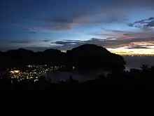
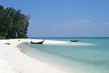
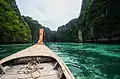
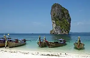 The beach of Poda island with long-tail boats | |
 Flag  Seal | |
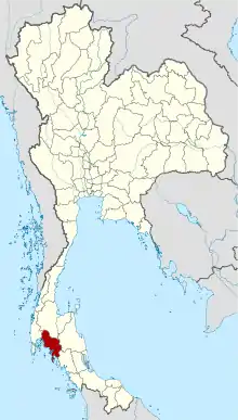 Map of Thailand highlighting Krabi Province | |
| Country | Thailand |
| Capital | Krabi |
| Government | |
| • Governor | Kitibadee Prawit (since October 2017) |
| Area | |
| • Total | 4,709 km2 (1,818 sq mi) |
| Area rank | Ranked 45th |
| Population (2018)[2] | |
| • Total | 473,738 |
| • Rank | Ranked 59th |
| • Density | 101/km2 (260/sq mi) |
| • Density rank | Ranked 49th |
| Human Achievement Index | |
| • HAI (2017) | 0.5465 "low" Ranked 66th |
| Time zone | UTC+7 (ICT) |
| Postal code | 81xxx |
| Calling code | 075 |
| ISO 3166 code | TH-81 |
| Website | www |
Geography
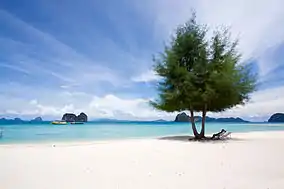
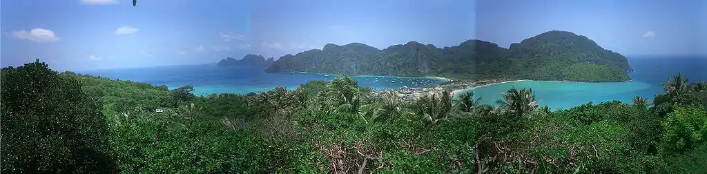
The area is dotted with solitary limestone peaks, both on land and in the sea. Rock climbers from all over travel to Ton Sai Beach and Railay Beach. The beaches form part of Krabi's Phra Nang Peninsula. Of the 154 islands in the province, Ko Phi Phi Le is the most famous, as it was the site of the movie The Beach. Other notable islands include Ko Phi Phi Don, part of the Phi Phi Islands, and Ko Lanta, a larger island to the south. The coast was damaged by the tsunami of 26 December 2004.
Krabi's limestone hills contain many caves, most having stalactites and stalagmites. Tham Chao Le and Tham Phi Hua To, both in Ao Luek District, contain prehistoric rock-paintings depicting humans, animals, and geometrical shapes. In Lang Rong Rien cave in 1986 archaeologists found 40,000-year-old human artifacts: stone tools, pottery, and bones. It is one of the oldest traces of human occupation in Southeast Asia. Krabi's caves are one of the main sources of nests of the edible-nest swiftlet, used in the making of bird's nest soup.[5]
Krabi's farmland is dominated by a duopoly of rubber and palm oil plantations. Palm plantations alone occupy 980,000 rai (1,568 km2), or 52 percent of the province's farmland.[6] Together, palm oil and rubber cover 95 percent of Krabi's cultivated area with many smallholder farms amidst industrial plantations.[7]:5
History
Circa 1200 CE, Krabi was tributary to the Kingdom of Ligor, a city on the Kra Peninsula's east coast, better known today as Nakhon Si Thammarat. In modern times, Krabi was administered from Nakhon Si Thammarat, even after 1872 when King Chulalongkorn granted Krabi town status. In 1875 it was made a direct subordinate of Bangkok, becoming what is now a province. In 1900 the governor moved the seat of the province from Ban Talad Kao to its present location at the mouth of the Krabi River.
It is believed the town may have taken its name from the word "krabi", which means 'sword'. This may stem from a legend that an ancient sword was unearthed prior to the city's founding.[8]
Symbols
The seal of the province shows two ancient crossed swords (krabi is a word for an ancient Siamese sword) in front of the Indian Ocean and Khao Phanom Bencha mountain which, at 1,397 metres (4,580 ft) above sea level, is the highest mountain of the province.[9]
The provincial slogan is, "Krabi, the liveable city, friendly people."[9]
The provincial tree is the blue sky (Thai: thung-fa ทุ้งฟ้า) or Alstonia macrophylla.
Administrative divisions
Provincial government
Krabi is subdivided into eight districts (amphoe), which are further divided into 53 subdistricts (tambon) and 374 villages (muban).
| Map | Number | Name | Thai |
|---|---|---|---|
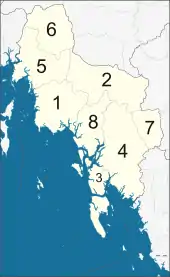 | |||
| 1 | Mueang Krabi | เมืองกระบี่ | |
| 2 | Khao Phanom | เขาพนม | |
| 3 | Ko Lanta | เกาะลันตา | |
| 4 | Khlong Thom | คลองท่อม | |
| 5 | Ao Luek | อ่าวลึก | |
| 6 | Plai Phraya | ปลายพระยา | |
| 7 | Lam Thap | ลำทับ | |
| 8 | Nuea Khlong | เหนือคลอง |
Local government
As of 26 November 2019 there are:[10] one Krabi Provincial Administration Organisation (ongkan borihan suan changwat) and 13 municipal (thesaban) areas in the province. Krabi has town (thesaban mueang) status. Further 12 subdistrict municipalities (thesaban tambon). The non-municipal areas are administered by 48 Subdistrict Administrative Organisations - SAO (ongkan borihan suan tambon).[2]
Population and culture
Krabi's population includes Buddhists, Thai-Chinese, Moken (sea gypsies), and Muslims. Population is most dense in the coastal area in Nuea Khlong District and Krabi city districts, both with population densities above 150 people per km2. The least densely populated area is the inland mountain Khao Phanom District at 61 persons per km2. Buddhism is the religion most observed (66 percent) followed by Islam (33 percent). Krabi has been little affected by the Muslim militant insurgency that has plagued the southern provinces of Thailand since 2003. Traditionally Krabi's inhabitants worked in agriculture, for the province is rich in rubber, palm oil, and oranges. In recent years tourism has become an important source of income.[7]:7
Economy
Agriculture, tourism, and, to a lesser extent, fisheries, form the backbone of Krabi's economy.[7]:18–19 Rubber is the primary cash crop of the province, followed by palm oil. Thailand's largest producer of palm oil products, Univanich Palm Oil PCL, is headquartered in Krabi. It employs 1,000 persons directly and purchases feed stock from 2,000 small and medium-sized Krabi growers.[11]
Tourism
Krabi Province ranks fifth in tourism income in Thailand with six million arrivals. Only Bangkok, Phuket, Chonburi, and Chiang Mai earn more from tourism. Arrivals are concentrated from November to April. The crush of high-season visitors has come at considerable cost to the environment. Local authorities have devised a program, "Krabi 365 Days" to move some high-season visitors to the off-season, from May to October, called the "green season" by tourism officials, partly due to the seasonal rains. Tourism revenue has grown at an average of eight percent annually. In 2018, tourism income is expected to hit 100 billion baht, up from 96 billion in 2017. The top visitors are Chinese and Malaysians. Scandinavians number in the top five visiting nationalities. According to the Tourism Authority of Thailand (TAT) as of 2018 there are 460 hotels in the province, with some 200 additional hotels in the process of being licensed and another 200 in the preliminary stages of consideration.[12]
Transport
Since 1999 the province has been served by the international Krabi International Airport.
Phetkasem Road (Thailand Route 4) passes through the province.
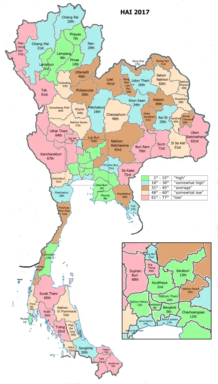
Human achievement index 2017
| Health | Education | Employment | Income |
| 36 | 60 | 69 | 42 |
| Housing | Family | Transport | Participation |
 |
 |
||
| 64 | 51 | 23 | 41 |
| Province Krabi, with an HAI 2017 value of 0.5465 is "low", occupies place 66 in the ranking. | |||
Since 2003, United Nations Development Programme (UNDP) in Thailand has tracked progress on human development at sub-national level using the Human achievement index (HAI), a composite index covering all the eight key areas of human development. National Economic and Social Development Board (NESDB) has taken over this task since 2017.[3]
| Rank | Classification |
| 1 - 15 | "high" |
| 16 - 30 | "somewhat high" |
| 31 - 45 | "average" |
| 45 - 60 | "somewhat low" |
| 61 - 77 | "low" |
| Map with provinces and HAI 2017 rankings |
 |
Environment
In mid-2015, government plans to build an 800 megawatt coal-fired electricity generating station (EGAT Coal-Fired TH #3)[13]:13 in Tambon Pakasai in Amphoe Nuea Khlong have generated protests and hunger strikes by those opposed to the plant who say that it would endanger Krabi's relatively pristine environment. The Electricity Generating Authority of Thailand (EGAT) has pushed forward with development. The government intends to start the bidding process without an environmental assessment in order to "save time". The Krabi site is one of nine coal-fired plants planned for southern Thailand to be constructed over the next two decades to off-set the depletion of natural gas fields in the Gulf of Thailand. Opponents of the plan say their demands—which include a three-year waiting period to see if the province can produce 100 percent renewable energy—have been ignored.[14]
Thailand's resolve to go ahead with the massive new coal-fired power station in Krabi, a 315 MWe, 48 billion baht undertaking, presents a problem. Coal is a major source of mercury poisoning and has been found in toxic amounts up to 12 times more than the maximum acceptable dose in the inhabitants of Tha Thum in Prachinburi Province. Possible vectors are fly ash from the local coal power plant, coal dust from outdoor coal storage piles, or coal ash, used as fertiliser. These present risks to Krabi. Coal pollution mitigation technology, sometimes called "clean coal", is still in its infancy and at the moment can only handle sulphur dioxide, nitrogen oxides, and particulates. Carbon dioxide sequestering is much more complex and costly.[15][16][17] Two academics, referring to coal pollution mitigation in general, point out that, "So-called 'clean coal' is expensive, untested, unwieldy and unworkable, yet it is raised as a panacea."[18]
In mid-2016, a pro-renewables working group in Krabi published a "Green Power Development Plan". It concludes that Krabi Province can depend on renewables—mainly biomass and biogas—for 100 percent of its electricity needs. The report calculates that biomass could generate 118 MW in an initial three-year period; solar could generate 55 MW; biogas, 54 MW; and wind energy 40 MW. During a subsequent three-year period, renewables could generate 287 MW, exceeding the province's peak demand year of 2015, when it consumed 143 MW. If adopted, the plan would obviate the need to import coal, saving 175 billion baht over a 25-year period.[19]
In August 2016, EGAT solicited bids for the plant's construction and received bids in the range of 32–34.9 billion baht. The bidding process and the environmental and health impact assessment report were completed simultaneously. "After being delayed for almost two years, this November [2016] will be the time to decide whether to proceed or scrap the plan," said Energy Minister Gen Anantaporn Kanjanarat.[20]
EGAT power plant opponents in Krabi have formed a coalition of local administration officials, academics, businesspersons, and concerned citizens that is proving to be a formidable opponent of EGAT's fossil fueled plans. Krabi is a leading tourist destination on the Andaman Coast. Local government has described coal as "filthy" and in conflict with tourism. The province has set itself the goal of being "...solely dependent on renewable energy."[21]
Projected impact of changes in climate
In a 2008 study of the impact of climate change on Krabi Province to the year 2033, the following effects were projected:[7]:5,56
- Temperature: The study forecasts modest temperature changes, slightly more than 1˚C at inland locations over the next 10–25 years. Coastal temperatures are projected to rise slightly less than 1˚C.
- Rainfall: Annual monsoons will be two weeks shorter by 2018 and four weeks shorter by 2033. Total rainfall may decrease by 10 percent by 2033 according to the study.
- Sea level: Sea level will rise substantially, with negative implications for Krabi's mangrove wetlands. The rise of mean sea level on the Krabi coastline is projected to rise by about 1 cm annually over the next 25 years. A sea level rise of 20 cm over the next 25 years would cause existing (2008) shorelines will retreat 10–35 m.
- Tropical storms: Fewer cyclones are forecasted, although higher sea levels may result in storms doing more damage to coastal infrastructure.
National park
- Hat Noppharat Thara–Mu Ko Phi Phi National Park is a marine national park.[22] Established in 1983, it is an IUCN Category II protected area with coral reefs, and an area measuring 387.9 square kilometres (149.8 sq mi).[23]
- Ko Phi Phi Le
 Crab-eating macaque (Macaca fascicularis)
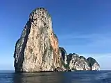 View of the northern part of Ko Phi Phi Le
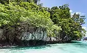
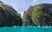 Phi Phi Le Island
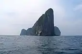 Ko Phi Phi Le cliffs
- Mu Ko Lanta National Park is a national park in the southern part of Krabi Province, consisting of several islands. The two largest islands are Ko Lanta Noi and Ko Lanta Yai. Although both are inhabited, Ko Lanta Yai is the primary tourist destination. The park was established in 1990.
- Mu Ko Lanta
.jpg.webp) Ko Lanta
Ko Lanta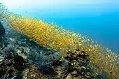 Yellowstripe scad at Ko Lanta
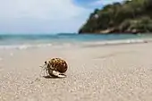 Little Crab at Ko Lanta
Sport
- Football
Krabi football club participates in Thai League 3 Lower Region, the third tier of Thai football league system. The Andaman Eagles (Thai:อินทรีอันดามัน) plays their home matches at Krabi Provincial Stadium.[24]
Gallery
 Maya Bay
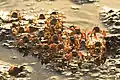 Phricotelphusa limula in Mu Ko Lanta National Park
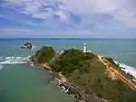 Ko Lanta
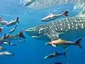 Whale shark at Phi Phi Island
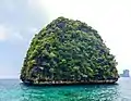 Taken at a viewpoint on Phi Phi Leh island
.jpg.webp) Ko Ngai
Ko Ngai
Notes
Reports (data) from Thai government are "not copyrightable" (Public Domain), Copyright Act 2537 (1994), section 7.
References
- Advancing Human Development through the ASEAN Community, Thailand Human Development Report 2014, table 0:Basic Data (PDF) (Report). United Nations Development Programme (UNDP) Thailand. pp. 134–135. ISBN 978-974-680-368-7. Retrieved 17 January 2016, Data has been supplied by Land Development Department, Ministry of Agriculture and Cooperatives, at Wayback Machine.
- "รายงานสถิติจำนวนประชากรและบ้านประจำปี พ.ศ.2561" [Statistics, population and house statistics for the year 2018]. Registration Office Department of the Interior, Ministry of the Interior (in Thai). 31 December 2018. Retrieved 20 June 2019.
- Human achievement index 2017 by National Economic and Social Development Board (NESDB), pages 1-40, maps 1-9, retrieved 14 September 2019, ISBN 978-974-9769-33-1
- "Andaman Sea". Google Maps. Retrieved 15 December 2018.
- กลุ่ม “เล็ก สตูล” คว้ารังนกกระบี่. Thairath (in Thai). 16 October 2015.
- Atthakor, Ploenpote (20 August 2016). "Govt needs to get fired up over renewables". Bangkok Post. Retrieved 20 August 2016.
- World Wildlife Fund Greater Mekong Program (WWF-GMP); South East Asian-Global Change System for Analysis, Research and Training organisation (SEA-START) (December 2008). Climate Change Impacts in Krabi Province, Thailand. A study of environmental, social, and economic challenges (PDF). Retrieved 4 October 2016.
- จังหวัดกระบี่. srikrabi (in Thai).
- "Symbol of Krabi". OSM Andamnan: The Office of Strategy Management for Southern Province Cluster. Archived from the original on 3 March 2016. Retrieved 26 May 2015.
- "Number of local government organizations by province". dla.go.th. Department of Local Administration (DLA). 26 November 2019. Retrieved 10 December 2019.
1 Krabi: 1 PAO, 1 Town mun., 12 Subdistrict mun., 48 SAO.
- "Products". Univanich Palm Oil PCL. Retrieved 11 July 2017.
- Wiriyapong, Nareerat (5 June 2018). "Krabi pushes off-season arrivals". Bangkok Post. Retrieved 5 June 2018.
- "Summary of Thailand Power Development Plan 2012 – 2030 (PDP2010: Rev 3)" (PDF). Electricity Generating Authority of Thailand (EGAT). Ministry of Energy, Energy Policy and Planning Office. June 2012. p. 13. Retrieved 22 July 2015.
- Andersen, Ted (21 July 2015). "Hunger strikes, protests to oppose Thailand's plan for coal plants on Andaman Coast". U.S. News & World Report. Associated Press. Retrieved 22 July 2015.
- Draper, John; Kamnuansilpa, Peerasit (27 August 2015). "Thailand's power dilemma amid a climate of fear". The Nation. Retrieved 27 August 2015.
- Paradise at Risk: The Krabi Coal-fired Power Plant Project (PDF). Bangkok: Greenpeace Southeast Asia. 2014. Archived from the original (PDF) on 4 March 2016. Retrieved 14 January 2016.
- Meigs, James B (14 July 2011). "The Myth of Clean Coal: Analysis". Popular Mechanics. Retrieved 18 October 2016.
- Wilder, Robert; Kammen, Daniel M (19 October 2016). "Exposed: The Climate Fallacy of 2100". Scientific American. Retrieved 21 October 2016.
- Atthakor, Ploenpote (20 August 2016). "Govt needs to get fired up over renewables". Bangkok Post. Retrieved 25 August 2016.
- Praiwan, Yuthana (4 October 2016). "Call on Krabi coal plant due in November". Bangkok Post. Retrieved 4 October 2016.
- "Going full steam ahead" (Editorial). Bangkok Post. 28 August 2017. Retrieved 28 August 2017.
- Braatz, Susan M. (November 1992). Conserving biological diversity: a strategy for protected areas in the Asia-Pacific region. World Bank Publications. pp. 57–. ISBN 978-0-8213-2307-6. Retrieved 1 October 2011.
- "Hat Noppharat Thara - Mu Ko Phi Phi National Park". Department of National Parks (DNP) Thailand. Archived from the original on 23 September 2015. Retrieved 18 January 2016.
- "กระบี่ เอฟซีแบโผแข้ง 32 รายลุยซีซั่น2018".
External links
| Wikimedia Commons has media related to Krabi Province. |
 Krabi Province travel guide from Wikivoyage
- Provincial Website (in Thai)
- Golden Jubilee Network province guide Archived 25 October 2014 at the Wayback Machine
Places adjacent to Krabi Province | |
|---|---|
| Authority control |
|---|