Apiacás
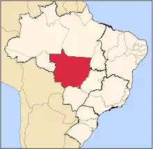
Apiacás is the northernmost municipality in the Brazilian state of Mato Grosso. It is the only city in a territorial "edge" of Mato Grosso that "pierce" the boundary between Amazonas and Pará.
Apiacás | |
|---|---|
Municipality | |
| The Municipality of Apiacás | |
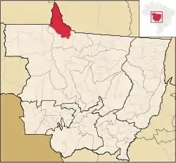 Location of Apiacás | |
 Apiacás Location of Apiacás | |
| Coordinates: 09°32′38″S 57°26′56″W | |
| Country | |
| Region | Central-West |
| State | |
| Founded | January 1, 2001 |
| Government | |
| • Mayor | Silda Kochemborger |
| Area | |
| • Total | 20,364.204 km2 (7,862.663 sq mi) |
| Elevation | 200 m (700 ft) |
| Population (2020 [1]) | |
| • Total | 10,283 |
| • Density | 0.3/km2 (0.8/sq mi) |
| Time zone | UTC-4 (UTC-4) |
| • Summer (DST) | UTC-3 (UTC-3) |
| HDI (2000) | 0.713 – medium[2] |
The municipality contains part of the 19,582 square kilometres (7,561 sq mi) Juruena National Park, one of the largest conservation units in Brazil.[3]
References
- IBGE 2020
- "Archived copy". Archived from the original on 2009-10-03. Retrieved 2009-12-17.CS1 maint: archived copy as title (link) - UNDP
- Unidade de Conservação: Parque Nacional do Juruena (in Portuguese), MMA: Ministério do Meio Ambiente, retrieved 2016-05-23
Capital: Cuiabá | |||||||||||||||||
| Centro-Sul Mato-Grossense |
|  | |||||||||||||||
| Nordeste Mato-Grossense |
| ||||||||||||||||
| Norte Mato-Grossense |
| ||||||||||||||||
| Sudeste Mato-Grossense |
| ||||||||||||||||
| Sudoeste Mato-Grossense |
| ||||||||||||||||
This article is issued from Wikipedia. The text is licensed under Creative Commons - Attribution - Sharealike. Additional terms may apply for the media files.