Cocalinho
Cocalinho is a municipality in the Brazilian state of Mato Grosso. It has an area of 16,516.319 square kilometres (6,376.986 sq mi). It has a tropical savanna climate. As of 2020 the estimated population was 5,681.
Cocalinho | |
|---|---|
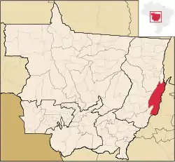 Municipal location within the State of Mato Grosso | |
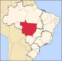
 Cocalinho Location in Brazil | |
| Coordinates: 13.80273°S 51.15344°W | |
| Country | Brazil |
| Region | Center-West |
| State | Mato Grosso |
| Mesoregion | Nordeste Mato-Grossense |
| Government | |
| • Mayor | Dalva Maria De Lima Peres[1] |
| Area | |
| • Total | 16,516.319 km2 (6,376.986 sq mi) |
| Elevation | 231 m (758 ft) |
| Population | |
| • Total | 5,681 |
| • Density | 0.34/km2 (0.89/sq mi) |
| Demonym(s) | cocalinhense |
| Time zone | UTC-3 |
Geography
Cocalinho is in the state of Mato Grosso, Brazil.[2] It has an area of 16,516.319 square kilometres (6,376.986 sq mi) as of 2018.[1] The elevation above sea level is about 231 metres (758 ft).[2]
Climate
The Köppen climate type is Aw : Tropical savanna climate.[4] The average annual temperature is 27 °C (81 °F).[5] The average annual rainfall is 2,024 millimetres (79.7 in).[6]
| Cocalinho, Mato Grosso | ||||||||||||||||||||||||||||||||||||||||||||||||||||||||||||
|---|---|---|---|---|---|---|---|---|---|---|---|---|---|---|---|---|---|---|---|---|---|---|---|---|---|---|---|---|---|---|---|---|---|---|---|---|---|---|---|---|---|---|---|---|---|---|---|---|---|---|---|---|---|---|---|---|---|---|---|---|
| Climate chart (explanation) | ||||||||||||||||||||||||||||||||||||||||||||||||||||||||||||
| ||||||||||||||||||||||||||||||||||||||||||||||||||||||||||||
| ||||||||||||||||||||||||||||||||||||||||||||||||||||||||||||
Demographics
The population in the 2010 census was 5490.[7] The estimated population as of 2020 was 5,681.[1] Population density as of 2010 was 0.33 inhabitants per square kilometre (0.85/sq mi).[1] As of 2010, 90.4% of the population had attended school between the ages of 6 and 14. Also as of 2010, the municipal Human Development Index was 0.660. This compares to 0.328 in 1991 and 0.500 in 2000.[1]
On the 2010 census religion was reported as Catholic by 3,449 people, Evangelical by 1,207 people and Animism by 19 people.[7]
In 2017, the average monthly salary was 2.3 minimum wages. Employed people were 17.3% of the total population. Households with monthly income of up to half a minimum wage per person represent 37.1% of the population.[7] Recent estimates of GDP per capita:[1]
Health and sanitation
1.9% of households have adequate sanitation, 81% of urban households are on public roads with afforestation and 0.3% of urban households are on public roads with adequate urbanization (presence of manhole, sidewalk, pavement and curb).[7] Annual hospitalizations due to diarrhea are 6.1 per 1,000 inhabitants.[7] Deaths per 1,000 live births:[1]
Municipal finances
Recent figures for committed municipal expenditure:[1]
Recent figures for realized municipal revenue:[1]
Sources
- Brasil / Mato Grosso / Cocalinho, IBGE, retrieved 2020-05-18
- "Cocalinho", Geonames, retrieved 2020-05-18
- Cocalinho, Brazilian Institute of Geography and Statistics, retrieved 2020-05-18
- "Cocalinho, Cocalinho, Brazil", Mindat, retrieved 2020-05-18
- NASA Earth Observations Data Set Index, NASA, retrieved 30 January 2016
- NASA Earth Observations: Rainfall (1 month - TRMM), NASA/Tropical Rainfall Monitoring Mission, retrieved 30 January 2016
Capital: Cuiabá | |||||||||||||||||
| Centro-Sul Mato-Grossense |
|  | |||||||||||||||
| Nordeste Mato-Grossense |
| ||||||||||||||||
| Norte Mato-Grossense |
| ||||||||||||||||
| Sudeste Mato-Grossense |
| ||||||||||||||||
| Sudoeste Mato-Grossense |
| ||||||||||||||||
