Aragonite, Utah
Aragonite is a ghost town in Tooele County, Utah, United States, located in the western portion of the state. The Utah Test and Training Range lies to the west and the Dugway Proving Grounds lie to the southwest. Interstate 80, exit 56 provides access to Aragonite. The site lies northwest of the Cedar Mountains. The low Grassy Mountains lie to the north.[2]
Aragonite, Utah | |
|---|---|
 Aragonite, Utah  Aragonite, Utah | |
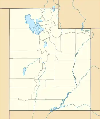
| Coordinates: 40°44′34″N 113°0′10″W | |
| Country | United States |
| State | Utah |
| County | Tooele |
| Elevation | 4,554 ft (1,388 m) |
| Time zone | UTC-7 (Mountain (MST)) |
| • Summer (DST) | UTC-6 (MDT) |
| Area code(s) | 435 |
| GNIS feature ID | [1] |
Aragonite lies along the Hastings Cutoff, a historical transmontane route taken by nineteenth-century pioneers. The town was established in the early twentieth century for the mining of aragonite, though all mining operations in the area have ceased.[3] The town site is now uninhabited and almost totally demolished.
Just east of the historical townsite is a large hazardous waste incineration facility. This facility was known as the Aptus Incinerator, and was built there in 1991 after Tooele County established the surrounding lands as the West Desert Hazardous Industries District.[4] The incinerator was, at times, operated by Westinghouse, Rollins, Laidlaw, and Safety-Kleen, and is now operated by Clean Harbors.[4] The facility has been the subject of several penalties administered by the EPA.[5][6]
References
- U.S. Geological Survey Geographic Names Information System: Aragonite, Utah
- Utah Atlas & Gazetteer, DeLorme, 9th ed., 2014, p. 15 ISBN 0-899332552
- Aragonite, Utah Ghost Towns.
- Aragonite Hazardous Waste Incinerator. Center for Land Use Interpretation.
- Utah Incinerator Faces Penalties. Deseret News, September 29, 2009.
- Clean Harbors Environmental Services, Inc. to pay penalty for chemical reporting violations at Aragonite, Utah facility. US EPA, May 30, 2013.
Municipalities and communities of Tooele County, Utah, United States | ||
|---|---|---|
| Cities | 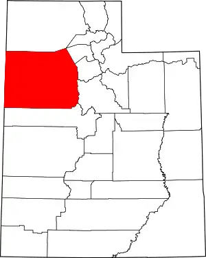 Map of Utah highlighting Tooele County | |
| Towns | ||
| CDPs | ||
| Townships | ||
| Unincorporated communities | ||
| Ghost towns | ||
| Indian reservations | ||
| Footnotes | ‡This populated place also has portions in an adjacent county or counties | |
| ||
