Ibapah, Utah
Ibapah (/ˈaɪbəpɑː/ EYE-bə-pah) is a small unincorporated community in far western Tooele County, Utah, United States, near the Nevada state line.
Ibapah | |
|---|---|
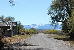 The roadway through Ibapah, September 2007 | |
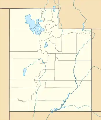 Ibapah Location within the state of Utah | |
| Coordinates: 40°02′12″N 113°59′07″W | |
| Country | United States |
| State | Utah |
| County | Tooele |
| Settled | 1859 |
| Named for | Goshute Ai-bim-pa "White Clay Water" |
| Elevation | 5,282 ft (1,610 m) |
| Time zone | UTC-7 (Mountain (MST)) |
| • Summer (DST) | UTC-6 (MDT) |
| ZIP code | 84034 |
| Area code(s) | 435 |
| GNIS feature ID | 1437592[1] |
Description
| Historical population | |||
|---|---|---|---|
| Census | Pop. | %± | |
| 1860 | 6 | — | |
| 1880 | 174 | — | |
| 1890 | 117 | −32.8% | |
| 1900 | 353 | 201.7% | |
| 1910 | 256 | −27.5% | |
| 1920 | 120 | −53.1% | |
| 1930 | 152 | 26.7% | |
| 1940 | 133 | −12.5% | |
| 1950 | 70 | −47.4% | |
| Source: U.S. Census Bureau[2] | |||
The settlement is located near the Deep Creek Mountains. The site was originally established in 1859 by Mormon missionaries sent to teach the local Native Americans farming methods. A Pony Express station operated here in 1860 and 1861, and the town was on an early alignment of the Lincoln Highway. A post office operated here from 1883 to 1980. Ibapah is currently inhabited mostly by Goshute people, with scattered farmlands and a trading post belonging to more recent settlers. The community is the headquarters of the Confederated Tribes of the Goshute Reservation, a federally recognized tribe.
Originally named Deep Creek for a creek of the same name in the area, the name was later changed to Ibapah, an anglicized form of the Goshute word Ai-bim-pa or Ai'bĭm-pa which means "White Clay Water".[3][4]
The town is isolated and is usually reached by going out of Utah into Nevada and back into Utah.
Climate
The climate is typical of that of a high elevation Great Basin location, being semi-arid and featuring, in consequence, large differences in temperature between day and night.
| Climate data for Ibapah, Utah (Elevation 5,280ft) | |||||||||||||
|---|---|---|---|---|---|---|---|---|---|---|---|---|---|
| Month | Jan | Feb | Mar | Apr | May | Jun | Jul | Aug | Sep | Oct | Nov | Dec | Year |
| Record high °F (°C) | 68 (20) |
75 (24) |
82 (28) |
88 (31) |
98 (37) |
103 (39) |
108 (42) |
107 (42) |
102 (39) |
94 (34) |
79 (26) |
73 (23) |
108 (42) |
| Average high °F (°C) | 41.6 (5.3) |
45.8 (7.7) |
53.9 (12.2) |
62.0 (16.7) |
71.3 (21.8) |
81.7 (27.6) |
91.6 (33.1) |
90.0 (32.2) |
80.5 (26.9) |
67.5 (19.7) |
52.9 (11.6) |
42.3 (5.7) |
65.1 (18.4) |
| Average low °F (°C) | 10.0 (−12.2) |
15.7 (−9.1) |
21.8 (−5.7) |
27.5 (−2.5) |
33.8 (1.0) |
39.8 (4.3) |
46.8 (8.2) |
44.9 (7.2) |
35.6 (2.0) |
26.8 (−2.9) |
17.9 (−7.8) |
10.6 (−11.9) |
27.6 (−2.4) |
| Record low °F (°C) | −39 (−39) |
−32 (−36) |
−17 (−27) |
2 (−17) |
8 (−13) |
20 (−7) |
23 (−5) |
21 (−6) |
10 (−12) |
−3 (−19) |
−19 (−28) |
−38 (−39) |
−39 (−39) |
| Average precipitation inches (mm) | 0.62 (16) |
0.77 (20) |
0.95 (24) |
1.29 (33) |
1.44 (37) |
0.98 (25) |
0.82 (21) |
0.90 (23) |
0.72 (18) |
0.95 (24) |
0.60 (15) |
0.65 (17) |
10.69 (272) |
| Average snowfall inches (cm) | 6.9 (18) |
7.1 (18) |
5.1 (13) |
3.4 (8.6) |
1.2 (3.0) |
0. (0) |
0 (0) |
0 (0) |
0.1 (0.25) |
1.7 (4.3) |
3.3 (8.4) |
5.9 (15) |
34.7 (88) |
| Source: The Western Regional Climate Center[5] | |||||||||||||
See also
![]() Utah portal
Utah portal
References
- U.S. Geological Survey Geographic Names Information System: Ibapah
- "Census of Population and Housing". U.S. Census Bureau. Archived from the original on February 8, 2006. Retrieved October 20, 2011.
- Van Cott, John W. (1990). Utah Place Names. Salt Lake City, Utah: University of Utah Press. p. 197. ISBN 0-87480-345-4.
- The University of Utah - Shoshoni Dictionary
- "Seasonal Temperature and Precipitation Information". Western Regional Climate Center. Retrieved April 12, 2013.
External links
![]() Media related to Ibapah, Utah at Wikimedia Commons
Media related to Ibapah, Utah at Wikimedia Commons
Municipalities and communities of Tooele County, Utah, United States | ||
|---|---|---|
| Cities | 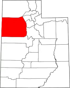 Map of Utah highlighting Tooele County | |
| Towns | ||
| CDPs | ||
| Townships | ||
| Unincorporated communities | ||
| Ghost towns | ||
| Indian reservations | ||
| Footnotes | ‡This populated place also has portions in an adjacent county or counties | |
| ||