Flux, Utah
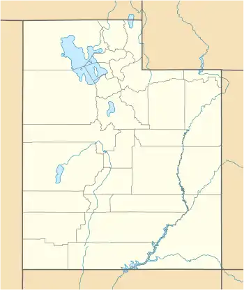
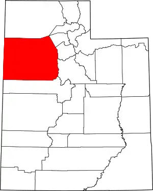
Flux is an unincorporated community in northeastern Tooele County, Utah, United States.[1]
Flux, Utah | |
|---|---|
 Flux Location of Flux within the State of Utah  Flux Flux (the United States) | |
| Coordinates: 40°40′52″N 112°33′18″W | |
| Country | United States |
| State | Utah |
| County | Tooele |
| Elevation | 4,245 ft (1,294 m) |
| Time zone | UTC-7 (Mountain (MST)) |
| • Summer (DST) | UTC-6 (MDT) |
| Area code(s) | 435 |
| GNIS feature ID | 1437561[1] |
Description
The community is situated in the west side of the Tooele Valley at the eastern base of the Stansbury Mountains, southwest of the Great Salt Lake. Flux is situated near a bend in Utah State Route 138, 3 miles (4.8 km) southwest of Interstate 80 exit 84.[2]
Flux sits in an area stratigraphically rich in dolomite, limestone, and quartzite.[3] In the early twentieth century, Flux was the site of mining operations, and limerock was mined there since at least 1918.[4] A rail line operated by Tintic Southern was run into the town, which spurred off the Union Pacific line located close to what is now Interstate 80. As of the early 2000s, the site was still mined by Tooele City-based Ophir Mining.[5]
See also
![]() Utah portal
Utah portal
References
- "Flux". Geographic Names Information System. United States Geological Survey.
- "MyTopo Maps - Flux, UT, USA" (Map). mytopo.com. Trimble Navigation, Ltd. Retrieved 18 Mar 2018.
- James H. Trexler, "The Devonian-Mississippian Stansbury Formation at Stansbury Island and in the Northeastern Stansbury Mountains, Utah". Field Guide to Geologic Excursions in Utah and Adjacent Areas of Nevada, Idaho, and Wyoming, 1992. Google Books link
- Reports of the Interstate Commerce Commission for 1922: No. 12619, Amalgamated Sugar Company v. Director General, As Agent, et al (Report). Washington, D.C.: Government Printing Office. 1922. Retrieved 18 Mar 2018 – via Google Books.
- "Tintic Southern Rail Road". utahrails.net. Don Strack. 29 Nov 2016. Retrieved 18 Mar 2018.
External links
![]() Media related to Flux, Utah at Wikimedia Commons
Media related to Flux, Utah at Wikimedia Commons

