Araranguá
Araranguá is a city located in the southern part of Santa Catarina state, in the south of Brazil. It has 68,867 inhabitants and was settled mainly by Azoreans and Italians. Araranguá is known as "A Cidade das Avenidas" ("The City of the Avenues") because of its wide roads.
Araranguá, Santa Catarina | |
|---|---|
 Flag  Seal | |
| Nickname(s): "Cidade das Avenidas" ("City of Avenues") | |
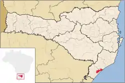 Location in Brazil | |
 Araranguá, Santa Catarina Location in Brazil | |
| Coordinates: 28°56′06″S 49°29′09″W | |
| Country | |
| Region | South |
| State | |
| MesoRegion | MesoRegion Sul Catarinense |
| Microregion | Microregion of Araranguá |
| Founded | 3 April 1880 |
| Government | |
| • Mayor | Sandro Maciel |
| Area | |
| • Total | 303.799 km2 (117.297 sq mi) |
| Elevation | 13 m (43 ft) |
| Population (2020 [1]) | |
| • Total | 68,867 |
| • Density | 230/km2 (590/sq mi) |
| • Ethnic Groups | Azorean and Italian |
| Time zone | UTC-3 (UTC-3) |
| • Summer (DST) | UTC-2 (UTC-2) |
| HDI (2000) | 0.814 – high |
| Climate Type | Temperate |
| Average Temp | 20 °C (68 °F) |
| Website | City’s official website |
History
Until the 18th century, the city was inhabited mostly by Carijós and Kaingang Indians. These ethnics groups disappeared after the arrival of the first Europeans settlers.
On 11 February 1728, was started the opening of the Caminho dos Conventos way that linked Morro dos Conventos ("Convents Mountain") to Curitiba. This way became used mostly by the tropeiros, who carried cattle from Rio Grande do Sul to São Paulo. Araranguá became a waypoint for those between Viamão (former capital of Rio Grande do Sul) and Lages (in the top of the Planalto Serrano).[2]
The first to arrive in Araranguá region were the Portugueses, who came from Laguna in the beginning of the 19th century. They first settled in the Morro dos Conventos. Later, Italian, German, Polish and Spanish immigrants and the African slaves arrived in the city.[3] In 1816 was inaugurated in the village of Canjicas the first chapel in the region. In 1864 was created the first church within the current city of Araranguá.[4]
The city was founded 3 April 1880, and was named Araranguá after the Araranguá River. The village was promoted to the condition of city in 1921.
Along the 20th century the city underwent some dismemberments. The city of Criciúma emancipated in 1925 followed by Turvo (1948), Sombrio (1953), Maracajá (1967) and Balneário Arroio do Silva (1997).
Climate
Araranguá was struck by the Cyclone Catarina in the night between 28 and 29 March 2003 with winds up to 150 km/h. This event still intrigues scientists.[5]
The city was again struck by at least two tornadoes in the night of September, the 29th of 2009, the first ever recorded in the urban area, although others have been already spotted in rural areas. A school gymnasium collapsed over a house and many windows were broken in some shops, but there were no victims.[6]
Economy
- Agriculture – production of rice, beans, tobacco and corn.
- Industry – based on metallurgy, ceramics, furniture and textiles.
- Commerce
- Tourism
Education
The city has a campus of the Federal University of Santa Catarina, inaugurated on 10 August 2009. With headquarters in Mato Alto and Jardim das Avenidas, the campus offers 4 undergraduate programs (Computer Engineering, Energy Engineering, Physiotherapy and Information and Communication Technologies) and 4 masters programs (Rehabilitation Sciences, Energy and Sustainability, Physics Teaching and Information and Communication Technologies).
Also located in Araranguá is a campus of the Federal Institute of Santa Catarina, which offers technical courses in Electromechanics, Fashion and Apparel Production, and undergraduate programs in Fashion Design and Physics .
Transportation
Highways
Araranguá is accessed by road mainly from the BR-101, an important highway that connects several major Brazilian cities. It lies roughly halfway between Porto Alegre and Florianópolis, the former being 210 km (130 mi) away.
Buses
The city is served by Viação Cidade[7] for intra-city routes and by União, Pluma, SantoAnjo and Eucatur for inter-city and inter-state routes. Among cities served are Porto Alegre, Florianópolis, Curitiba and São Paulo besides most of the neighboring cities and cities along those routes.
References
- IBGE 2020
- http://www.ararangua.net/?acao=historia
- "Archived copy". Archived from the original on 24 May 2011. Retrieved 8 January 2009.CS1 maint: archived copy as title (link)
- "Archived copy". Archived from the original on 12 February 2009. Retrieved 8 January 2009.CS1 maint: archived copy as title (link)
- http://www.apolo11.com/furacao_catarina.php
- http://www.ararangua.net/?acao=noticia&cd_noticia=343&pagina=0
- http://www.viacidade.com.br/
External links
| |
| Araranguá | |
| Criciúma | |
| Tubarão | |