Arkansas Highway 275
Arkansas Highway 275 (AR 275) is a state highway in Arkansas that serves Union County. It spans 18.92 miles (30.45 km).
| ||||
|---|---|---|---|---|
| ||||
| Route information | ||||
| Maintained by ArDOT | ||||
| Length | 18.92 mi (30.45 km) | |||
| Major junctions | ||||
| South end | ||||
| North end | ||||
| Highway system | ||||
| ||||

Route description
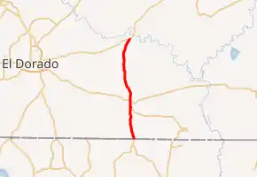
From the south, AR 275 begins as a continuation of LA 549 at the state line. Heading north, AR 275 meets AR 129, and the two are signed together towards Strong. AR 129/275 then meet U.S. Route 82 (US 82) in Strong, with AR 129 ending at the intersection.
AR 275 continues north towards Moro Bay, passing through relatively rural areas. AR 275 ends at an intersection with US 63.
AR 275 is an undivided, two-lane road for its entire route.[1]
Major intersections
The entire route is in Union County.
| Location | mi | km | Destinations | Notes | |
|---|---|---|---|---|---|
| | 0.0 | 0.0 | Southern terminus; Louisiana state line | ||
| | 6.0 | 9.7 | Southern end of AR 129 concurrency | ||
| Strong | 7.2 | 11.6 | Northern terminus of AR 129 | ||
| Moro Bay | 19.0 | 30.6 | Northern terminus | ||
1.000 mi = 1.609 km; 1.000 km = 0.621 mi
| |||||
See also
 United States portal
 U.S. Roads portal
References
- Google (November 16, 2019). "Arkansas Highway 275" (Map). Google Maps. Google. Retrieved November 16, 2019.
External links
This article is issued from Wikipedia. The text is licensed under Creative Commons - Attribution - Sharealike. Additional terms may apply for the media files.