List of Arkansas state highway business routes
This is a list of state highway business routes in the U.S. state of Arkansas. The routes are named after their parent highway, which leads to different loops with the same designation.
   Highway markers for AR 1B, AR 11B, and AR 102B | |
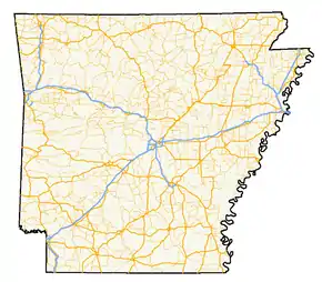 A map of highways in the state of Arkansas | |
| System information | |
|---|---|
| Formed | 1924 |
| Highway names | |
| Interstates | Interstate nn (I-nn) |
| US Highways | US Route n (US nn) |
| State | Highway nn |
| System links | |
State highway business routes
Dark background indicates a deleted route.
| Number | Location | Length (mi) | Length (km) | Notes |
|---|---|---|---|---|
| De Witt | 2.13 | 3.43 | ||
| Marianna | 1.55 | 2.49 | ||
| Forrest City | 7.96 | 12.81 | ||
| Vanndale | 1.06 | 1.71 | ||
| Cherry Valley | 0.83 | 1.34 | ||
| Jonesboro | 4.03 | 6.49 | ||
| Camden | 6.1 | 9.8 | Former AR 4 | |
| Warren | 3.8 | 6.1 | ||
| Smackover | 5.55 | 8.93 | ||
| Star City | 0.74 | 1.19 | ||
| Manila | 1.97 | 3.17 | ||
| 0.23 | 0.37 | |||
| Heber Springs | 5.53 | 8.90 | ||
| Nashville | 2.38 | 3.83 | ||
| Hope | 2.82 | 4.54 | ||
| Ashdown | 4.31 | 6.94 | ||
| Augusta | 3.10 | 4.99 | ||
| Gentry | 0.94 | 1.51 | ||
| Siloam Springs/Springdale | 9.8 | 15.8 | Former AR 68 and AR 68N | |
| Batesville | 2.25 | 3.62 | ||
| Newark | 2.21 | 3.56 | ||
| Sage | 2.88 | 4.63 | ||
| 2.36 | 3.80 | |||
| McNeil | 0.94 | 1.51 | ||
| Centerton | 1.78 | 2.86 | ||
| Huttig | 2.24 | 3.60 | ||
| Marked Tree | 1.37 | 2.20 | Elm Street | |
References
This article is issued from Wikipedia. The text is licensed under Creative Commons - Attribution - Sharealike. Additional terms may apply for the media files.