List of state highways in Arkansas
The following is a list of state highways in Arkansas. The state does not use a numbering convention. Generally the two-digit odd numbered highways run north–south with a few exceptions; and even-numbered two-digit state highways run east–west with a few exceptions.
   Highway markers for some of the longest Arkansas state routes | |
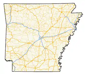 A map of highways in the state of Arkansas | |
| System information | |
|---|---|
| Formed | 1924, renumbered in 1926 |
| Highway names | |
| State | AR nn, Ark. nn, Hwy. nn |
| System links | |
Arkansas has long had a stigma of poor roads, dating from the "Arkansas Roads Scandal" playing a prominent role in state politics through the 1920s and 1930s, periodic allegations of corruption, waste, and fraud, and a long-running struggle to adequately fund the operation, maintenance and expansion of a large highway system serving a rural state.[1][2]
The state has received the designation of "worst roads in America" from several publications throughout the 1990s and into the 2000s, with Interstate 30 and Interstate 40 often ranking particularly poorly among truckers.[3][4] Rankings improved until a large construction plan was completed on I-40.[5]
A 2000 survey cited the poor condition of rural interstates, as well as narrow lanes on rural state highways, as areas of concern, ranking Arkansas 47th of the 50 states.[6] A 2011 study found Arkansas's rural highways fourth-most, and the state's roads overall the 16th most deadly.[7]
State highways
| Number | Length (mi)[8] | Length (km) | Southern or western terminus | Northern or eastern terminus | Formed | Removed | Notes | |
|---|---|---|---|---|---|---|---|---|
| 159.88 | 257.30 | US 278 in McGehee | Route BB at the Missouri state line | 1926[9] | current | |||
| 195 | 314 | US 67 in Texarkana | Ferry to MS 10 | 1926[9] | 1932 | |||
| 263 | 423 | LA 159 at Louisiana state line | US 64 near West Memphis | 1926[9] | 1940 | |||
| 2.99 | 4.81 | SH-4 at the Oklahoma state line | US 59/US 71 in Cove | 1926[9] | current | |||
| 22.49 | 36.19 | US 65/US 165/US 278 in McGehee | AR 1 at Rohwer | 1926[9] | current | |||
| 42.22 | 67.95 | AR 7 near Hot Springs | US 70 in Little Rock | 1926[9] | current | |||
| 0.38 | 0.61 | AR 100 in Little Rock | AR 107 in North Little Rock | 1926[9] | current | Unsigned | ||
| 118.87 | 191.30 | US 67/US 167 in Cabot | Route 5 at the Missouri state line | 1926[9] | current | |||
| 162 | 261 | US 71 | US 65 in Pine Bluff | 1926[9] | 1935 | |||
| — | — | US 70 in Brinkley | Mississippi state line | 1961 | 1963 | |||
| 296.01 | 476.38 | LA 558 at the Louisiana state line | Diamond City | 1926[9] | current | Longest state highway in Arkansas. | ||
| 229.83 | 369.88 | SH-63 at the Oklahoma state line | US 65 near Eudora | 1926[9] | current | |||
| 174.17 | 280.30 | AR 5 at Crows | US 63 in Mammoth Spring | 1926[9] | current | |||
| 51.44 | 82.78 | US 79 at Eagle Mills | US 67/US 270B in Malvern | 1926[9] | current | |||
| 135.41 | 217.92 | SH-16 at the Oklahoma state line | I-30 in Little Rock | 1926[9] | current | |||
| 37.53 | 60.40 | I-40/US 63 in Hazen | AR 367 in Searcy | 1926[9] | current | |||
| 36.23 | 58.31 | US 63 at Pansy | Huff's Island Public Use Area | 1926[9] | current | |||
| 12.83 | 20.65 | AR 88 at Reydell | US 165 at Eldridge Corner | 1926[9] | current | |||
| 56.60 | 91.09 | SH-116 at the Oklahoma state line | AR 23 near Clifty | 1926[9] | current | |||
| 54.58 | 87.84 | US 79 near Humphrey | Campground Road | 1926[9] | current | |||
| 5.03 | 8.10 | AR 367 in McRae | AR 267 | 1994 | current | Formerly AR 371 | ||
| 6.13 | 9.87 | AR 367 in Judsonia | AR 258 | 1994 | current | Formerly AR 371 | ||
| 227.35 | 365.88 | Boat Dock Road at Table Rock Lake | Mississippi CR 1020 at Golden Lake | 1926[9] | current | |||
| 34.45 | 55.44 | US 79B near Altheimer | AR 89/AR 294 in Furlow | 1926[9] | current | |||
| 21.10 | 33.96 | LA 161 at the Louisiana state line | US 82 in El Dorado | 1926[9] | current | |||
| 260.77 | 419.67 | US 412 in Siloam Springs | US 67B/AR 36 in Searcy | 1926[9] | current | |||
| 114.28 | 183.92 | US 49 in Brinkley | AR 37 in Tuckerman | 1926[9] | current | |||
| 53.7 | 86.4 | Morgan Loop Road near Ethel | US 70 south of Brinkley | —[9] | — | |||
| 4.9 | 7.9 | Access to Ward Reservoir | End of state maintenance west of La Grue Bayou | —[9] | — | |||
| 93.43 | 150.36 | AR 69 in Jacksonport | I-55 in Blytheville | 1926[9] | current | |||
| 5 | 8 | AR 68 at Old Alabam | AR 23 at Forum | c. 1927[10] | c. 1928[11] | Renumbered AR 127 | ||
| 18.05 | 29.05 | LA 159 at the Louisiana state line | US 79B in Magnolia | 1926[9] | current | |||
| 24.73 | 39.80 | US 371/AR 24 in Prescott | Narrows Dam at Lake Greeson | 1953 | current | |||
| 31.76 | 51.11 | US 70 in Brinkley | Phillips CR 422 south of Helena-West Helena | 1926 | 1962 | Replaced by AR 6, AR 49, and a spur of AR 49 | ||
| 31.76 | 51.11 | Phillips CR 622 at Lambrook | US 49/Great River Road in Helena-West Helena | 1963[9] | current | Former AR 49; has a spur south to Phillips CR 422 | ||
| 99.57 | 160.24 | US 64 near Clarksville | Route 13 at the Missouri state line | 1926[9] | current | |||
| 75.60 | 121.67 | US 64/US 71B in Fort Smith | AR 7 in Dardanelle | 1926[9] | current | |||
| 132.67 | 213.51 | US 71 at Elm Park | Route P at the Missouri state line | 1926[9] | current | |||
| 18.6 | 29.9 | McCurtain CR E2100 at the Oklahoma state line | US 71 in Lockesburg | 1926[9] | current | |||
| 38.2 | 61.5 | US 371 in Prescott | US 278 in Camden | 1926[9] | current | |||
| 85.66 | 137.86 | US 64 in Conway | US 63/US 412 in Black Rock | 1926[9] | current | |||
| 56.03 | 90.17 | US 371 | AR 8/AR 51 in Arkadelphia | 1926[9] | current | |||
| 1.8 | 2.9 | I-30 | US 67 in Gum Springs | 1926[9] | current | |||
| 193.70 | 311.73 | US 59/US 71 near Ben Lomond | AR 14 in Harriet | 1926[9] | current | |||
| 20.448 | 32.908 | SH-128 at the Oklahoma state line | US 71 | 1926[9] | current | |||
| 54.451 | 87.630 | US 71 at Needmore | AR 7 in Ola | 1926[9] | current | |||
| 8.998 | 14.481 | AR 154 at Mt. George | AR 7 in Dardanelle | 1963[12] | current | |||
| 76.84 | 123.66 | LA 3 at the Louisiana state line | AR 301 in Antoine | 1926[9] | current | |||
| — | — | — | — | 1926[9] | 1958 | decommissioned due to creation of I-30; renumbered AR 130 | ||
| 75.34 | 121.25 | US 79B near Altheimer | AR 5 near Romance | 1926[9] | current | |||
| 63.10 | 101.55 | SH-3 at the Oklahoma state line | US 371/AR 19 in Willisville | 1926[9] | current | |||
| 85.92 | 138.27 | AR 130 north of DeWitt | AR 37 | 1926[9] | current | |||
| 40.19 | 64.68 | US 412/AR 25 in Walnut Ridge | AR 139 at Fritz | 1926[9] | current | |||
| 115.83 | 186.41 | Macon Lake Road near Dewey | AR 5 in Benton | 1926[9] | current | |||
| 67.96 | 109.37 | U.S. Route 64 at Hamlet | Georgetown | 1926[9] | current | |||
| 52.40 | 84.33 | AR 17 near McCrory | AR 112 at Cord | 1926[9] | current | |||
| 0.61 | 0.98 | US 62 in Gateway | Route 37 at the Missouri state line | 1926[9] | current | |||
| 71.11 | 114.44 | AR 367 in Austin | US 49 near Hunter | 1926[9] | current | |||
| 8.89 | 14.31 | AR 1/AR 316 near Turner | US 49 | 1926[9] | current | |||
| 9.98 | 16.06 | US 49 at Blackton | US 49/AR 241 | 1926[9] | current | |||
| — | — | — | — | 1926[9] | 1958 | decommissioned due to creation of I-40; renumbered AR 140 | ||
| 18.62 | 29.97 | Franklin CR 40 | AR 23 near Chismville | 1926[9] | current | |||
| 38.38 | 61.77 | US 70B/AR 329 in De Queen | SH 8 at the Texas state line | 1926[9] | current | |||
| 53.541 | 86.166 | AR 37 | Barton Street in Turrell | 1926[9] | current | |||
| 27.1 | 43.6 | AR 59 in Siloam Springs | Route 43 at the Missouri state line (concurrent with Oklahoma SH-20) | — | — | |||
| 30.0 | 48.3 | AR 21 at Boxley | AR 7 in Harrison | — | — | |||
| 1.8 | 2.9 | US 65 in Harrison | AR 7 in Harrison | — | — | |||
| 66.14 | 106.44 | Snow Lake | AR 20 in Helena | 1926[9] | current | |||
| 26.97 | 43.40 | AR 96 in Hartford | I-540/US 71 in Fort Smith | 1926[9] | current | |||
| 10.64 | 17.12 | AR 59 at Dutch Mills | US 62 | 1926[9] | current | |||
| 25.42 | 40.91 | US 71B in Fayetteville | AR 12 near Clifty | 1926[9] | current | |||
| 39.07 | 62.88 | AR 9 | White Bluff Road near Redfield | 1926[9] | current | |||
| 0.61 | 0.98 | US 62 in Gateway | Route 37 at the Missouri state line | 1926[9] | 1976 | Changed to AR 37 to match Missouri | ||
| 14.53 | 23.38 | AR 9 | US 62 at Ferindale | 1926[9] | current | |||
| — | — | — | — | 1926[9] | 1963 | Decommissioned due to extension of US 49 into Arkansas; renumbered AR 20 | ||
| 27.96 | 45.00 | St. Francis CR 415 | AR 147 near Anthonyville | 1926[9] | current | |||
| 15.84 | 25.49 | US 70 | AR 77 in Clarkedale | — | — | |||
| 57.37 | 92.33 | AR 53 near Whelen Springs | US 67 in Donaldson | 1926[9] | current | |||
| 7.92 | 12.75 | US 270 in Rockport | US 270 at Magnet Cove | 1926[9] | current | |||
| 7.49 | 12.05 | AR 133 at North Crossett | US 82/US 425 | 1926[9] | current | |||
| 1.83 | 2.95 | US 82/US 425 | Ashley CR 25/Ashley CR 26 | 1926[9] | current | |||
| 16.59 | 26.70 | US 165 in Wilmot | AR 159 at Indian | 1926[9] | current | |||
| 53.31 | 85.79 | Bradley Rd, Louisiana state line | US 371 | — | — | |||
| 32.55 | 52.38 | AR 24 | AR 8 | 1926[9] | current | |||
| 28.80 | 46.35 | US 65/US 165 in Dumas | US 425/AR 11 | 1926[9] | current | |||
| 52.65 | 84.73 | AR 114 | Grant CR 18 | 1963[13] | current | |||
| 22.4 | 36.0 | US 67 in Fulton | AR 27 at Mineral Springs | 1926[9] | 1958 | decommissioned due to creation of I-55; renumbered AR 355 | ||
| 42.44 | 68.30 | AR 5 in Calico Rock | AR 58 at Poughkeepsie | 1926[9] | current | |||
| 39.38 | 63.38 | US 82 at Marysville | AR 24 in Chidester | 1926[9] | current | |||
| 54.89 | 88.34 | AR 14 | US 62/US 63/US 412 at Ozark Acres | 1926 | current | |||
| — | — | Louisiana state line | Eudora | 1926[9] | 1935 | decommissioned due to creation of new AR 59; renumbered AR 159 | ||
| 93.24 | 150.06 | AR 22 in Barling | Route 59 at the Missouri state line | 1935 | current | |||
| 71.31 | 114.76 | CR 23 near Rudy | US 64 / US 71B near Van Buren | 1926[9] | current | |||
| — | — | — | — | 1926[9] | 1930 | Decommissioned due to creation of US 62 | ||
| 30.16 | 48.54 | AR 9 in Mountain View | US 65 in Leslie | 1926[9] | current | |||
| — | — | — | — | 1926[9] | 1988 | Replaced by US 412 | ||
| 57.6 | 92.7 | AR 9 at Melbourne | AR 14 / AR 367 in Newport | 1926[9] | current | |||
| 15.3 | 24.6 | AR 163 | AR 158 in Lunsford | 1926[9] | current | |||
| 7.4 | 11.9 | US 49 / AR 1 at Paragould | US 412 / AR 135 in Paragould | 1926[9] | current | |||
| 26.32 | 42.36 | AR 163 at Maysville | US 71B in Bentonville | 1926[9] | current | |||
| 12.67 | 20.39 | I-49/US 71 in Bentonville | US 62 near Avoca | — | — | |||
| 18.59 | 29.92 | AR 355 | US 278 | 1926[9] | current | |||
| 12.37 | 19.91 | US 67 in Hope | AR 53 | 1926[9] | current | |||
| 13.06 | 21.02 | AR 170 in Devil's Den State Park | US 71 in Winslow | — | — | |||
| 2.45 | 3.94 | US 71 near Brentwood | Washington CR 43 | 1926[9] | current | |||
| 19.18 | 30.87 | AR 16 in Elkins | US 412B in Huntsville | — | — | |||
| 13.98 | 22.50 | AR 23 | AR 21 at Kingston | — | — | |||
| 33.92 | 54.59 | AR 21 near Ponca | Newton CR 37/Newton CR 38 near Bass | — | — | |||
| 7.13 | 11.47 | AR 377 at Snowball | US 65 near Marshall | — | — | |||
| 18.18 | 29.26 | AR 27 in Marshall | AR 66 | — | — | |||
| 42.62 | 68.59 | AR 50 | Future I-555/US 63/US 63B/AR 14 in Marked Tree | 1926[9] | current | |||
| — | — | — | — | 1926[9] | 1937 | Replaced by AR 60 | ||
| 6.6 | 10.6 | AR 57 / AR 387 near White Oak Lake State Park | AR 24 near Chidester | — | — | |||
| 7.2 | 11.6 | US 371 | US 278 | — | — | |||
| 66.70 | 107.34 | US 70 in West Memphis | Route 108 at the Missouri state line | 1926[9] | current | |||
| 24.03 | 38.67 | AR 306 near Hunter | US 79 | 1926[9] | current | |||
| 4.30 | 6.92 | AR 121 in Aubrey | Lee CR 132/CR 173 | 1973[14] | current | |||
| 50 | 80 | US 167/AR 58 in Cave City | Route 21 at Missouri state line | 1926[9] | 1935[15] | Renumbered AR 115 due to creation of US 79 | ||
| 10.3 | 16.6 | Oklahoma state line | AR 45 | 1926[9] | 1930 | Replaced by US 62 | ||
| 49.87 | 80.26 | AR 28 at Hon | AR 27 in Danville | 1945 | current | |||
| 12 | 19 | AR 4 in Hon | AR 1 | 1926[9] | c. 1928[11] | |||
| 2.3 | 3.7 | US 63 / US 79 at Pine Bluff | US 65 / US 425 at Pine Bluff | 1945 | current | |||
| — | — | — | — | 1926[9] | 1932 | decommissioned due to extension of US 82 in Arkansas; renumbered AR 152 | ||
| 16.6 | 26.7 | US 425 near Monticello | AR 54 south of Star City | 1945 | current | |||
| 5.8 | 9.3 | AR 54 | AR 114 | — | — | |||
| — | — | Polk CR 14 in Bogg Springs | US 71 | 1926[9] | current | |||
| — | — | US 278 in Umpire | Haltom Road in Malvern | 1926[9] | current | |||
| 9.73 | 15.66 | AR 44 in Lake View | US 49/AR 1 at Walnut Corner | 1926[9] | current | |||
| 7 | 11 | Oklahoma state line | US 71 near Gillham | 1926[9] | c. 1928[11] | |||
| 13.27 | 21.36 | AR 38 at Hayley | Prairie CR 251/CR 522 | 1965[16] | current | |||
| 25.33 | 40.76 | US 70 at Screeton | AR 33 | 1953 | current | |||
| 20.17 | 32.46 | Pine Tree Road/Lumber Lane near Clarendon | US 49 | 1940[lower-alpha 1] | current | |||
| 14.0 | 22.5 | Fulton CR 2 in Elizabeth | Route AR at the Missouri state line | 1926[9] | current | |||
| 71.2 | 114.6 | AR 14 near Fifty-six | US 67 in Bradford | 1926[9] | current | |||
| 60.7 | 97.7 | OK 1 at Queen Wilhelmina State Park | US 27 at Washita | — | — | |||
| 2.7 | 4.3 | AR 7 at Hot Springs | AR 7 at Hot Springs | — | — | |||
| 1.8 | 2.9 | Lonsdale | US 70 near Lonsdale | — | — | |||
| 2.6 | 4.2 | AR 35 at Benton | Alcoa Road at Bryant | — | — | |||
| 23.4 | 37.7 | US 79B in Altheimer | AR 11 at Reydell | — | — | |||
| 16.6 | 26.7 | End of state maintenance west of Mayflower | Jacksonville-Conway Road near Sherwood | — | — | |||
| 25.1 | 40.4 | AR 107 near Cabot | US 70 in Lonoke | — | — | |||
| 81.93 | 131.85 | Main Street in Ravenden | Route 84 at the Missouri state line | 1926[9] | current | |||
| 31.91 | 51.35 | US 49/AR 1 in Jonesboro | US 412 in Walnut Ridge | 1926[9] | current | |||
| 63.4 | 102.0 | US 64 in Plumerville | AR 5/AR 25 at Drasco | 1926[9] | current | |||
| 14.66 | 23.59 | AR 90 | Route BB at the Missouri state line | 1926[9] | current | |||
| 22.07 | 35.52 | Horseshoe Bend Park | Route E at the Missouri state line | 1926[9] | current | |||
| 50.5 | 81.3 | US 64 in Morrilton | AR 330 | 1926[9] | current | |||
| 38.2 | 61.5 | AR 10 in Greenwood | AR 23 | 1926[9] | current | |||
| 1.84 | 2.96 | AR 23 in Ozark | AR 219 in Ozark | 1991 | current | |||
| 2 | 3 | US 63 | AR 91 | 1926[9] | c. 1928[11] | |||
| 6.45 | 10.38 | AR 8 | US 79 in Kingsland | c. 1940 | current | |||
| — | — | US 64 in Altus | AR 109 | 1926[9] | c. 1928[11] | |||
| 47.15 | 75.88 | US 82 | AR 19 at Walkerville | 1940 | current | |||
| — | — | — | — | 1926[9] | 1971 | |||
| 11 | 18 | US 71 in Bentonville | Route 88 at the Missouri state line | 1926[9] | 1960[18] | Supplanted by US 71 | ||
| 8.72 | 14.03 | I-40 in North Little Rock | AR 365 | 1987[19] | current | |||
| 1.61 | 2.59 | AR 365 in North Little Rock | US 70 in North Little Rock | 1987[20] | 2020 | |||
| 11.17 | 17.98 | US 62/US 412 | Route 101 at the Missouri state line | 1926[9] | current | |||
| 7.13 | 11.47 | Marion CR 664 at Hand Valley | US 62/US 412 | c. 1928[11] | current | |||
| 26.27 | 42.28 | AR 43 near Maysville | I-49/US 71 in Bentonville | 1926[9] | current | |||
| 20.43 | 32.88 | Marina Road/Lakeview Drive in Clarksville | AR 215 | — | — | |||
| 31.31 | 50.39 | AR 43 at the Buffalo National River | AR 21 at Oak Grove | 1926[9] | current | |||
| 8.973 | 14.441 | Southeast Arkansas Community Correction Center in Pine Bluff | I-530/US 63/US 65/US 79/US 425 in Pine Bluff | 1926[21] | 2000[22] | Renumbered AR 190 | ||
| 4.66 | 7.50 | US 270 | AR 365 | 1926[9] | current | |||
| 24.90 | 40.07 | Galla Creek Wildlife Management Area | AR 27 near Hector | 1926[9] | current | |||
| — | — | — | — | 1926[9] | 1929 | |||
| 12.42 | 19.99 | AR 69 near Cushman | AR 69B in Batesville | 1941 | current | |||
| — | — | — | — | 1926[9] | 1937 | |||
| 28.32 | 45.58 | I-40 in North Little Rock | US 64B in Vilonia | — | — | |||
| 23.78 | 38.27 | AR 36 | AR 110 in Heber Springs | 1945 | current | |||
| — | — | — | — | 1926[9] | c. 1928[11] | |||
| 6.96 | 11.20 | US 59/US 71 | US 67 | 1945 | 1951 | See below | ||
| 26.09 | 41.99 | SH-87 at the Oklahoma state line | US 59/US 71 in Ashdown | 1953 | current | |||
| 6.96 | 11.20 | US 59/US 71 | US 67 | 1965 | current | |||
| 32.26 | 51.92 | AR 217 | US 64 in Clarksville | 1926[9] | current | |||
| 16.71 | 26.89 | US 65 at Botkinburg | AR 9/AR 16 near Shirley | — | — | |||
| 3.15 | 5.07 | Greers Ferry Lake | AR 16/AR 92 in Greers Ferry | — | — | |||
| 20.09 | 32.33 | Eden Isle, Greers Ferry Lake | AR 124 in Pangburn | — | — | |||
| 2.30 | 3.70 | Alexander | I-30/US 67/US 70 | — | — | |||
| 23.35 | 37.58 | AR 265 in Fayetteville | AR 12 in Bentonville | 1926[9] | current | |||
| — | — | — | — | 1926[9] | 1959 | |||
| 29.27 | 47.11 | AR 10 | US 64 at Blackwell | — | — | |||
| 28.66 | 46.12 | AR 35 | US 65 in Gould | 1926[9] | current | |||
| 45 | 72 | US 167 in El Dorado | US 167 in Thornton | 1926[9][15] | 1935 | Supplanted by US 167 | ||
| 49.926 | 80.348 | US 167/AR 58 in Cave City | Route 21 at Missouri state line | 1935[15] | current | Former AR 79 | ||
| — | — | — | — | c. 1927[10] | c. 1928[11] | |||
| 3.40 | 5.47 | AR 23 | AR 10 | c. 1928[11] | current | |||
| 1.02 | 1.64 | AR 23 | Booneville Human Development Center | — | — | |||
| 16.54 | 26.62 | AR 25/AR 230 in Strawberry | AR 25 in Black Rock | — | — | |||
| 45.72 | 73.58 | US 70/US 79 in West Memphis | CR 495 | — | — | |||
| 9.60 | 15.45 | AR 14 in Marie | Butler | — | — | |||
| 7.22 | 11.62 | US 61 in Osceola | AR 158 in Victoria | — | — | |||
| 3.36 | 5.41 | AR 18 in Leachville | AR 77 in Leachville | — | — | |||
| 5.57 | 8.96 | AR 77 at Poplar Corner | Route K/Route Y at Missouri state line | — | — | |||
| 3.03 | 4.88 | AR 139 | US 49 in Rector | — | — | |||
| 8.03 | 12.92 | US 61 | O'Donnell Bend | — | — | |||
| 39.53 | 63.62 | Lee CR 153 | Lee CR 210/Lee CR 215/Lee CR 233 in La Grange | — | — | |||
| 16.27 | 26.18 | AR 14 | AR 25 | — | — | |||
| 1.62 | 2.61 | Salmon Lane | US 65B in Harrison | 1975[23] | current | |||
| 67.74 | 109.02 | AR 103 in Clarksville | US 65/US 65B in Western Grove | c. 1927[10] | current | |||
| 72.72 | 117.03 | AR 7 in Russellville | AR 36 in Rose Bud | c. 1927[10] | current | |||
| 9.08 | 14.61 | AR 110 in Pangburn | AR 157 at Sunnydale | 1953 | current | |||
| 29.39 | 47.30 | AR 235 near Bruno | Route 125 at the Missouri state line | — | — | |||
| 11.66 | 18.76 | Buffalo City | US 62/US 412 | — | — | |||
| 7.03 | 11.31 | US 62/US 412 in Gassville | AR 5/AR 178 at Midway | — | — | |||
| 4.13 | 6.65 | Madison CR 3345 | AR 23 at Aurora | 1973 | current | |||
| 4.86 | 7.82 | US 412 at Old Alabam | AR 23 at Forum | c. 1928[11] | current | |||
| 8.58 | 13.81 | AR 12 at Lookout | AR 12 | 1965 | current | |||
| 5.82 | 9.37 | Buckhorn Cir at Lost Bridge Village | US 62 in Garfield | 1966 | current | |||
| 31.7 | 51.0 | AR 24 | AR 27 | 1928[11] | 1937 | Renumbered AR 26 | ||
| 11.99 | 19.30 | AR 7 in Sparkman | AR 9 at Holly Springs | — | — | |||
| 6.23 | 10.03 | AR 7/AR 8 | AR 51 at Joan | — | — | |||
| 20.04 | 32.25 | AR 7 | US 270B in Hot Springs | — | — | |||
| 8.78 | 14.13 | AR 5 in Fountain Lake | US 70 | — | — | |||
| 15.02 | 24.17 | LA 33 at the Louisiana state line | US 82 in Strong | 1928[11] | current | |||
| 4.30 | 6.92 | US 63 at Old Union | Union CR 185 at Lawson | 1956 | current | |||
| 8 | 13 | US 65 at Tillar | AR 1 at McArthur | c. 1927[24][25] | c. 1929[26] | |||
| 3 | 5 | AR 9 | Choctaw | c. 1937[27] | 1958[28] | Former AR 134, renumbered AR 330 | ||
| 25.31 | 40.73 | US 79B in Stuttgart | AR 1 in DeWitt | 1958 | current | Former AR 30 | ||
| 5.27 | 8.48 | AR 1 in Haynes | Lee CR 719/Lee CR 722 | — | — | |||
| 9.57 | 15.40 | US 79 | Lee CR 533/Lee CR 632 | — | — | |||
| 8.80 | 14.16 | AR 147 at Bruins | AR 147 at Thompson Grove | — | — | |||
| 3.01 | 4.84 | Proctor Road | AR 147 in Edmondson | — | — | |||
| 1.29 | 2.08 | Service Road in West Memphis | I-40 in West Memphis | — | — | |||
| 25 | 40 | Louisiana state line | US 82 in Magnolia | c. 1928[11] | 1994 | |||
| 1.24 | 2.00 | AR 95 in Morrilton | AR 9 in Morrilton | 1997 | current | |||
| 15.05 | 24.22 | LA 142 at the Louisiana state line | AR 8 at Long View | — | — | |||
| 6.29 | 10.12 | AR 160 | US 425 at Lacey | — | — | |||
| 12.51 | 20.13 | AR 35 in Rison | AR 54 | — | — | |||
| 1 | 2 | US 65 | Choctaw | c. 1928[11] | c. 1931[29] | |||
| 20.27 | 32.62 | US 71 | US 82 in Garland | c. 1928[11] | current | |||
| 69.53 | 111.90 | US 63 near Rivervale | US 62 near Corning | 1929 | current | |||
| 7.87 | 12.67 | AR 135 near Rivervale | AR 77 at Carroll's Corner | — | — | |||
| 8.82 | 14.19 | AR 312 | Route DD at the Missouri state line | 1930 | current | |||
| 37.05 | 59.63 | US 278 | AR 1 in Kelso | 1930 | current | |||
| 17.65 | 28.40 | AR 158 in Caraway | Route F at the Missouri state line | — | — | |||
| 34.86 | 56.10 | US 412 | Route 51 | — | — | |||
| 12 | 19 | US 65 in Dumas | Garrett Bridge | 1931 | 1937 | Replaced by AR 54 | ||
| 32.70 | 52.63 | US 63B/AR 14 in Marked Tree | US 61/Great River Road in Osceola | 1958 | current | Former AR 40 | ||
| 1.93 | 3.11 | Pearl Street / Quinn Avenue in Osceola | US 61/Great River Road in Osceola | 1966 | current | |||
| 51.68 | 83.17 | Main Street in Jonesboro | US 62/Crowley's Ridge Parkway in McDougal | 1931 | current | |||
| 2.08 | 3.35 | Culberhouse Street in Jonesboro | Parker Road in Jonesboro | 1973 | current | |||
| 5.14 | 8.27 | Levee Road near Lakeport | US 82/US 278 at Shives | c. 1930 | current | |||
| — | — | US 63 near Rivervale | AR 18 in Black Oak | 1931 | 1955 | Replaced by AR 135 | ||
| 10.08 | 16.22 | US 62/AR 980 | Route H at the Missouri state line | 1965[30] | current | |||
| 20.50 | 32.99 | US 165 near Jerome | Mississippi River levee | c. 1932 | current | |||
| 4.16 | 6.69 | Big Bayou Meto Use Area | US 165/AR 1/Great River Road | 1973[31] | current | |||
| 9.005 | 14.492 | AR 14 | AR 37 | 1931[29] | current | |||
| 8.293 | 13.346 | AR 42 | AR 37 | 1935[15] | current | |||
| 15.344 | 24.694 | AR 269 | US 64/AR 17 in McCrory | 1966[32] | current | |||
| 5.527 | 8.895 | AR 367 in Tuckerman | CR 85 | 1974[33] | current | |||
| 12.96 | 20.86 | US 79 near Stuttgart | White River at Preston Ferry | 1932 | current | |||
| 17.43 | 28.05 | Resort Road at Lawrenceville | AR 39 at Noy | 1965 | current | |||
| 25.83 | 41.57 | AR 131 at Bruins | US 64 near West Memphis | — | — | |||
| 4.61 | 7.42 | AR 151 | Mississippi River levee | — | — | |||
| 8.81 | 14.18 | AR 181 | US 61 in Burdette | — | — | |||
| 3.53 | 5.68 | AR 135 in Black Oak | AR 139 | — | — | |||
| 41.28 | 66.43 | AR 38 in Hughes | I-555/US 63/US 63B in Marked Tree | — | — | |||
| 14.19 | 22.84 | AR 181 in Gosnell | AR 137 at Huffman | — | — | |||
| 5.8 | 9.3 | AR 148 | AR 18 in Blytheville | —[9] | — | |||
| 6.7 | 10.8 | AR 18 in Blytheville | Missouri Supplemental Route TT at the Missouri state line | —[9] | — | |||
| 13.344 | 21.475 | US 79 near Humphrey | US 165 | 1957[34] | current | |||
| 0.714 | 1.149 | US 165 in DeWitt | AR 1B in DeWitt | 1933 | current | |||
| 7.488 | 12.051 | US 165/AR 267 | AR 17 at DeLuce | 1933 | current | Former AR 82 | ||
| 29.8 | 48.0 | AR 17 near Ethel | AR 130 near Stuttgart | —[9] | — | |||
| 41.0 | 66.0 | AR 27 near Danville | AR 113 near Oppelo | — | — | |||
| 7.10 | 11.43 | Mount Nebo State Park | AR 22 in Dardanelle | — | — | |||
| 7.56 | 12.17 | AR 7 north of Datto | AR 154 | — | — | |||
| 11.16 | 17.96 | AR 10 near Casa | AR 154 at Petit Jean State Park | — | — | |||
| 11.16 | 17.96 | AR 60 | Perry CR 14 | — | — | |||
| 0.30 | 0.48 | SH-100 at the Oklahoma state line | AR 59 north of Evansville | — | — | |||
| 37.42 | 60.22 | AR 367 in Judsonia | AR 14 in Oil Trough | — | — | |||
| 44.24 | 71.20 | AR 1 in Greenfield | US 61 in Luxora | 1936 | current | |||
| 0.33 | 0.53 | US 49 | Agriculture facility | 1979 | current | |||
| 7.8 | 12.6 | LA 17 at Kilbourne, Louisiana | AR 8 in Eudora | —[9] | — | |||
| 5.5 | 8.9 | AR 160 near Chicot | AR 144 in Lake Village | —[9] | — | |||
| 5.5 | 8.9 | AR 160 near Chicot | AR 144 in Lake Village | —[9] | — | |||
| 4.9 | 7.9 | AR 35 / AR 208 in Halley | AR 4 near McGehee | —[9] | — | |||
| 5.5 | 8.9 | AR 1 in McGehee | US 65 in McGehee | —[9] | — | |||
| 4.6 | 7.4 | US 65 near Masonville | US 278 in McGehee | —[9] | — | |||
| 1.5 | 2.4 | AR 138 near Winchester | US 65 in Omega | —[9] | — | |||
| 4.4 | 7.1 | AR 54 in Dumas | US 65 in Mitchellville | —[9] | — | |||
| 51.55 | 82.96 | FM 249 at the Texas state line | AR 19 in Macedonia | — | — | |||
| 14.73 | 23.71 | AR 57 in Mount Holly | AR 7B in Smackover | — | — | |||
| 38.99 | 62.75 | US 278 | US 425 in Fountain Hill | — | — | |||
| 22.73 | 36.58 | US 82 | US 65 in Chicot Junction | — | — | Formerly part of AR 278 | ||
| 11.28 | 18.15 | US 70 at Prothro Junction | Vandenburg Boulevard at LRAFB | 1960 | current | |||
| 19.71 | 31.72 | US 165/AR 15/AR 256 in England | US 165 in Scott | — | — | |||
| — | — | US 67 | US 64 | — | 1970 | Redesignated as an extension of AR 5 | ||
| 1.5 | 2.4 | AR 120 | End state maintenance | 1937 | 1939 | |||
| 1 | 2 | AR 7 near El Dorado | US 167 near El Dorado | 1945 | 1950 | |||
| 11.29 | 18.17 | US 64/US 71B in Van Buren | I-40/US 71/US 71B in Alma | 1953 | current | |||
| 5.39 | 8.67 | AR 59 in Cedarville | CR 24 at Hobbtown | 1973[35] | current | |||
| 2.2 | 3.5 | Wittsburg | US 64 at Levesque | 1942[lower-alpha 2] | c. 1945[37] | |||
| 42.57 | 68.51 | CR 739 at Wittsburg | AR 1/AR 1/Crowley's Ridge Parkway in Jonesboro | 1957[38] | current | |||
| 13.34 | 21.47 | US 64 in Coal Hill | AR 103 | 1957 | current | |||
| 16.64 | 26.78 | AR 21 in Clarksville | AR 7 | 1945 | current | |||
| 1.79 | 2.88 | AR 27 at Scottsville | FR 1001/Broomfield Road | 1963 | current | |||
| 9.83 | 15.82 | AR 7 in Dover | AR 105 at Oak Grove | 1963 | current | |||
| 7.97 | 12.83 | AR 361 in Old Davidsonville State Park | US 62 in Pocahontas | — | — | |||
| 14.57 | 23.45 | US 62/US 67 in Pocahontas | Route A at the Missouri state line | — | — | |||
| 8.59 | 13.82 | AR 228 in Fontaine | US 412 | — | — | |||
| 4.9 | 7.9 | US 79 in Humphrey | AR 13 | 1973[31] | 1977[39] | Supplanted by AR 13 | ||
| 7.82 | 12.59 | Sulphur Springs | Hancock Road in Crossett | 1985[40] | current | section south of US 82 was formerly part of AR 278 | ||
| 2.21 | 3.56 | Arkansas Post National Memorial | US 65/US 165 in McGehee | c. 1936 | current | |||
| 1.27 | 2.04 | AR 4 in McGehee | US 65/US 165 in McGehee | 2000[41] | current | |||
| 17.3 | 27.8 | AR 74 / AR 220 at Devil's Den State Park | US 71 in West Fork | —[9] | — | |||
| 5.4 | 8.7 | US 62 in Prairie Grove | US 62 in Farmington | —[9] | — | |||
| 1.2 | 1.9 | Wine Dot Road in Gifford | US 67 in Gifford | 1939 | current | |||
| 12 | 19 | AR 84/Hot Spring CR 846 in Malvern | Lake Catherine State Park | 1939 | current | |||
| 9.1 | 14.6 | US 270 in Price | AR 88 in Lonsdale | 1939 | current | |||
| — | — | — | — | 1939 | 1941 | |||
| 23.5 | 37.8 | US 425 near Monticello | US 278 near Warren | —[9] | — | |||
| 7.0 | 11.3 | US 167 near Hampton | AR 160 near Jersey | —[9] | — | |||
| — | — | — | — | 1940 | 1979 | |||
| 6.66 | 10.72 | Overflow National Wildlife Refuge | US 165 in Wilmot | 1985[40] | current | |||
| 4.0 | 6.4 | US 67 near Hope | AR 299 near Emmet | —[9] | — | |||
| 6.1 | 9.8 | AR 355 in Spring Hill | US 67 near Hope | —[9] | — | |||
| 21.80 | 35.08 | AR 289 in Cherokee Village | Wirth | 1940[lower-alpha 3] | current | |||
| 2.1 | 3.4 | I-40 at North Little Rock (via Exit 152A Westbound) | Remount Road (CR 67) in North Little Rock | — | — | |||
| 3.0 | 4.8 | AR 107 in Sherwood | US 67 US 167 in Sherwood (via Exit 5) | — | — | |||
| 16.20 | 26.07 | Shield Lane in Herron | AR 223 in Pineville | — | — | |||
| — | — | — | — | 1945 | 1951 | |||
| 24.4 | 39.3 | US 62 / US 412 in Flippin | US 62B in Mountain Home | — | — | |||
| 4.3 | 6.9 | US 62B in Mountain Home | Norfork Lake | — | — | |||
| — | — | — | — | 1945 | 1968 | |||
| 2.95 | 4.75 | Greenwood | US 64 | 1998 | current | Former AR 924 | ||
| 1.65 | 2.66 | I-540/US 62/US 71/AR 16 in Fayetteville | US 71B in Fayetteville | 1945 | current | |||
| 2.4 | 3.9 | US 61 in Bassett | I-55 near Bassett | — | — | |||
| 31.2 | 50.2 | AR 14 in Marie | Missouri Supplemental Route NN at the Missouri state line | — | — | |||
| 7.2 | 11.6 | AR 84 in Amity | US 70 near Bonnerdale | — | — | |||
| 12.4 | 20.0 | AR 51 in Okolona | US 67/AR 53 in Gurdon | — | — | |||
| 8.8 | 14.2 | AR 35 in Benton | AR 5 in Bryant | — | — | |||
| 7.3 | 11.7 | US 64 in Parkin | US 64 in Earle | — | — | |||
| 2.3 | 3.7 | AR 242 in Helena-West Helena | US 49B in Helena-West Helena | — | — | |||
| 2.5 | 4.0 | US 49 in Wycamp | AR 242 in Helena-West Helena | — | — | |||
| 2.6 | 4.2 | AR 44 in Marianna | County Road 215, Lee County | — | — | |||
| 9.5 | 15.3 | County Road 97 in Alix | County Road 90 in Wiederkehr | — | — | |||
| — | — | — | — | 1945 | 1952 | |||
| 16.6 | 26.7 | AR 23 north of Eureka Springs | US 62 | — | — | |||
| 8.11 | 13.05 | AR 27 | Little Fir Use Area, Montgomery County | 1965 | current | |||
| 0.9 | 1.4 | County Road 17, Ashley County | US 82 / US 425 / AR 8 in Hamburg | — | — | |||
| 9.9 | 15.9 | AR 160 near Milo | US 82 / US 425 / AR 8 in Hamburg | — | — | |||
| 3.8 | 6.1 | US 278 in Warren | US 63 in Warren | — | — | |||
| 23.8 | 38.3 | AR 8 in Orlando | End of state maintenance near Kingsland | — | — | |||
| 4.48 | 7.21 | US 270 in Prattsville | AR 46 | 1965[43] | current | |||
| 6.30 | 10.14 | AR 35 | AR 291 in Tull | 1966[44] | current | |||
| 6.70 | 10.78 | AR 35 | Princeton Pike, Jefferson County line | 1966[44] | current | |||
| 8.973 | 14.441 | Southeast Arkansas Community Correction Center in Pine Bluff | I-530/US 63/US 65/US 79/US 425 in Pine Bluff | 2000[22] | current | |||
| 2.3 | 3.7 | US 70 in West Memphis | AR 77 in West Memphis | — | — | |||
| 5.6 | 9.0 | AR 227 near Lake Ouachita State Park | AR 7 in Hot Springs Village | — | — | |||
| 5.3 | 8.5 | US 70 in Rockwell | Northshore Drive in Lake Hamilton | — | — | |||
| 17.8 | 28.6 | AR 306 near Colt | AR 42 near Hickory Ridge | — | — | |||
| — | — | — | — | 1965 | 1992 | |||
| 12.3 | 19.8 | US 371 near McCaskill | AR 26 in Delight | — | — | |||
| 6.9 | 11.1 | AR 332 | US 371 near Blevins | — | — | |||
| 13.9 | 22.4 | AR 355 in Fulton | US 278 near Washington | — | — | |||
| 17.8 | 28.6 | US 71 in Texarkana | AR 134 near Garland City | — | — | |||
| 3.1 | 5.0 | AR 22 in New Blaine | Shoal Bay Recreational Area | — | — | |||
| 16.7 | 26.9 | AR 22 in Subiaco | End of state maintenance near Lake Dardanelle | — | — | |||
| 2.5 | 4.0 | AR 69 / AR 214 in Trumann | AR 463 in Trumann | — | — | |||
| 2.7 | 4.3 | AR 140 | AR 77 | — | — | |||
| 3.4 | 5.5 | US 61 | Sans Souchi Landing | — | — | |||
| 6.79 | 10.93 | US 425 at Terry | US 65 at Linwood | 1965[45] | current | |||
| 9.6 | 15.4 | US 278 / US 371 in Rosston | AR 299 in Morris | — | — | |||
| 1.9 | 3.1 | US 371 in Prescott | AR 19 in Prescott | — | — | |||
| 24.05 | 38.70 | AR 341 in Salesville | Route J at the Missouri state line | 1957 | current | |||
| 7.38 | 11.88 | US 62/US 412 in Yelleville | AR 178 in Flippin | 1957[46] | current | |||
| 3.00 | 4.83 | AR 14 at Lakeway | End state maintenance | 1973[47] | 1975[48] | |||
| 9.63 | 15.50 | Marion CR 141, Oakland Use Area | AR 5 | 1975[48] | current | |||
| 20.2 | 32.5 | US 278 in Hampton | AR 274 in East Camden | — | — | |||
| 8.0 | 12.9 | US 79B in Bearden | AR 9 near Holly Springs | — | — | |||
| 2.50 | 4.02 | AR 12 in Gentry | AR 59 in Gentry | 1980[49] | 1994[50] | Supplanted by AR 59S | ||
| — | — | AR 43 in Siloam Springs | AR 59 in Siloam Springs | 1957[47] | 1996[51] | Supplanted by AR 43 | ||
| 0.35 | 0.56 | Airport Road | US 71B | 1975[52] | 2015[53] | |||
| 6.8 | 10.9 | US 79B in Thornton | End of state maintenance at the Ouachita county line | — | — | |||
| 4.5 | 7.2 | US 79 in Camden | AR 274 in East Camden | — | — | |||
| 2.0 | 3.2 | Tri-County Lake Access | AR 8 east of Fordyce | — | — | |||
| 20.07 | 32.30 | AR 43 south of Capps | Boone CR 419 | — | — | |||
| 3.00 | 4.83 | AR 14 in Ralph | Marion CR 6022 | — | — | |||
| 8.16 | 13.13 | AR 128 | AR 8 | 1957[54] | 1973[55] | |||
| 4.145 | 6.671 | AR 7 near Ouachita | AR 128 near Pine Grove | 1962[56] | current | |||
| 7.3 | 11.7 | US 165 in Dermott | US 65 | — | — | |||
| 8.3 | 13.4 | Macon Lake Road | AR 35 / AR 159 in Halley | — | — | |||
| 1.02 | 1.64 | AR 8 in Parkdale | US 165 in Parkdale | 1975 | current | |||
| 0.59 | 0.95 | US 65 | AR 8 in Readland | 1957 | current | |||
| 0.82 | 1.32 | Greers Ferry Lake | AR 25B in Heber Springs | c. 1970 | current | |||
| 2.25 | 3.62 | AR 110 | Cow Shoals Lane | 1957 | current | |||
| 9.7 | 15.6 | US 62 / US 67 near Datto | Route E, Missouri state line | — | — | |||
| 12.9 | 20.8 | US 65 / AR 114 in Gould | Pendleton | — | — | |||
| 6.7 | 10.8 | AR 54 | AR 114 in Star City | — | — | |||
| 9.4 | 15.1 | AR 54 | AR 124 | — | — | |||
| 8.9 | 14.3 | AR 163 north of Harrisburg | AR 463 north of Payneway | — | — | |||
| 13.8 | 22.2 | US 49 in Fisher | AR 1 south of Harrisburg | — | — | |||
| 8.8 | 14.2 | County Road 31 / County Road 221, Franklin County | AR 96 west of Cecil | — | — | |||
| 15.9 | 25.6 | US 64 in Mulberry | Shores Lake, Ouachita National Forest | — | — | |||
| 16.4 | 26.4 | AR 23 at Cass | Oark | — | — | |||
| 10.3 | 16.6 | AR 9 / AR 10 south of Perryville | AR 60 at Houston | — | — | |||
| 10.7 | 17.2 | AR 23 in Booneville | End of state maintenance west of Sugar Grove | — | — | |||
| 19.1 | 30.7 | AR 23 north of Booneville | AR 252 near Island | — | — | |||
| 7.4 | 11.9 | US 70 / US 79 south of Jennette | AR 147 at Cunningham Corner | — | — | |||
| 10.88 | 17.51 | US 64, Ozark | Franklin CR 312 | 1957 | current | |||
| 1.5 | 2.4 | Mountain View Road near Ozark | US 64 in Ozark | — | — | |||
| 17.0 | 27.4 | AR 59 near Cedarville | AR 170 at Devil's Den State Park | — | — | |||
| 18.25 | 29.37 | McIlroy WMA | Route 39, Missouri state line | 1957[57] | current | |||
| 17.6 | 28.3 | AR 51 near Donaldson | AR 229 near Jenkins Ferry State Park | — | — | |||
| 29.9 | 48.1 | AR 56 in Calico Rock | Route E, Missouri state line | — | — | |||
| 8.3 | 13.4 | AR 367 | Swifton city limits | — | — | |||
| 17.9 | 28.8 | US 67 (via Exit 74) | AR 14 south of Newport | — | — | |||
| 17.9 | 28.8 | AR 285 at Bethleham | AR 107 near Enders | — | — | |||
| 25.28 | 40.68 | AR 367 | I-555/US 63/AR 18, Jonesboro | 1957 | current | |||
| 2.38 | 3.83 | Jackson CR 278 | AR 37 | 1996 | current | |||
| 11.7 | 18.8 | US 270 in Piney | Lake Ouachita State Park | — | — | |||
| 7.4 | 11.9 | US 70 at Hempwallace | US 270 near Royal | — | — | |||
| 4.5 | 7.2 | Clover Bend | AR 367 in Minturn | — | — | |||
| 15.8 | 25.4 | AR 91 | US 412 in Light | — | — | |||
| 57.61 | 92.71 | AR 8 in Fordyce | South Drive in Benton | 1957[58] | current | |||
| 8.15 | 13.12 | AR 14/AR 25 at Locust Grove | US 167 in Independence | 1978[59] | current | |||
| 13.80 | 22.21 | US 167 in Cave City | AR 25/AR 117 in Strawberry | 1957[60] | current | |||
| 16.25 | 26.15 | AR 367 in Alicia | US 63B in Bono | 1965[61] | current | |||
| 7.04 | 11.33 | US 49B in Brookland | AR 135 at Dixie | 1966[62] | current | |||
| 1.6 | 2.6 | Craighead CR 762/CR 763 | AR 1 | 1973[63] | 1979[64] | |||
| 2.28 | 3.67 | Jackson CR 70 | US 67 | 1975[65] | 1979[66] | |||
| 5.79 | 9.32 | AR 34 | US 412 | — | — | |||
| 3.02 | 4.86 | AR 90 near O'Kean | AR 304 at Sharum | — | — | |||
| 6.12 | 9.85 | AR 251 | AR 93 | 1980 | current | |||
| 7.5 | 12.1 | AR 115 | AR 251 at Warm Springs | 1973 | 1980 | |||
| 1.02 | 1.64 | US 67 | Walnut Ridge Industrial Park | 1980 | — | |||
| 1.1 | 1.8 | Pulaski / Lonoke County line | US 165 in Keo | — | — | |||
| 7.2 | 11.6 | AR 31 at Blakemore | AR 13 near Hamilton | — | — | |||
| 18.5 | 29.8 | US 167 / AR 25 / AR 69 in Batesville | AR 69B in Newark | — | — | |||
| 23.1 | 37.2 | Oklahoma State Line | US 71 in Wilton | — | — | |||
| 9.9 | 15.9 | US 71 near Ben Lomond | End of state maintenance at Paraloma | — | — | |||
| 19.73 | 31.75 | US 65 in Pindall | AR 14 in Yellville | — | — | |||
| 12.51 | 20.13 | AR 89 in Cabot | AR 13 | — | — | |||
| 25.91 | 41.70 | AR 160 | US 67 in Texarkana | — | — | |||
| 17.6 | 28.3 | US 49 / US 70 in Brinkley | US 79 near Moro | — | — | |||
| 1.47 | 2.37 | AR 325 | CR 718 in Osceola | — | — | |||
| 10.30 | 16.58 | AR 148 | AR 188 | — | — | |||
| 11.8 | 19.0 | End of state maintenance west of Hopper | AR 8 / AR 27 near Caddo Gap | — | — | |||
| 7.08 | 11.39 | US 67/AR 39 | AR 302 | 1957 | current | |||
| 14.7 | 23.7 | AR 1 near Lexa | AR 44 south of Helena-West Helena | — | — | |||
| 7.8 | 12.6 | AR 121 in Rondo | AR 1 south of Marianna | — | — | |||
| 10.3 | 16.6 | US 49 / AR 1 in Marvell | AR 121 south of Aubrey | — | — | |||
| 6.7 | 10.8 | AR 59 in Illinois Township | AR 16 in Wedington Township | — | — | |||
| 0.6 | 1.0 | OK 51, Oklahoma state line | AR 59 near Evansville | — | — | |||
| 8.75 | 14.08 | I-30 | I-30 | 1957 | 2013 | |||
| 26.16 | 42.10 | US 59/US 59 near Vandervoort | AR 84 at Athens | 1957[67] | current | |||
| 5.99 | 9.64 | CR 260 at the Oklahoma state line | US 59/US 59 in Hatfield | 1963[68] | current | |||
| 7.7 | 12.4 | AR 7 in Russellville | I-40 / US 64 / AR 363 in Pottsville | — | — | |||
| 10.2 | 16.4 | AR 105 in Atkins | AR 213 in Hattieville | — | — | |||
| 1.7 | 2.7 | AR 9B in Morrilton | AR 95 in Morrilton | — | — | |||
| 4.5 | 7.2 | AR 155 | AR 154 in Pontoon | — | — | |||
| 10.1 | 16.3 | AR 80 in Waldron | Cold Spring Road at Cardiff | — | — | |||
| 10.1 | 16.3 | Little Pines Recreation Area | US 71 in Waldron | — | — | |||
| 8.7 | 14.0 | US 70 in Hazen | AR 11 north of Hazen | — | — | |||
| 12.8 | 20.6 | US 71B in Waldron | AR 80 east of Waldron | — | — | |||
| 15.28 | 24.59 | AR 115 north of Pocahontas | Route P at the Missouri state line | — | — | |||
| 9.4 | 15.1 | AR 22 west of Charleston | AR 96 | — | — | |||
| 0.8 | 1.3 | AR 255 in Barling | AR 22 in Barling | — | — | |||
| 2.0 | 3.2 | AR 45 in Fort Smith | I-540 / US 271 in Fort Smith | — | — | |||
| 8.8 | 14.2 | AR 45 / AR 252 in Midland | AR 10 near Greenwood | — | — | |||
| 20.68 | 33.28 | AR 27 | US 65 at Dennard | 1957 | current | |||
| 7.4 | 11.9 | AR 22 in Central City | AR 22 near Lavaca | — | — | |||
| 17.2 | 27.7 | US 64 / US 71B in Fort Smith | AR 22 in Barling | — | — | |||
| 14.3 | 23.0 | End of state maintenance south of Wright | US 165 / AR 15 / AR 161 in England | — | — | |||
| 2.1 | 3.4 | I-530 in White Hall | Pine Bluff Arsenal entrance | — | — | |||
| 3.9 | 6.3 | US 65 / AR 144 | AR 144 north of Lake Village | — | — | |||
| 0.5 | 0.8 | Lake Chicot State Park | AR 144 | — | — | |||
| 8.2 | 13.2 | AR 13 near Providence | US 167 in Bald Knob | — | — | |||
| 12.1 | 19.5 | AR 238 west of Moro | US 70 at Lake Grove | — | — | |||
| 6.9 | 11.1 | AR 306 | AR 284 | — | — | |||
| 3.1 | 5.0 | AR 364 | AR 42 near Hickory Ridge | — | — | |||
| 19.3 | 31.1 | AR 33 south of Augusta | AR 145 | — | — | May be more than one route | ||
| 15.15 | 24.38 | AR 259 at South Plains | I-40/US 63 in Palestine | 1957 | current | |||
| 4.37 | 7.03 | St. Francis CR 255 / CR 265 at Horton | AR 1 in Caldwell | 1973 | current | |||
| 11.5 | 18.5 | AR 33 | AR 33 near Gregory | — | — | |||
| 43.7 | 70.3 | AR 92 east of Greers Ferry | AR 14 in Big Flat | — | — | |||
| 7.8 | 12.6 | US 71B in Springdale | Beaver Lake | — | — | |||
| 13.1 | 21.1 | AR 12 in Highfill | US 71B in Lowell | — | — | |||
| 2.7 | 4.3 | US 412 / AR 59 in Siloam Springs | Brashears Road | — | — | |||
| 19.70 | 31.70 | AR 170 near Strickler | I-540/US 71/AR 112, Fayetteville | 1957 | current | |||
| 12.07 | 19.42 | AR 16 in Fayetteville | AR 264 in Springdale | c. 1973 | current | |||
| 3.33 | 5.36 | AR 94, Pea Ridge | Route KK at the Missouri state line | 1973 | current | |||
| 0.87 | 1.40 | US 64/US 65B in Conway | Siebenmorgen Road in Conway | — | — | |||
| 15.47 | 24.90 | AR 31 | AR 367 in Searcy | — | — | |||
| 2.25 | 3.62 | AR 31 | AR 13 | — | — | |||
| 3.00 | 4.83 | AR 14 | CR 227/CR 259 | 1973 | current | |||
| 2.78 | 4.47 | AR 14 near Mull | Buffalo National River | — | — | |||
| 16.94 | 27.26 | US 49 | AR 37 | 1957 | current | |||
| 2.06 | 3.32 | US 71B in Waldron | Waldron Municipal Airport | 1973 | current | |||
| 1.58 | 2.54 | AR 88 in Queen Wilhelmina State Park | US 59/US 270 | 1958 | current | |||
| 15.7 | 25.3 | AR 9 near Holly Springs | US 79 / US 167 in Fordyce | — | — | |||
| 2.2 | 3.5 | AR 229 | US 167 near Ivan | — | — | |||
| 23.6 | 38.0 | US 278 in Hampton | US 79B / AR 8 in Fordyce | — | — | |||
| 18.9 | 30.4 | US 278 in East Camden | US 167 north of Hampton | — | — | |||
| 18.9 | 30.4 | LA 549 at the Louisiana state line | US 63 near Moro Bay | — | — | |||
| 7.4 | 11.9 | US 278 in Banks | AR 274 in Tinsman | — | — | |||
| 16.17 | 26.02 | US 165 at Lodge Corner | US 165/AR 1/Great River Road at Indiana | 1963[69] | current | |||
| 1.62 | 2.61 | Gregory Fisher Road / Lennox Road in Stuttgart | US 79B in Stuttgart | 1974[70] | current | |||
| 7.6 | 12.2 | AR 83 at Coleman | AR 293 | — | — | |||
| 6.7 | 10.8 | US 278 | US 65 in Tillar | — | — | |||
| 11.4 | 18.3 | US 165 east of Dumas | AR 1 at Pea Ridge | — | — | |||
| 22.73 | 36.58 | US 82 at Thebes | US 65/US 278 at Chicot Junction | 1963[69] | 1998[71] | Supplanted by AR 160 due to US 278 extension into Arkansas | ||
| 0.94 | 1.51 | US 82 in Hamburg | Ashley CR 73 | 1973[72] | 1998[71] | Supplanted by AR 189 due to US 278 extension into Arkansas | ||
| 6.79 | 10.93 | US 82 in Crossett | Sulphur Springs | 1973[72] | 1998[71] | Supplanted by AR 169 due to US 278 extension into Arkansas | ||
| 14.9 | 24.0 | AR 12 at Vaughn | Route OO, Missouri state line near Bella Vista | — | — | |||
| 5.85 | 9.41 | AR 90 near Delaplaine | AR 90 in Peach Orchard | 1963 | current | |||
| 12.33 | 19.84 | AR 7 near Bergman | Bull Shoals Lake | 1963[69] | current | |||
| 19.48 | 31.35 | US 64 near Van Buren | Brown Street in Chester | — | — | |||
| 3.14 | 5.05 | AR 7 | AR 128 at Caney | 1963 | current | |||
| 1.14 | 1.83 | US 67 in Friendship | Post Oak Road | 1968 | current | |||
| 34.83 | 56.05 | US 49 at Penrose | AR 1B in Forrest City | 1963[73] | current | |||
| 6.2 | 10.0 | US 65 near Greenbrier | Woolly Hollow State Park | — | — | |||
| 9.9 | 15.9 | AR 25 in Wooster | AR 124 at Martinville | — | — | |||
| 4.9 | 7.9 | US 65 in Damascus | AR 92 at Rabbit Ridge | — | — | |||
| 6.5 | 10.5 | I-40 / US 65B in Conway | Saltillo | — | — | |||
| 4.8 | 7.7 | AR 9 in Morrilton | AR 92 | — | — | |||
| 9.0 | 14.5 | AR 9 in Solgohachia | AR 95 in Prairie View | — | — | |||
| 10.0 | 16.1 | AR 41 | AR 309 in Roseville | — | — | |||
| 4.6 | 7.4 | AR 197 | AR 109 south of Scranton | — | — | |||
| 4.9 | 7.9 | AR 69B at Sage | Zion | — | — | |||
| 37.9 | 61.0 | AR 56 in Franklin | AR 9 in Mammoth Spring | — | — | |||
| — | — | AR 7 in Lake Hamilton | AR 171 in Diamondhead | — | — | |||
| 15.71 | 25.28 | AR 46 in Dogwood | AR 190 in Tull | — | — | |||
| 3.78 | 6.08 | AR 21 in Ludwig | AR 123/AR 164 in Tull | — | — | |||
| 5.8 | 9.3 | US 425 / AR 11 in Star City | Cane Creek State Park | — | — | |||
| 30.2 | 48.6 | US 278 near Selma | AR 11 / AR 114 in Meroney | — | — | |||
| 8.2 | 13.2 | AR 161 in Jacksonville | AR 15 / AR 89 in Furlow | — | — | |||
| 5.5 | 8.9 | County Road 4035 | AR 16 at Crosses | — | — | |||
| 3.1 | 5.0 | AR 16 | County Road 5445 | — | — | |||
| 4.7 | 7.6 | County Road 5395 | AR 74 at Drake's Creek | — | — | |||
| 3.1 | 5.0 | AR 74 at Wesley | US 412 near Hindsville | — | — | |||
| 25.68 | 41.33 | US 59/US 71 in Texarkana | US 82 | 1963[74] | current | |||
| 1.7 | 2.7 | AR 140 in West Ridge | AR 77 | — | — | |||
| 2.0 | 3.2 | AR 14 near Dyess | County Road 139 south of Dyess | — | — | |||
| 3.7 | 6.0 | AR 88 at Sims | US 270 | — | — | |||
| 28.4 | 45.7 | AR 27 at Story | AR 7 near Jessieville | — | — | |||
| 13.8 | 22.2 | AR 9 at Paron | AR 5 near Kentucky | — | — | |||
| 16.2 | 26.1 | I-30 via Exit 36 | AR 24 / AR 387 in Bluff City | — | — | |||
| 34.11 | 54.89 | AR 9/AR 10 near Perryville | AR 10 in Little Rock | — | — | |||
| 1.45 | 2.33 | I-430 in Little Rock | AR 5 in Little Rock | — | — | |||
| 23.49 | 37.80 | AR 26/AR 27 in Murfreesboro | AR 29 in Antoine | 1963 | current | |||
| 3.0 | 4.8 | AR 86 near Hazen | AR 249 near Hazen | — | — | |||
| 3.2 | 5.1 | AR 33 south of De Valls Bluff | County Road 218 / County Road 222 | — | — | |||
| 10.9 | 17.5 | US 79B in Clarendon | AR 17 near Brinkley | — | — | |||
| 1.86 | 2.99 | Madison CR 192 | AR 74 | — | — | |||
| 9.62 | 15.48 | AR 45 at Mayfield | Benton County line | 1963 | current | |||
| 2.27 | 3.65 | AR 12 | Madison CR 99 | — | — | |||
| 2.27 | 3.65 | US 67/AR 90 in Pocahontas | AR 34/AR 90 in Delaplaine | 1963 | current | |||
| 0.9 | 1.4 | AR 367 in Austin | Main Street, Austin | — | — | |||
| 7.5 | 12.1 | AR 31 at Floyd | AR 36 near Crosby | — | — | |||
| 11.0 | 17.7 | AR 16 near Albion | End of state maintenance at Hickory Flat | — | — | |||
| 6.7 | 10.8 | AR 38 in Cotton Plant | County Road 680 at Becton | — | — | |||
| 24.3 | 39.1 | US 49 in Hunter | AR 284 east of Colt | — | — | |||
| 6.7 | 10.8 | County Road 825 | AR 75 south of Parkin | — | — | |||
| 4.1 | 6.6 | AR 10 in Belleville | End of state maintenance at the Ozark-St. Francis National Forest | — | — | |||
| 3.7 | 6.0 | End of state maintenance at the Ozark-St. Francis National Forest | AR 27 near Chickalah | — | — | |||
| 6.2 | 10.0 | US 63B in Marked Tree | AR 135 at Spear Lake | — | — | |||
| 10.9 | 17.5 | AR 118 at Whitton | US 61 at Frenchman's Bayou | — | — | |||
| 5.11 | 8.22 | Yell CR 28 | AR 10 at Waveland | — | — | |||
| 42.90 | 69.04 | AR 10 in Havana | AR 23 at Webb City | — | — | |||
| 1.84 | 2.96 | AR 23 in Ozark | AR 219 in Ozark | 1975 | 1991 | Redesignated AR 96 | ||
| 12.6 | 20.3 | AR 5 near Romance | Clinton Mountain Road | — | — | |||
| 13.4 | 21.6 | AR 16 near Letona | AR 36 near Rose Bud | — | — | |||
| 22.7 | 36.5 | Industrial Park Drive in Green Forest | AR 21 in Blue Eye | — | — | |||
| 4.9 | 7.9 | AR 18 | US 61 south of Blytheville | — | — | |||
| 2.1 | 3.4 | AR 239 in Blytheville | AR 151 in Blytheville | — | — | |||
| 4.5 | 7.2 | AR 18 near Amorel | AR 150 at Number Nine | — | — | |||
| 9.0 | 14.5 | AR 53 at Mars Hill | AR 29 in Lewisville | — | — | |||
| 17.45 | 28.08 | AR 27 in Onyx | AR 7 in Hollis | 1963 | current | |||
| 5.10 | 8.21 | AR 359 | Lutherville | — | — | |||
| 0.60 | 0.97 | US 64 at Knoxville | I-40 | — | — | |||
| 23.0 | 37.0 | AR 1 / AR 39 at Turner | AR 121 in Rondo | — | — | |||
| 3.5 | 5.6 | AR 32 at Fomby | Yarborough Landing | — | — | |||
| 18.1 | 29.1 | White Cliffs Use Area, Millwood Lake | US 71 south of Lockesburg | — | — | |||
| 2.60 | 4.18 | AR 242 | AR 20 in Helena | 1965[75] | 1970[76] | Partially supplanted by US 49 | ||
| 4.39 | 7.07 | AR 85 at Oneida | AR 44 | 1966[77] | current | |||
| 15.12 | 24.33 | AR 1 | AR 20/GRR | 1973[78] | current | |||
| 18.01 | 28.98 | AR 38 in Ward | AR 107 | 1965 | current | |||
| 1.65 | 2.66 | Cadron Settlement Park | US 64 in Conway | 1975 | current | |||
| 0.77 | 1.24 | AR 36 | Center Hill School | — | — | |||
| 11.20 | 18.02 | AR 5/AR 367 in Cabot | AR 38 | — | — | |||
| 3.79 | 6.10 | AR 31 | AR 267 | — | — | |||
| 3.2 | 5.1 | AR 149 south of Marked Tree | AR 118 near Tyronza | — | — | |||
| 5.7 | 9.2 | End of state maintenance at Letchworth | AR 11 / AR 38 in Des Arc | — | — | |||
| 7.4 | 11.9 | AR 11 at Showalters Corner | AR 36 in West Point | — | — | |||
| 0.76 | 1.22 | US 64 in Russellville | Tyler Road in Russellville | 1986 | current | |||
| 6.85 | 11.02 | AR 105 at Gold Hill | AR 105 in Atkins | 1965 | current | |||
| 4.01 | 6.45 | AR 155 | AR 10 | 1973 | current | |||
| 3.73 | 6.00 | Lake Sylvia Recreational Area | AR 9 | 1973 | current | |||
| 5.00 | 8.05 | US 61 in Osceola | AR 158 | — | — | |||
| 9.96 | 16.03 | AR 7/AR 7T in Russellville | AR 7 in Russellville | 1965[79] | current | |||
| 1.50 | 2.41 | US 64 in Russellville | AR 124 in Russellville | 1965[80] | current | |||
| 6.52 | 10.49 | AR 124 at Gum Log | AR 105 | 1973[81] | current | |||
| 10.97 | 17.65 | Ozark National Forest boundary at Wayton | AR 74 near Jasper | 1965 | current | |||
| 18.37 | 29.56 | AR 251 | US 62/US 67 in Reyno | 1965 | current | |||
| 7.81 | 12.57 | AR 211 in Success | US 67 | 1973 | current | |||
| 7.8 | 12.6 | AR 24 west of Lockesburg | US 70B / AR 41 in De Queen | — | — | |||
| 4.4 | 7.1 | US 65/AR 9 | Choctaw Recreation Area | 1958[82] | 2013[83] | Former AR 130 | ||
| 0.90 | 1.45 | US 65 in Clinton | US 65 in Clinton | 1966[84] | 1997[85] | |||
| 4.207 | 6.771 | Van Buren Recreation Area in Fairfield Bay | AR 16 | 1963[86] | current | |||
| 5.28 | 8.50 | AR 274, Pottsville | Bradley Cove Road | 1971 | current | |||
| 8.0 | 12.9 | AR 335 in Tollette | US 278 near Yancy | — | — | |||
| 11.2 | 18.0 | AR 29 in De Ann | US 67 in Prescott | — | — | |||
| 17.2 | 27.7 | US 64 in London | AR 7 near Dover | — | — | |||
| 2.6 | 4.2 | County Road 8 near Canaan | US 65 near Marshall | — | — | |||
| 3.4 | 5.5 | Frost Street, Gilbert | US 65 | — | — | |||
| 5.51 | 8.87 | AR 1B in Forrest City | St. Francis CR 734 / CR 735 / CR 736 at Tuni | 1965[87] | current | |||
| 3.27 | 5.26 | US 79 in Bledsoe | Lee CR 621 | 1966[88] | current | |||
| 17.67 | 28.44 | AR 15 at Newell | US 167 near Norphlet | 1965[89] | current | |||
| 2 | 3 | US 82/AR 15 in El Dorado | US 82B/US 167B in El Dorado | 1994[90] | 1995[91] | |||
| 5.8 | 9.3 | US 65/AR 9 | Greers Ferry Lake | 1965[92] | 2013[93] | |||
| 11.155 | 17.952 | AR 9 at Formosa | US 65/AR 9 in Clinton | 1966[94] | current | |||
| 0.876 | 1.410 | AR 16 in Higden | Higden Road in Higden | 1972[95] | current | |||
| 1.4 | 2.3 | AR 92 west of Higden | Sugar Loaf Use Area | — | — | |||
| 7.9 | 12.7 | AR 16 west of Pangburn | AR 5 / AR 25 in Heber Springs | — | — | |||
| 8.1 | 13.0 | AR 365 in Sweet Home | AR 5 in Little Rock | — | — | |||
| 0.7 | 1.1 | County Road 816 | AR 33B in Augusta | — | — | |||
| 9.1 | 14.6 | AR 279 in Bella Vista | AR 94 in Bella Vista | — | — | |||
| 26.2 | 42.2 | AR 14 east of Big Flat | AR 5 / AR 201 near Norfolk | — | — | |||
| 1.9 | 3.1 | AR 5 | Tracy Ferry Road / Rocky Ridge Road | — | — | |||
| 3.48 | 5.60 | AR 5 | Norfork Lake | — | — | |||
| 0.76 | 1.22 | US 63 | Mammoth Spring State Park | — | — | |||
| 1.55 | 2.49 | Boat launch site on Spring River | US 63/US 412/AR 175 | — | — | |||
| 9.56 | 15.39 | AR 152 | US 63/US 79 | 1965[96] | current | |||
| 8.59 | 13.82 | US 165 | AR 86 near Slovak | 1966[80] | current | |||
| 4.04 | 6.50 | Wheeler Lake Road | AR 11 | 1966[23] | current | |||
| 8.08 | 13.00 | US 82 | US 371 near Magnolia | 1966[97] | current | |||
| 8.00 | 12.87 | AR 98 at Atlanta | Columbia/Union county line | 1973[98] | 1978[99] | |||
| 3.36 | 5.41 | US 62B in Cotter | US 62/US 412 in Gassville | 1973 | current | |||
| 0.63 | 1.01 | US 62/US 412 in Gassville | AR 126 in Gassville | 1969 | current | |||
| 3.2 | 5.1 | AR 84 | Amity Landing Recreation Area | — | — | |||
| 6.72 | 10.81 | AR 84 | rural Hot Spring County | — | — | |||
| 5.56 | 8.95 | AR 59 at Figure Five | AR 60 | 1966[100] | current | |||
| 3.61 | 5.81 | US 71 at Cain | Forest Service Road 1117 | 1973[35] | current | |||
| 4.45 | 7.16 | AR 226 | AR 18/AR 91 near Herman | 1966[100] | current | |||
| 2.44 | 3.93 | AR 230 | AR 228 | 1973[101] | current | |||
| 8.21 | 13.21 | US 64 | AR 1 at Wilkins | 1966[100] | current | |||
| 0.92 | 1.48 | Access Road in Jonesboro | AR 18 in Jonesboro | 1966[100] | current | |||
| 13.87 | 22.32 | Airport Road in Jonesboro | AR 358 | 1966[100] | current | |||
| 1.11 | 1.79 | Franklin CR 441 | US 64 | 1973[102] | current | |||
| 21.43 | 34.49 | US 64 in Clarksville | AR 23 | 1966[103] | current | |||
| 1.09 | 1.75 | US 67 | Hempstead CR 2/CR 15 at Guernsey | 1966[103] | current | |||
| 9.70 | 15.61 | AR 9 in Oxford | AR 289 in Horseshoe Bend | — | — | |||
| 12.65 | 20.36 | US 167 in Ash Flat | AR 58 | — | — | |||
| 6.4 | 10.3 | Bois D'Arc Lake | AR 29 | — | — | |||
| 22.2 | 35.7 | AR 29 near Patmos | US 371 near Waldo | — | — | |||
| 31.8 | 51.2 | US 67 in Fulton | US 278 | — | — | |||
| 11.7 | 18.8 | AR 92 near Bee Branch | AR 25 / AR 124 in Quitman | — | — | |||
| 9.20 | 14.81 | AR 50 | US 70 | — | — | |||
| 13.89 | 22.35 | AR 141 | AR 69 in Paragould | 1967 | current | |||
| 12.9 | 20.8 | US 64 near Knoxville | US 64 in Lamar | — | — | |||
| 18.8 | 30.3 | AR 160 at Gin City | AR 53 | — | — | |||
| 8.2 | 13.2 | AR 25 at Saffell | AR 25 at Lynn | — | — | |||
| 5.4 | 8.7 | AR 117 in Black Rock | AR 166 at Davidsonville Historic State Park | — | — | |||
| 1.72 | 2.77 | US 49 | Louisiana Purchase State Park | 1969 | current | |||
| 1.1 | 1.8 | US 64 / AR 247 in Pottsville | Phillips Road | — | — | |||
| 2.1 | 3.4 | End of state maintenance | AR 105 / AR 247 in Atkins | — | — | |||
| 20.0 | 32.2 | US 49 in Tilton | AR 163 south of Birdeye | — | — | |||
| 69.31 | 111.54 | US 65B/US 79B, Pine Bluff | US 65B/AR 60, Conway | — | — | |||
| 8.0 | 12.9 | US 49 near Blackton | AR 86 east of Holly Grove | — | — | |||
| 3.2 | 5.1 | AR 33 south of Roe | End of state maintenance at Aberdeen | — | — | |||
| 15.0 | 24.1 | US 167 in East End | US 70 in Little Rock | — | — | |||
| 81.5 | 131.2 | AR 5 / AR 321 in Cabot | US 412 / AR 34 in Walnut Ridge | — | — | Longest 3 digit highway in Arkansas | ||
| 6.9 | 11.1 | AR 24 near Reader | AR 24 near Reader | — | — | |||
| 30.5 | 49.1 | AR 26 near Center Point | Albert Pike Recreation Area, Ouachita National Forest | — | — | |||
| 0.18 | 0.29 | Charcoal Road | AR 22 in Paris | — | — | |||
| 2.00 | 3.22 | AR 8 | Opal | — | — | |||
| 5.03 | 8.10 | AR 367 in McRae | AR 267 | 1970 | 1994 | Renumbered AR 13 due to creation of US 371 | ||
| 6.13 | 9.87 | AR 367 in Judsonia | AR 258 | 1970 | 1994 | Renumbered AR 13 due to creation of US 371 | ||
| 2.2 | 3.5 | US 371 | AR 299 | — | — | |||
| 1.2 | 1.9 | AR 53 | US 371 at Laneburg | — | — | |||
| 14.3 | 23.0 | AR 163 | AR 214 | — | — | |||
| 7.3 | 11.7 | AR 7 near Jasper | AR 74 / AR 123 near Vendor | — | — | |||
| 2.7 | 4.3 | County Road 18 near St. Joe | County Road 28 near St. Joe | — | — | |||
| 8.1 | 13.0 | US 59 / US 71 at Potter Junction | AR 8 in Mena | — | — | |||
| 8.1 | 13.0 | AR 8 near Mena | County Road 630, Ouachita National Forest | — | — | |||
| 17.8 | 28.6 | US 278 near Camden | AR 7 in Louann | — | — | |||
| 11.2 | 18.0 | AR 16 near Witts Spring | AR 74 in Snowball | — | — | |||
| 10.0 | 16.1 | US 71 | AR 96 in Mansfield | — | — | |||
| 5.0 | 8.0 | End of state maintenance, Ouachita National Forest | US 270 / AR 27 in Mount Ida | — | — | |||
| 1.0 | 1.6 | Southside Road south of Oden | AR 88 in Oden | — | — | |||
| — | — | — | — | 1966 | 1979 | |||
| 4.42 | 7.11 | Oklahoma state line | AR 41 | 1997 | current | |||
| 0.20 | 0.32 | Ogden | US 71 | 1997 | current | |||
| 12.3 | 19.8 | AR 232 | US 70 west of Carlisle | — | — | |||
| 1.03 | 1.66 | Ozark Folk Center | AR 5/AR 9/AR 14 | 1970 | current | |||
| — | — | — | — | 1966 | 1971 | signage was not changed until 1973/1974 | ||
| 9.1 | 14.6 | AR 367 in Newport | AR 18 | — | — | |||
| 2.3 | 3.7 | AR 14 / AR 37 near Amagon | County Road 108 in Balch | — | — | |||
| 9.0 | 14.5 | AR 11 in Griffithville | AR 36 in Kensett | — | — | |||
| 6.2 | 10.0 | AR 367 in Judsonia | AR 157 in Plainview | — | — | |||
| 1.35 | 2.17 | AR 365 in Wrightsville | Wrightsville Unit | — | — | |||
| 1.25 | 2.01 | Toltec Mounds Archeological State Park | US 165 | — | — | |||
| 6.5 | 10.5 | AR 24 / AR 299 in Bluff City | AR 57 / AR 76 near Chidester | — | — | |||
| 2.39 | 3.85 | US 65 | Arkansas State Penitentiary | 1956 | current | numbered 1968 | ||
| — | — | — | — | 1966 | 1993 | |||
| 1.86 | 2.99 | DeGray Lake | AR 7 | 1968 | current | |||
| 4.51 | 7.24 | I-40 in Galloway (via Exit 161) | US 165 near North Little Rock | — | — | |||
| — | — | — | — | 1968 | 1977 | |||
| — | — | US 62 east of Alpena | AR 7 in Harrison | 1990 | current | |||
| 2.57 | 4.14 | near Six Mile Park | AR 109 | 1994 | current | |||
| 1.86 | 2.99 | AR 22 | Delaware Park, Lake Dardanelle | 1970 | current | |||
| 0.67 | 1.08 | AR 197 | Pleasant Hill | 1990 | current | |||
| 7.7 | 12.4 | AR 69 in Batesville | AR 69 near Magness | — | — | |||
| 1.5 | 2.4 | AR 233 in Batesville | US 167 north of Batesville | — | — | |||
| 3.0 | 4.8 | Byron Road south of Salem | US 62 / US 412 in Salem | — | — | |||
| 10.4 | 16.7 | AR 9 in Salem | MO 17 at the Missouri state line | — | — | |||
| 2.56 | 4.12 | Ursey Road | US 65 southwest of Omaha | 1973 | current | |||
| 2.08 | 3.35 | AR 43 | Harrison | 1973 | current | |||
| 2.5 | 4.0 | AR 41 | County Road 62 | — | — | |||
| 1.1 | 1.8 | AR 23 in Caulksville | AR 22 in Ratcliff | — | — | |||
| 0.6 | 1.0 | US 70B in De Queen | US 70 in De Queen | — | — | |||
| 2.1 | 3.4 | US 71 near Chester | Lake Fort Smith State Park | — | — | |||
| 3.9 | 6.3 | I-40 (via Exit 159) | US 67 / US 167 (via Exit 6) | — | — | |||
| 20.59 | 33.14 | AR 14 | Future I-555/US 63/US 63B, Jonesboro | — | — | |||
| — | — | US 71 in Fayetteville | US 62/US 71, Rogers | 1984 | 1987 | |||
| 23.0 | 37.0 | AR 11 near Star City | I-530 (via Exit 44) | — | — | |||
| 4.5 | 7.2 | AR 35 | US 278 near Wilmar | — | — | |||
| — | — | — | — | 1969 | 1979 | |||
| — | — | — | — | 1995 | 1998 | |||
| 29.49 | 47.46 | Future I-49 | AR 245, Texarkana | 2004 | current | |||
| — | — | AR 112 | I-49 | 2018 | current | Opened on April 30, 2018. | ||
| ||||||||
Institutional routes
| Number | Length (mi)[8] | Length (km) | Southern or western terminus | Northern or eastern terminus | Formed | Removed | Notes | |
|---|---|---|---|---|---|---|---|---|
| 73.17 | 117.76 | State Park roads | — | — | ||||
| — | — | Arkansas Forestry Commission & Arkansas Geological Survey, Pulaski; former Arkansas State Police, Little Rock | — | — | ||||
| AR 802 | — | — | Arkansas State Police | — | — | |||
| — | — | Arkansas State Police, Clarksville | — | 1998 | ||||
| — | — | Arkansas State Police, Hope | — | 1981 | ||||
| — | — | Arkansas State Police, Warren, North Arkansas College | — | — | ||||
| — | — | Arkansas State Police, Forrest City | — | — | section around old facility removed 1998 | |||
| AR 807 | — | — | Arkansas State Police | — | — | |||
| — | — | Arkansas State Police, Madison | — | 1998 | ||||
| — | — | Arkansas State Capital, Pulaski | — | — | ||||
| 1.22 | 1.96 | McClellan Drive & Arkansas Services Center entry, Jonesboro | — | 2012 | ||||
| 0.60 | 0.97 | UA Soil Testing and Research Laboratory roads, Lee Co. | — | — | ||||
| 1.86 | 2.99 | Washington Co. Fairgrounds/UA–F Ag Station roads | 1972 | current | ||||
| 0.88 | 1.42 | UA Livestock and Forestry Research Station road, Independence Co. | — | — | ||||
| 0.50 | 0.80 | Southwest Research and Extension Center roads, Hempstead Co. | — | — | ||||
| 1.22 | 1.96 | UA Rice Research and Extension Center roads, Arkansas Co. | 1975 | current | ||||
| 0.32 | 0.51 | UA Delta Branch Experiment Station road, Crittenden Co. | 1980 | current | ||||
| 0.87 | 1.40 | UA Northeast Research and Extension Center road, Mississippi Co. | 1965 | current | ||||
| 3.92 | 6.31 | UA Fruit Research Station roads, Johnson Co. | 1987 | current | Signed | |||
| — | — | Joe Hogan State Fish Hatchery, Lonoke Co. | 1957 | 1982 | ||||
| 3.50 | 5.63 | UA Vegetable Research Station road, Crawford Co. | 1987 | current | ||||
| — | — | Newport Extension Center, Jackson Co. | — | 1992 | ||||
| — | — | Phillips Community College | — | — | ||||
| AR 822 | — | — | — | — | — | — | ||
| — | — | Southeast Research and Extension Center | — | — | ||||
| — | — | Pine Tree Research Experiment Station | — | — | ||||
| — | — | Arkansas Governor's Mansion | — | — | ||||
| — | — | Arkansas State Highway and Transportation Department | — | — | ||||
| — | — | Cummins Unit | — | — | ||||
| — | — | Tucker Unit | — | — | ||||
| — | — | Southeast Arkansas Community Correction Center, Pine Bluff Unit, Diagnostic Unit | — | — | ||||
| — | — | Wrightsville Unit, Delta Regional Unit, North Central Unit | — | — | ||||
| — | — | Arkansas Juvenile Assessment and Treatment Center | — | — | ||||
| AR 836 | — | — | Fargo Agricultural School | — | 1980 | |||
| — | — | Fargo Agricultural School | — | 1980 | ||||
| — | — | University of Arkansas for Medical Sciences, Arkansas State Hospital, War Memorial Stadium | — | — | ||||
| — | — | Arkansas Health Center | — | — | ||||
| — | — | Booneville Human Development Center | — | — | ||||
| AR 844 | — | — | — | — | — | — | ||
| — | — | Alexander Human Development Center | — | 2011 | ||||
| — | — | Arkansas Department of Health | 1972 | current | ||||
| — | — | Arkansas Department of Health | 1976 | — | ||||
| — | — | Hope Migrant Farm Labor Center | 1999 | — | ||||
| AR 851 | — | — | Lake Catherine State Park | — | — | |||
| AR 852 | — | — | Arkansas Post State Park | — | — | |||
| AR 853 | — | — | Crowley's Ridge State Park | — | — | |||
| AR 854 | — | — | Buffalo River State Park | — | — | |||
| AR 855 | — | — | Petit Jean State Park | — | — | |||
| AR 856 | — | — | Mount Nebo State Park | — | — | |||
| AR 857 | — | — | — | — | — | — | ||
| AR 858 | — | — | Daisy State Park | — | — | |||
| AR 859 | — | — | — | — | — | — | ||
| AR 860 | — | — | — | — | — | — | ||
| AR 861 | — | — | — | — | — | — | ||
| AR 862 | — | — | Devil's Den State Park | — | — | |||
| 5.33 | 8.58 | University of Arkansas at Monticello campus roads | — | — | ||||
| 3.66 | 5.89 | Arkansas Tech University campus roads | — | — | ||||
| 5.34 | 8.59 | University of Arkansas campus roads | — | — | ||||
| 0.27 | 0.43 | University of Arkansas at Little Rock campus roads | — | — | ||||
| 1.42 | 2.29 | Henderson State University campus roads | — | — | ||||
| 2.33 | 3.75 | Southern Arkansas University campus roads | — | — | ||||
| 2.04 | 3.28 | University of Central Arkansas campus roads | — | — | ||||
| 8.56 | 13.78 | Arkansas State University campus roads | — | — | ||||
| 1.27 | 2.04 | University of Arkansas at Pine Bluff campus roads | — | — | ||||
| — | — | Arkansas School for the Deaf | — | — | ||||
| — | — | Arkansas School for the Blind | — | — | ||||
| AR 881 | — | — | State Vocational School (Huntsville) | — | 1998 | |||
| AR 882 | — | — | State Vocational School (Clinton) | — | 2007 | |||
| — | — | Arkansas State University-Beebe | — | — | ||||
| — | — | Southeast Arkansas College | — | — | ||||
| — | — | Arkansas State Veterans Home | — | — | decommissioned from closure of old location to opening of new location | |||
| — | — | Conway Human Development Center, Jonesboro Human Development Center | — | — | ||||
| — | — | Arkansas Career Training Institute, National Park Community College | — | — | ||||
| — | — | University of Arkansas Community College at Morrilton | — | — | ||||
| — | — | Arkansas State University-Searcy | — | — | ||||
| — | — | Various buildings | — | — | ||||
| 3.0 | 4.8 | Wilson Brake in Portland | — | — | Signed | |||
| AR 904 | — | — | C. B. "Charlie" Craig State Hatchery | — | 2004 | |||
| AR 912 | — | — | Lobo Landing | — | 1980 | became part of AR 337 | ||
| 1.0 | 1.6 | Access to Lake Overcup | — | — | Signed | |||
| 1.7 | 2.7 | Vine Prairie Park in Mulberry | — | — | Signed | |||
| 2.7 | 4.3 | Lake Wallace access south of Dermott | — | — | Signed | |||
| AR 924 | — | — | West Creek Public Use Area | — | 1998 | Renumbered AR 179 | ||
| 6.2 | 10.0 | Brady Mountain access near Royal | — | — | Signed | |||
| 0.8 | 1.3 | White River access near Oil Trough Black River access near Cord | — | 2004 | Former portions of AR 37 and AR 122 | |||
| 0.3 | 0.5 | White River and Sylamore Creek access near Allison | — | — | Signed, Former portion of AR 9 | |||
| AR 934 | — | — | Black River access near Elgin | — | 1985 | Former portion of AR 37 | ||
| 0.1 | 0.2 | Lake Saracen access at Pine Bluff | — | — | Unsigned | |||
| 0.3 | 0.5 | Joe Hogan State Fish Hatchery at Lonoke | 1982 | current | Unsigned, Renumbered from AR 819 | |||
| 0.6 | 1.0 | Red River access at Doddridge | 1995 | current | Signed, Former portion of AR 160 | |||
| — | — | Mississippi River levee access at Luxora | — | — | Unsigned | |||
| 0.7 | 1.1 | Signed, Denby Point Use Area at Lake Ouachita near Joplin | — | — | Signed | |||
| 2.1 | 3.4 | Tompkins Bend near Lake Ouachita | — | — | Signed | |||
| 1.9 | 3.1 | Primary access to Lake Ouachita | — | — | Signed | |||
| 2.8 | 4.5 | Lake Hogue Access Area north of Waldenburg | — | — | Signed | |||
| 0.5 | 0.8 | Lake Des Arc access near Des Arc | — | — | Unsigned | |||
| 35.41 | 56.99 | Airport Roads | — | — | ||||
| ||||||||
Notes
References
- Arnold, Morris S.; DeBlack, Thomas A.; Sabo III, George; Whayne, Jeannie M. (2002). Arkansas: A narrative history (1st ed.). Fayetteville, Arkansas: The University of Arkansas Press. pp. 317–318. ISBN 1-55728-724-4. OCLC 49029558.
- McLaren, Christie. "Arkansas Highway History and Architecture, 1910–1965." Article. Archived June 2, 2011, at the Wayback Machine Page 13. Retrieved October 4, 2010.
- Oman, Noel E. (November 5, 1997). "Arkansas roads 3rd-worst in nation, truckers say". Arkansas Democrat-Gazette. Little Rock. p. B2 – via NewsBank.
- "The Best, Worst, and Deadliest Roads in America: The Rankings." Reader's Digest. Article. Archived March 25, 2010, at the Wayback Machine. Retrieved October 4, 2010.
- Lewis, Edward. "Roads In America — The Worst And The Best." American Chronicle. Article.. Retrieved October 4, 2010.
- Oman, Noel B. (April 14, 2000). "Arkansas' roads rank 47th in U.S. in annual survey Rural interstates, narrow 2-lanes cited, but $575 million in repairs will help". Arkansas Democrat Gazette. Little Rock. p. B10. Retrieved July 4, 2020 – via NewsBank.
- Moritz, Rob (September 2, 2011). "Study: State Rural Roads Dangerous". Fort Smith Times-Record. Fort Smith. Retrieved July 4, 2020 – via NewsBank.
- "[Arkansas] State Highways 2009 (Database)." April 2010. AHTD: Planning and Research Division. Database. Archived July 7, 2011, at the Wayback Machine Retrieved April 3, 2011.
- Arkansas State Highway Department (April 1, 1926). State of Arkansas Showing System of State Highways (TIF) (Map). 1:500,000. Little Rock: Arkansas State Highway Commission. Retrieved December 23, 2017 – via Arkansas GIS Office.
- Arkansas State Highway Department (1927). State of Arkansas Showing System of State Highways (TIF) (Map). 1:500,000. Little Rock: Arkansas State Highway Commission. Retrieved December 23, 2017 – via Arkansas GIS Office.
- Arkansas State Highway Department (1928). State of Arkansas Showing System of State Highways (TIF) (Map). Scale not given. Little Rock: Arkansas State Highway Commission. Retrieved December 23, 2017 – via Arkansas GIS Office.
- "Minutes" (1953–1969), pp. 913–919.
- "Minutes" (1953–1969), pp. 914-919.
- "Minutes" (1970–1979), p. 1119.
- Arkansas State Highway Commission (1935). Official Highway Service Map (TIF) (Map). Scale not given. Little Rock: Arkansas State Highway Commission. Retrieved September 4, 2019 – via Arkansas GIS Office.
- "Minutes" (1970–1979), p. 671.
- Arkansas State Highway Commission (1936). General Highway and Transportation Map, Monroe County, Arkansas (TIFF) (Map). 1:62,500. Little Rock: Arkansas State Highway Commission. Retrieved March 13, 2017.
- "Minutes" (1953–1969), p. 1318.
- "Minutes" (1980–1989), p. 822.
- "Minutes" (1980–1989), pp. 900-901.
- Arkansas State Highway Department (April 1, 1926). State of Arkansas Showing System of State Highways (TIF) (Map). 1:500,000. Little Rock: Arkansas State Highway Commission. Retrieved February 3, 2019 – via Arkansas GIS Office.
- "Minutes" (2000–2009), p. 114.
- "Minutes" (1953–1969), p. 555.
- Arkansas State Highway Department (April 1, 1926). State of Arkansas Showing System of State Highways (TIF) (Map). 1:500,000. Little Rock: Arkansas State Highway Commission. Retrieved June 6, 2019 – via Arkansas GIS Office.
- Arkansas State Highway Department (1927). State of Arkansas Showing System of State Highways (TIF) (Map). 1:500,000. Little Rock: Arkansas State Highway Commission. Retrieved June 6, 2019 – via Arkansas GIS Office.
- Arkansas State Highway Commission (September 1, 1929). State of Arkansas Showing Types of Roads (TIF) (Map). Scale not given. Little Rock: Arkansas State Highway Commission. Retrieved June 6, 2019 – via Arkansas GIS Office.
- Arkansas State Highway Commission (1937). Official Highway Service Map (TIF) (Map). Scale not given. Little Rock: Arkansas State Highway Commission. Retrieved April 26, 2020 – via Arkansas GIS Office.
- "Minutes" (1953–1969), p. 1701.
- Arkansas State Highway Commission (June 1, 1931). Official Highway Service Map (TIF) (Revised). Scale not given. Little Rock: Arkansas State Highway Commission. Retrieved May 2, 2020 – via Arkansas GIS Office.
- "Minutes" (1953–1969), p. 674.
- "Minutes" (1970–1979), p. 1117.
- "Minutes" (1953–1969), p. 569.
- "Minutes" (1970–1979), p. 936.
- "Minutes" (1953–1969), p. 1777.
- "Minutes" (1970–1979), p. 1190.
- Arkansas State Highway Commission (1936). General Highway and Transportation Map, Cross County, Arkansas (TIFF) (Map). 1:62,500. Little Rock: Arkansas State Highway Commission. Retrieved December 11, 2017.
- Arkansas State Highway Commission (1945). Map of the State Highway System of Arkansas (TIFF) (Map). Little Rock: Arkansas State Highway Commission. Retrieved December 11, 2017.
- "Minutes" (1953–1969), p. 1782.
- "Minutes" (1970–1979), p. 492.
- "Minutes" (1980–1989), p. 610.
- "Minutes" (2000–2009), p. 130.
- Arkansas State Highway Commission (1936). General Highway and Transportation Map, Sharp County, Arkansas (TIFF) (Map). 1:62,500. Little Rock: Arkansas State Highway Commission. Retrieved November 26, 2017.
- "Minutes" (1953–1969), p. 670.
- "Minutes" (1953–1969), p. 560.
- "Minutes" (1953–1969), p. 666.
- "Minutes" (1953–1969), pp. 1778, 1789.
- "Minutes" (1953–1969), p. 1778.
- "Minutes" (1970–1979), p. 875.
- "Minutes" (1980–1989), p. 5.
- "Minutes" (1990–1999), p. 473-474.
- "Minutes" (1990–1999), p. 799-800.
- "Minutes" (1970–1979), p. 788.
- "Minute Order 2015-033" (PDF). Administrative Circular 2015-18. Little Rock: AHTD. April 22, 2015. pp. 2–3. Retrieved December 6, 2016.
- "Minutes" (1953–1969), pp. 1782-1783.
- "Minutes" (1970–1979), p. 1160.
- "Minutes" (1953–1969), p. 1045.
- "Minutes" (1953–1969), p. 1779.
- "Minutes" (1953–1969), p. 1647.
- "Minutes" (1970–1979), p. 269.
- "Minutes" (1953–1969), pp. 1787, 1795.
- "Minutes" (1953–1969), pp. 675-676.
- "Minutes" (1953–1969), p. 407.
- "Minutes" (1970–1979), pp. 1163-1164.
- "Minutes" (1970–1979), pp. 66-67.
- "Minutes" (1970–1979), p. 810.
- "Minutes" (1970–1979), p. 31.
- "Minutes" (1953–1969), p. 1792.
- "Minutes" (1953–1969), pp. 913-919.
- "Minutes" (1953–1969), p. 913.
- "Minutes" (1970–1979), p. 1054.
- "Minutes" (1990–1999), p. 1052.
- "Minutes" (1970–1979), p. 1188.
- "Minutes" (1953–1969), p. 914.
- "Minutes" (1953–1969), p. 916.
- "Minutes" (1953–1969), p. 663.
- "Minutes" (1970–1979), p. 1636.
- "Minutes" (1953–1969), p. 565.
- "Minutes" (1970–1979), p. 1195.
- "Minutes" (1953–1969), p. 673.
- "Minutes" (1953–1969), p. 739.
- "Minutes" (1970–1979), p. 1170.
- "Minutes" (1953–1969), p. 1701.
- "Minutes" (2010–2019), pp. 454-455.
- "Minutes" (1953–1969), p. 568.
- "Minutes" (1990–1999), p. 983.
- "Minutes" (1953–1969), pp. 913-918.
- "Minutes" (1953–1969), pp. 662–663.
- "Minutes" (1953–1969), p. 562.
- "Minutes" (1953–1969), p. 671.
- "Minutes" (1990–1999), p. 576.
- "Minutes" (1990–1999), p. 632.
- "Minutes" (1953–1969), pp. 672-673.
- "Minutes" (2010–2019), pp. 454-455.
- "Minutes" (1953–1969), p. 408.
- "Minutes" (1970–1979), p. 1397.
- "Minutes" (1953–1969), p. 738.
- "Minutes" (1953–1969), p. 1557.
- "Minutes" (1970–1979), p. 1163.
- "Minutes" (1970–1979), p. 313.
- "Minutes" (1953–1969), p. 558.
- "Minutes" (1970–1979), p. 1167.
- "Minutes" (1970–1979), p. 1166-1167.
- "Minutes" (1953–1969), p. 559.
- "Minutes of the Meeting" (PDF). Arkansas State Highway Commission. 1953–1969. Retrieved December 4, 2016.
- "Minutes of the Meeting" (PDF). Arkansas State Highway Commission. 1970–1979. Retrieved December 4, 2016.
- "Minutes of the Meeting" (PDF). Arkansas State Highway Commission. 1980–1989. Retrieved December 4, 2016.
- "Minutes of the Meeting" (PDF). Arkansas State Highway Commission. 1990–1999. Retrieved December 4, 2016.
- "Minutes of the Meeting" (PDF). Arkansas State Highway Commission. 2000–2009. Retrieved December 4, 2016.