Ascot, Western Australia
Ascot is a suburb of Perth, covering a narrow strip of land along the southern bank of the Swan River approximately 10 kilometres (6 mi) east of the Perth central business district. Its local government area is the City of Belmont.
| Ascot Perth, Western Australia | |||||||||||||||
|---|---|---|---|---|---|---|---|---|---|---|---|---|---|---|---|
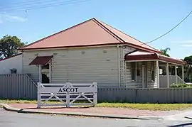 Corner of Great Eastern Highway and Carbine Street | |||||||||||||||
 Ascot Location in metropolitan Perth | |||||||||||||||
| Coordinates | 31.933°S 115.935°E | ||||||||||||||
| Population | 2,572 (2016 census)[1] | ||||||||||||||
| • Density | 695/km2 (1,800/sq mi) | ||||||||||||||
| Established | 1991 | ||||||||||||||
| Postcode(s) | 6104 | ||||||||||||||
| Area | 3.7 km2 (1.4 sq mi) | ||||||||||||||
| Location | 10 km (6 mi) from Perth | ||||||||||||||
| LGA(s) | City of Belmont | ||||||||||||||
| State electorate(s) | Belmont | ||||||||||||||
| Federal Division(s) | Swan | ||||||||||||||
| |||||||||||||||
The suburb, which was previously part of Belmont and Redcliffe, was officially established on 7 March 1991, with the boundaries being approved on 22 March 1991. It was named after the Ascot Racecourse, a major horse-racing track located within the suburb's boundaries.
Geography
The suburb is a narrow strip of about 5 kilometres (3.1 mi) in length, extending along the Swan River's southern foreshore from Abernethy Road in Belmont to the City of Belmont's boundary with the City of Swan at South Guildford.
References
- Australian Bureau of Statistics (27 June 2017). "Ascot (State Suburb)". 2016 Census QuickStats. Retrieved 25 August 2020.

This article is issued from Wikipedia. The text is licensed under Creative Commons - Attribution - Sharealike. Additional terms may apply for the media files.