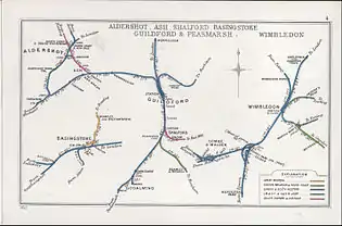
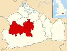
Ash railway station
Ash railway station serves the village of Ash in Surrey, England. The station is served by South Western Railway, who manage the station, and by Great Western Railway. It is situated on the Ascot to Guildford line and the North Downs Line, 36 miles 34 chains (58.6 km) from London Waterloo.
 Ash railway station | |
| Location | Ash, Guildford England |
| Grid reference | SU899508 |
| Managed by | South Western Railway |
| Platforms | 2 |
| Other information | |
| Station code | ASH |
| Classification | DfT category E |
| Key dates | |
| 20 August 1849 | Opened as Ash |
| July 1855 | Renamed Ash and Aldershot |
| September 1858 | Renamed Aldershot (Ash) |
| June 1859 | Renamed Ash and Aldershot |
| June 1863 | Renamed Ash Junction |
| 1 December 1926 | Renamed Ash |
| Passengers | |
| 2015/16 | |
| Interchange | |
| 2016/17 | |
| Interchange | |
| 2017/18 | |
| Interchange | |
| 2018/19 | |
| Interchange | |
| 2019/20 | |
| Interchange | |
| Notes | |
Passenger statistics from the Office of Rail and Road | |

Ascot–Ash Vale Jn | |||||||||||||||||||||||||||||||||||||||||||||||||||||||||||||||||||||||||||||||||||||||||||||||||||||||
|---|---|---|---|---|---|---|---|---|---|---|---|---|---|---|---|---|---|---|---|---|---|---|---|---|---|---|---|---|---|---|---|---|---|---|---|---|---|---|---|---|---|---|---|---|---|---|---|---|---|---|---|---|---|---|---|---|---|---|---|---|---|---|---|---|---|---|---|---|---|---|---|---|---|---|---|---|---|---|---|---|---|---|---|---|---|---|---|---|---|---|---|---|---|---|---|---|---|---|---|---|---|---|---|
| |||||||||||||||||||||||||||||||||||||||||||||||||||||||||||||||||||||||||||||||||||||||||||||||||||||||
History
Opened by the Reading, Guildford and Reigate Railway, then operated by the South Eastern Railway, it became part of the Southern Railway during the Grouping of 1923. The station then passed on to the Southern Region of British Railways on nationalisation in 1948.
The station had four platforms when it was built, which were later reduced to two after the Second World War. The other two platforms were placed over where the station car park and the Network Rail offices now stand. The station is 49 miles 18 chains (79.2 km) from Charing Cross (measured via Redhill); platform 1 can accommodate an eight-coach train, but platform 2 only accommodates four coaches. To the east is the former Ash Junction, 48 miles 34 chains (77.9 km) from Charing Cross, where the former route via Tongham left the North Downs Line 35 miles 50 chains (57.3 km) from Waterloo (via Worplesdon and milepost 30 1⁄4 at Guildford).[1]
When Sectorisation was introduced in the 1980s, the station was served by Network SouthEast until the Privatisation of British Railways.
Services
Regular train destinations are Reading, Redhill, Guildford, Gatwick Airport and Farnham.[2]
Typical off-peak services from Ash Monday - Friday are:
- 2 trains per hour to Guildford (South Western Railway)
- 2 trains per hour to Farnham (South Western Railway)
- 1 train per hour to Reading (Great Western Railway)
- 1 train per hour to Redhill (Great Western Railway)
- 5 trains per day to Gatwick Airport (Great Western Railway)
South Western Railway services between Guildford & Ascot are run using Class 450. The Reading to Redhill & Gatwick Airport service is operated by Class 165 or Class 166 Diesel Multiple Units.
| Preceding station | Following station | |||
|---|---|---|---|---|
| Aldershot | South Western Railway Ascot to Guildford line |
Wanborough | ||
| North Camp | Great Western Railway Limited Service |
|||
| Great Western Railway North Downs Line |
Guildford | |||
Notes
- Yonge, John (November 2008) [1994]. Jacobs, Gerald (ed.). Railway Track Diagrams 5: Southern & TfL (3rd ed.). Bradford on Avon: Trackmaps. map 23. ISBN 978-0-9549866-4-3.
- GB eNRT 2015-16 Edition, Tables 148 & 149
References
- Butt, R. V. J. (1995). The Directory of Railway Stations: details every public and private passenger station, halt, platform and stopping place, past and present (1st ed.). Sparkford: Patrick Stephens Ltd. ISBN 978-1-85260-508-7. OCLC 60251199.
- Jowett, Alan (March 1989). Jowett's Railway Atlas of Great Britain and Ireland: From Pre-Grouping to the Present Day (1st ed.). Sparkford: Patrick Stephens Ltd. ISBN 978-1-85260-086-0. OCLC 22311137.
- Jowett, Alan (2000). Jowett's Nationalised Railway Atlas (1st ed.). Penryn, Cornwall: Atlantic Transport Publishers. ISBN 978-0-906899-99-1. OCLC 228266687.
- Station on navigable O.S. map
