Chilworth railway station
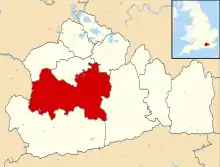
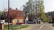
Chilworth railway station serves the village of Chilworth, Surrey, England. The station, and all trains serving it, are operated by Great Western Railway. It is on the North Downs Line, 39 miles 15 chains (63.07 km) measured from London Charing Cross via Redhill.
Chilworth | |
|---|---|
 | |
| Location | Chilworth, Surrey, Guildford England |
| Grid reference | TQ031472 |
| Managed by | Great Western Railway |
| Platforms | 2 |
| Other information | |
| Station code | CHL |
| Classification | DfT category F2 |
| History | |
| Opened | 20 August 1849 |
| Original company | Reading, Guildford and Reigate Railway |
| Pre-grouping | South Eastern Railway |
| Post-grouping | Southern Railway |
| Passengers | |
| 2015/16 | |
| 2016/17 | |
| 2017/18 | |
| 2018/19 | |
| 2019/20 | |
| Notes | |
Passenger statistics from the Office of Rail and Road | |
History
The Reading, Guildford and Reigate Railway opened the station in 1849 as "Chilworth and Albury", although the village of Albury is over 1.2 miles (2 km) away.
British Railways destaffed the station in November 1967. The signalling controls were transferred to the two nearest manned signal boxes at Shalford and Gomshall, for control of the track in between. The signal box was then officially closed. The original Victorian footbridge and road crossing gates from the station were removed, and sold for £1 to the artist David Shepherd. They were transported on BRS low loader trucks to Somerset, for re-use on the East Somerset Railway, Cranmore. The station is 39 miles 15 chains (63.1 km) from Charing Cross, and has two platforms, which can each accommodate a six-coach train.[1]
Services
The typical off-peak service on the North Downs Line (from December 2006) is one train every two hours between Reading and Redhill (extended to Gatwick Airport on Sundays).[2]
| Preceding station | Following station | |||
|---|---|---|---|---|
| Shalford | Great Western Railway North Downs Line |
Gomshall | ||
References
- Yonge, John (November 2008) [1994]. Jacobs, Gerald (ed.). Railway Track Diagrams 5: Southern & TfL (3rd ed.). Bradford on Avon: Trackmaps. map 24A. ISBN 978-0-9549866-4-3.
- GB eNRT May 2016 Edition, Table 148 (Network Rail)