Ashby, Western Australia
Ashby is a suburb of Perth, the capital city of Western Australia 26 kilometres (16 mi) north of Perth's central business district. Its local government area is the City of Wanneroo.
| Ashby Perth, Western Australia | |||||||||||||||
|---|---|---|---|---|---|---|---|---|---|---|---|---|---|---|---|
 Ashby Location in metropolitan Perth | |||||||||||||||
| Coordinates | 31.733°S 115.798°E | ||||||||||||||
| Population | 2,394 (2011 census)[1] | ||||||||||||||
| • Density | 1,600/km2 (4,130/sq mi) | ||||||||||||||
| Established | 1990s | ||||||||||||||
| Postcode(s) | 6065 | ||||||||||||||
| Area | 1.5 km2 (0.6 sq mi) | ||||||||||||||
| Location | 26 km (16 mi) N of Perth CBD | ||||||||||||||
| LGA(s) | City of Wanneroo | ||||||||||||||
| State electorate(s) | Wanneroo | ||||||||||||||
| Federal Division(s) | Cowan | ||||||||||||||
| |||||||||||||||
The suburb came into being in the late 1990s as a subdivision of Wanneroo, and was named in 1997 after a local landowner, Mr E E Ashby, who owned land in the area in 1913.[2]
Geography
Ashby is a triangular suburb and is bounded by Wanneroo Road to the southwest, Pinjar Road to the southeast and Conti Road to the north. About 40% of the suburb has been developed for residential purposes.[3]
References
- Australian Bureau of Statistics (31 October 2012). "State Suburbs: Ashby". 2011 Census QuickStats. Retrieved 4 July 2012.

- Western Australian Land Information Authority. "History of metropolitan suburb names – A". Retrieved 15 February 2008.
- Department of Land Information. StreetSmart Perth Street Directory (54th ed.). West Australian Newspapers Ltd. pp. Map 221. ISBN 978-0-909439-67-5.
Suburbs and localities of the City of Wanneroo, Perth, Western Australia | ||
|---|---|---|
| North West | 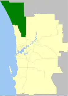 | |
| North East | ||
| South | ||
¹ Suburb shared with the City of Joondalup | ||
This article is issued from Wikipedia. The text is licensed under Creative Commons - Attribution - Sharealike. Additional terms may apply for the media files.