Aurora, Oregon
Aurora is a city in Marion County, Oregon, United States. Before being incorporated as a city, it was the location of the Aurora Colony, a religious commune founded in 1856 by William Keil and John E. Schmitz who named the settlement after their daughter.[6] The population was 918 at the 2010 census.[7] It is part of the Salem Metropolitan Statistical Area.
Aurora, Oregon | |
|---|---|
_(marDA0083).jpg.webp) Old Aurora Colony Museum | |
 Seal | |
 Location in Oregon | |
| Coordinates: 45°13′49″N 122°45′19″W | |
| Country | United States |
| State | Oregon |
| County | Marion |
| Incorporated | 1893 |
| Government | |
| • Mayor | Brian Asher |
| Area | |
| • Total | 0.48 sq mi (1.24 km2) |
| • Land | 0.48 sq mi (1.24 km2) |
| • Water | 0.00 sq mi (0.00 km2) |
| Elevation | 136 ft (41.45 m) |
| Population | |
| • Total | 918 |
| • Estimate (2019)[3] | 1,039 |
| • Density | 2,169.10/sq mi (837.14/km2) |
| Time zone | UTC-8 (Pacific) |
| • Summer (DST) | UTC-7 (Pacific) |
| ZIP code | 97002 |
| Area code(s) | 503 |
| FIPS code | 41-03300[4] |
| GNIS feature ID | 1117094[5] |
| Website | www.ci.aurora.or.us |
Geography
According to the United States Census Bureau, the city has a total area of 0.48 square miles (1.24 km2), all of it land.[8]
The Pudding River flows northward, just east of Aurora.
Climate
This region experiences warm (but not hot) and dry summers, with no average monthly temperatures above 71.6 °F (22.0 °C). According to the Köppen Climate Classification system, Aurora has a warm-summer Mediterranean climate, abbreviated "Csb" on climate maps.[9]
Demographics
| Historical population | |||
|---|---|---|---|
| Census | Pop. | %± | |
| 1900 | 122 | — | |
| 1910 | 190 | 55.7% | |
| 1920 | 229 | 20.5% | |
| 1930 | 215 | −6.1% | |
| 1940 | 228 | 6.0% | |
| 1950 | 242 | 6.1% | |
| 1960 | 274 | 13.2% | |
| 1970 | 306 | 11.7% | |
| 1980 | 523 | 70.9% | |
| 1990 | 567 | 8.4% | |
| 2000 | 655 | 15.5% | |
| 2010 | 918 | 40.2% | |
| 2019 (est.) | 1,039 | [3] | 13.2% |
| U.S. Decennial Census[10] | |||
2010 census
As of the census[2] of 2010, there were 918 people, 336 households, and 256 families living in the city. The population density was 1,912.5 inhabitants per square mile (738.4/km2). There were 349 housing units at an average density of 727.1 per square mile (280.7/km2). The racial makeup of the city was 89.7% White, 0.5% African American, 0.9% Native American, 0.3% Asian, 6.3% from other races, and 2.3% from two or more races. Hispanic or Latino of any race were 10.9% of the population.
There were 336 households, of which 37.5% had children under the age of 18 living with them, 64.0% were married couples living together, 7.4% had a female householder with no husband present, 4.8% had a male householder with no wife present, and 23.8% were non-families. 18.5% of all households were made up of individuals, and 6.6% had someone living alone who was 65 years of age or older. The average household size was 2.73 and the average family size was 3.12.
The median age in the city was 39.6 years. 27.8% of residents were under the age of 18; 5.2% were between the ages of 18 and 24; 24.5% were from 25 to 44; 31.8% were from 45 to 64; and 10.8% were 65 years of age or older. The gender makeup of the city was 51.6% male and 48.4% female.
2000 census
As of the census[4] of 2000, there were 655 people, 250 households, and 186 families living in the city. The population density was 1,441.8 people per square mile (562.0/km2). There were 262 housing units at an average density of 576.7 per square mile (224.8/km2). The racial makeup of the city was 94.20% White, 0.46% African American, 0.61% Native American, 1.07% Asian, 1.98% from other races, and 1.68% from two or more races. Hispanic or Latino of any race were 6.26% of the population.
There were 250 households, out of which 31.6% had children under the age of 18 living with them, 62.4% were married couples living together, 7.2% had a female householder with no husband present, and 25.6% were non-families. 19.6% of all households were made up of individuals, and 9.2% had someone living alone who was 65 years of age or older. The average household size was 2.62 and the average family size was 3.01.
In the city, the population was spread out, with 24.4% under the age of 18, 7.0% from 18 to 24, 27.8% from 25 to 44, 27.6% from 45 to 64, and 13.1% who were 65 years of age or older. The median age was 41 years. For every 100 females, there were 105.3 males. For every 100 females age 18 and over, there were 98.0 males.
The median income for a household in the city was $55,938, and the median income for a family was $65,556. Males had a median income of $45,938 versus $29,444 for females. The per capita income for the city was $24,839. None of the families and 1.6% of the population were living below the poverty line, including no under eighteens and 7.5% of those over 64.
Education
North Marion School District has a unique school system with four schools within walking distance: North Marion Primary School, North Marion Intermediate School, North Marion Middle School, and North Marion High School.
Places of Interest
- Old Aurora Museum, about the Old Aurora Colony[11]
- Aurora Mills Architectural Salvage, set in the town's historic seed cleaning mill complex built in 1890, it is now the town's largest and most unique antique shopping venue.[12]
- Mainstreet Merchantile Antiques, one of the town's larger antique shops.
- French Prairie Perennials at 14936 SE 3rd St features fine gifts as well as perennial plants and unique conifers.
Transportation
Airport
The Aurora State Airport is located one mile northwest of Aurora. The airport is owned by the State of Oregon and operated by the Oregon Department of Aviation.
Economy
Columbia Helicopters is located in Aurora. The facility provides maintenance, repair and overhaul services.[13]
References
- "2019 U.S. Gazetteer Files". United States Census Bureau. Retrieved July 28, 2020.
- "U.S. Census website". United States Census Bureau. Retrieved 2012-12-21.
- "Population and Housing Unit Estimates". United States Census Bureau. May 24, 2020. Retrieved May 27, 2020.
- "U.S. Census website". United States Census Bureau. Retrieved 2008-01-31.
- "US Board on Geographic Names". United States Geological Survey. 2007-10-25. Retrieved 2008-01-31.
- Lyman, Horace S. (1901). . Oregon Historical Quarterly. 2.
- American FactFinder - Results
- "US Gazetteer files 2010". United States Census Bureau. Archived from the original on 2012-01-24. Retrieved 2012-12-21.
- Climate Summary for Aurora, Oregon
- "Census of Population and Housing". Census.gov. Retrieved June 4, 2015.
- Homepage of the museum
- http://auroramills.com/ Homepage of Aurora Mills
- http://phx.corporate-ir.net/External.File?item=UGFyZW50SUQ9NzAxNzM5fENoaWxkSUQ9NDEzNDk0fFR5cGU9MQ==&t=1
External links
| Wikivoyage has a travel guide for Aurora (Oregon). |
 Media related to Aurora, Oregon at Wikimedia Commons
- Entry for Aurora in the Oregon Blue Book
- Kopp, Jim. "Aurora". The Oregon Encyclopedia.
Municipalities and communities of Marion County, Oregon, United States | ||
|---|---|---|
| Cities | 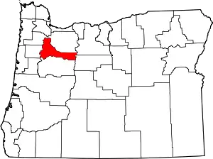 Marion County map | |
| CDPs | ||
| Unincorporated communities | ||
| Ghost towns | ||
| Indian reservation | ||
| Footnotes | ‡This populated place also has portions in an adjacent county or counties | |
| ||
| Authority control |
|---|