Austin, Pennsylvania
Austin is a borough along the Freeman Run (river) in southwestern Potter County, Pennsylvania, United States. The population was 562 at the 2010 census.
Austin, Pennsylvania | |
|---|---|
 Main Street (PA 607) in Austin, September 2007 | |
 Location of Austin in Potter County, Pennsylvania. | |
 Austin Location within the U.S. state of Pennsylvania  Austin Austin (the United States) | |
| Coordinates: 41°37′51″N 78°05′37″W | |
| Country | United States |
| State | Pennsylvania |
| County | Potter |
| Settled | 1856 |
| Incorporated (borough) | 1888 |
| Government | |
| • Mayor | James Setzer (R) |
| • Fire District | Austin Volunteer Fire Dept. |
| Area | |
| • Total | 4.04 sq mi (10.47 km2) |
| • Land | 4.04 sq mi (10.47 km2) |
| • Water | 0.00 sq mi (0.00 km2) |
| Elevation [2] (borough benchmark) | 1,352 ft (412 m) |
| Highest elevation [2] (high points at east end of borough) | 2,260 ft (690 m) |
| Lowest elevation [2] (Freeman Run) | 1,305 ft (398 m) |
| Population (2010) | |
| • Total | 562 |
| • Estimate (2019)[3] | 531 |
| • Density | 131.40/sq mi (50.73/km2) |
| Time zone | Eastern (EST) |
| • Summer (DST) | EDT |
| ZIP code | 16720 |
| Area code(s) | 814 |
| FIPS code | 42-03576 |
Geography
Austin is located at 41°37′51″N 78°5′37″W (41.630781, -78.093590).[4]
According to the United States Census Bureau, the borough has a total area of 4.0 square miles (10.4 km2), all of it land.
Demographics
| Historical population | |||
|---|---|---|---|
| Census | Pop. | %± | |
| 1890 | 1,679 | — | |
| 1900 | 2,300 | 37.0% | |
| 1910 | 2,941 | 27.9% | |
| 1920 | 1,556 | −47.1% | |
| 1930 | 1,116 | −28.3% | |
| 1940 | 1,050 | −5.9% | |
| 1950 | 804 | −23.4% | |
| 1960 | 721 | −10.3% | |
| 1970 | 626 | −13.2% | |
| 1980 | 740 | 18.2% | |
| 1990 | 569 | −23.1% | |
| 2000 | 623 | 9.5% | |
| 2010 | 562 | −9.8% | |
| 2019 (est.) | 531 | [3] | −5.5% |
| Sources:[5][6] | |||
At the 2000 census there were 623 people, 243 households, and 164 families residing in the borough. The population density was 156.5 people per square mile (60.4/km²). There were 282 housing units at an average density of 70.8 per square mile (27.4/km²). The racial makeup of the borough was 98.72% White, 0.16% African American, 0.32% from other races, and 0.80% from two or more races. Hispanic or Latino of any race were 0.16%.[7]
There were 243 households, 39.1% had children under the age of 18 living with them, 49.4% were married couples living together, 11.5% had a female householder with no husband present, and 32.5% were non-families. 26.7% of households were made up of individuals, and 11.9% were one person aged 65 or older. The average household size was 2.56 and the average family size was 3.13.
In the borough the population was spread out, with 31.3% under the age of 18, 7.7% from 18 to 24, 30.0% from 25 to 44, 17.8% from 45 to 64, and 13.2% 65 or older. The median age was 31 years. For every 100 females there were 88.8 males. For every 100 females age 18 and over, there were 90.2 males.
The median household income was $28,846 and the median family income was $34,375. Males had a median income of $29,659 versus $20,729 for females. The per capita income for the borough was $12,210. About 13.4% of families and 21.2% of the population were below the poverty line, including 25.8% of those under age 18 and 9.1% of those age 65 or over.
References
- "2019 U.S. Gazetteer Files". United States Census Bureau. Retrieved July 28, 2020.
- "Ridge Trail Topo Map, Potter County PA (Austin Area)". TopoZone. Locality, LLC. Retrieved 28 November 2019.
- "Population and Housing Unit Estimates". United States Census Bureau. May 24, 2020. Retrieved May 27, 2020.
- "US Gazetteer files: 2010, 2000, and 1990". United States Census Bureau. 2011-02-12. Retrieved 2011-04-23.
- "Census of Population and Housing: Decennial Censuses". United States Census Bureau. Retrieved 2012-03-04.
- "Incorporated Places and Minor Civil Divisions Datasets: Subcounty Resident Population Estimates: April 1, 2010 to July 1, 2012". Population Estimates. U.S. Census Bureau. Archived from the original on 11 June 2013. Retrieved 11 December 2013.
- "U.S. Census website". United States Census Bureau. Retrieved 2008-01-31.
External links
![]() Media related to Austin, Pennsylvania at Wikimedia Commons
Media related to Austin, Pennsylvania at Wikimedia Commons
Municipalities and communities of Potter County, Pennsylvania, United States | ||
|---|---|---|
| Boroughs | 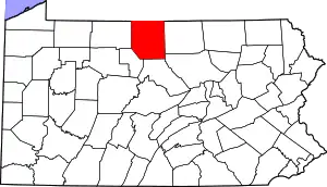 | |
| Townships | ||
| CDPs | ||
| Unincorporated communities | ||
| ||