Shinglehouse, Pennsylvania
Shinglehouse is a borough in Potter County, Pennsylvania, United States. The population was 1,127 at the 2010 census.
Shinglehouse, Pennsylvania | |
|---|---|
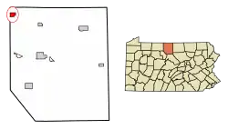 Location of Shinglehouse in Potter County, Pennsylvania. | |
 Shinglehouse Location within the U.S. state of Pennsylvania  Shinglehouse Shinglehouse (the United States) | |
| Coordinates: 41°57′51″N 78°11′35″W | |
| Country | United States |
| State | Pennsylvania |
| County | Potter |
| Settled | 1808 |
| Incorporated (borough) | 1902 |
| Area | |
| • Total | 2.10 sq mi (5.43 km2) |
| • Land | 2.09 sq mi (5.42 km2) |
| • Water | 0.00 sq mi (0.01 km2) |
| Elevation [2] (borough benchmark) | 1,492 ft (455 m) |
| Highest elevation [2] (southwest boundary of borough) | 1,940 ft (590 m) |
| Lowest elevation [2] (Oswayo Creek) | 1,465 ft (447 m) |
| Population (2010) | |
| • Total | 1,127 |
| • Estimate (2019)[3] | 1,054 |
| • Density | 503.34/sq mi (194.32/km2) |
| Time zone | Eastern (EST) |
| • Summer (DST) | EDT |
| ZIP code | 16748 |
| Area code(s) | 814 Exchange: 697 |
| FIPS code | 42-70304 |
| Website | shinglehouseborough |
The community was named for a landmark shingled inn near the original town site.[4]
Geography
Shinglehouse is located at 41°57′51″N 78°11′35″W (41.964182, -78.193188).[5]
According to the United States Census Bureau, the borough has a total area of 2.1 square miles (5.4 km²), all of it land.
Demographics
| Historical population | |||
|---|---|---|---|
| Census | Pop. | %± | |
| 1910 | 1,598 | — | |
| 1920 | 1,169 | −26.8% | |
| 1930 | 1,380 | 18.0% | |
| 1940 | 1,106 | −19.9% | |
| 1950 | 1,201 | 8.6% | |
| 1960 | 1,298 | 8.1% | |
| 1970 | 1,320 | 1.7% | |
| 1980 | 1,310 | −0.8% | |
| 1990 | 1,243 | −5.1% | |
| 2000 | 1,250 | 0.6% | |
| 2010 | 1,127 | −9.8% | |
| 2019 (est.) | 1,054 | [3] | −6.5% |
| Sources:[6][7][8] | |||
As of the census[7] of 2000, there were 1,250 people, 513 households, and 319 families residing in the borough. The population density was 599.4 people per square mile (230.9/km²). There were 550 housing units at an average density of 263.7 per square mile (101.6/km²). The racial makeup of the borough was 98.24% White, 0.16% Native American, 0.08% Asian, 0.32% from other races, and 1.20% from two or more races. Hispanic or Latino of any race were 0.80% of the population.
There were 513 households, out of which 30.0% had children under the age of 18 living with them, 51.3% were married couples living together, 7.4% had a female householder with no husband present, and 37.8% were non-families. 34.3% of all households were made up of individuals, and 19.5% had someone living alone who was 65 years of age or older. The average household size was 2.44 and the average family size was 3.19.
In the borough the population was spread out, with 27.5% under the age of 18, 6.7% from 18 to 24, 25.7% from 25 to 44, 20.9% from 45 to 64, and 19.2% who were 65 years of age or older. The median age was 38 years. For every 100 females there were 92.0 males. For every 100 females age 18 and over, there were 84.1 males.
The median income for a household in the borough was $25,987, and the median income for a family was $35,750. Males had a median income of $30,417 versus $20,000 for females. The per capita income for the borough was $13,253. About 9.8% of families and 13.1% of the population were below the poverty line, including 13.0% of those under age 18 and 15.7% of those age 65 or over.
Notable people
- Fielder Jones, baseball player and manager.
- William C. Davis, Jr., ballistic engineer and author.
- Myrtl Meriwether, first Miss America
References
- "2019 U.S. Gazetteer Files". United States Census Bureau. Retrieved July 28, 2020.
- "Shinglehouse Topo Map, Potter County PA (Shinglehouse Area)". TopoZone. Locality, LLC. Retrieved 28 November 2019.
- "Population and Housing Unit Estimates". United States Census Bureau. May 24, 2020. Retrieved May 27, 2020.
- Moyer, Armond; Moyer, Winifred (1958). The origins of unusual place-names. Keystone Pub. Associates. p. 119.
- "US Gazetteer files: 2010, 2000, and 1990". United States Census Bureau. 2011-02-12. Retrieved 2011-04-23.
- "Census of Population and Housing". U.S. Census Bureau. Retrieved 11 December 2013.
- "U.S. Census website". United States Census Bureau. Retrieved 2008-01-31.
- "Incorporated Places and Minor Civil Divisions Datasets: Subcounty Resident Population Estimates: April 1, 2010 to July 1, 2012". Population Estimates. U.S. Census Bureau. Archived from the original on 11 June 2013. Retrieved 11 December 2013.
External links
- Shinglehouse, official website
- Oswayo Valley Memorial Library For the History of Shinglehouse, PA
- Oswayo Valley School District homepage
Municipalities and communities of Potter County, Pennsylvania, United States | ||
|---|---|---|
| Boroughs | 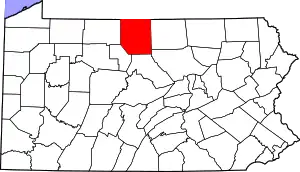 | |
| Townships | ||
| CDPs | ||
| Unincorporated communities | ||
| ||
| Authority control |
|---|