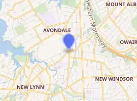
Avondale, Auckland
Avondale is a suburb in central (western) Auckland, New Zealand, located in the Whau ward, one of the thirteen administrative divisions for the Auckland Council. It was originally called Te Whau, which is the common name, of Māori origin, for Entelea arborescens, a native tree.
Avondale | |
|---|---|
Suburb | |
| |
| Country | New Zealand |
| Local authority | Auckland Council |
| Electoral ward | Whau Ward |
| Established | c. 1850s |
| Population (2018) | |
| • Total | 20,082 |
| Train station(s) | Avondale Railway Station |
| Rosebank | Waterview | |
| New Lynn |
|
Owairaka |
| Green Bay | Blockhouse Bay |
Demographics
| Year | Pop. | ±% p.a. |
|---|---|---|
| 2006 | 17,565 | — |
| 2013 | 18,294 | +0.58% |
| 2018 | 20,082 | +1.88% |
| Source: [1] | ||
Avondale, comprising the statistical areas of Avondale Rosebank, Avondale West (Auckland), Avondale North (Auckland), Avondale Central (Auckland) and Avondale South (Auckland), had a population of 20,082 at the 2018 New Zealand census, an increase of 1,788 people (9.8%) since the 2013 census, and an increase of 2,517 people (14.3%) since the 2006 census. There were 5,985 households. There were 10,086 males and 9,993 females, giving a sex ratio of 1.01 males per female, with 3,708 people (18.5%) aged under 15 years, 5,253 (26.2%) aged 15 to 29, 9,123 (45.4%) aged 30 to 64, and 1,998 (9.9%) aged 65 or older.
Ethnicities were 37.0% European/Pākehā, 11.1% Māori, 25.4% Pacific peoples, 36.4% Asian, and 4.7% other ethnicities (totals add to more than 100% since people could identify with multiple ethnicities).
The proportion of people born overseas was 47.2%, compared with 27.1% nationally.
Although some people objected to giving their religion, 36.5% had no religion, 38.6% were Christian, and 19.3% had other religions.
Of those at least 15 years old, 4,776 (29.2%) people had a bachelor or higher degree, and 2,415 (14.7%) people had no formal qualifications. The employment status of those at least 15 was that 8,478 (51.8%) people were employed full-time, 2,115 (12.9%) were part-time, and 729 (4.5%) were unemployed.[1]
History
The first European settler in the area was John Sheddon Adam in 1843, but settlement did not occur in larger numbers until the late 1850s, with the completion of Great North Road. Expansion was rapid, with churches, stores and a public hall built by 1867. With a railway connection to the settlement in 1880, the rate of settlement increased further. Te Whau became Avondale District on 5 June 1882, although the old name survives in the Whau River, an estuarial arm of the Waitematā Harbour, which runs along the western edge of the suburb. A prominent community leader and Member of Parliament was John Bollard, who lived in Avondale from 1861 to 1915.
Early industries included brickyards, tanneries, mills and pottery works. Avondale also had numerous market gardens, especially on the Rosebank Peninsula. It was here that the "Hayward" cultivar of the Chinese gooseberry, later known as the kiwifruit, was developed by Hayward Wright.
From the mid-1920s Avondale became increasingly suburban. In 1927 the Avondale Borough Council was absorbed into the Auckland City Council.
The so-called Avondale spider (Delena cancerides), an introduced species of a spectacular but harmless Australian huntsman spider, was for decades only found in the area surrounding Avondale, and thus received its New Zealand name. It was introduced to New Zealand in a shipment of timber to the Aitkins Timber Yard in Patiki Road, and was left to spread, so its distribution pattern might help with the identification of future introduced species dispersal.
In 2017, the council-controlled organisation Panuku Development Auckland announced a major redevelopment of Avondale town centre, including a new library building, community and recreation centre, increased housing and local business development.[2]
Local government
Avondale had a local government just like other suburbs of Auckland at that time. The local government was called Avondale Borough Council, which started in 1922 and merged into Auckland City Council in 1927, eventually amalgamated into Auckland Council in November 2010.
Mayors of Avondale Borough Council
- 1922–1923 James Watkin Kinniburgh
- 1923–1927 William John Tait
- 1927–1927 Edward Ernest Copsey
- 1927–1927 Herbert Tiarks
Amenities
Education
- Avondale College is a state secondary (years 9-15) school with a roll of 2878 students. It is one of the largest high schools in New Zealand.[3] Avondale Intermediate is a school for years 7-8 with a roll of 378.[4] It shares the site with Avondale College.
- Avondale Primary School and Rosebank School are coeducational state contributing primary (years 1-6) schools with rolls of 286 and 448 students, respectively.[5][6]
- St Mary's Catholic School is a state-integrated full primary (years 1-8) school with a roll of 180.[7]
All these schools are coeducational. Rolls are as of March 2020.[8]
Sports
The Avondale Jockey Club operates the Avondale Racecourse - one of only two gallops tracks in suburban Auckland. The racecourse is also the location of the Avondale Sunday markets, the largest in the country. The interior of the racecourse is occupied by several sports fields, which are used for rugby union, rugby league, soccer and cricket. A set of netball courts are located adjacent to the racecourse. Additional sports facilities are located along Rosebank Road, at Eastdale Reserve and Riversdale Reserve.
Transport
Avondale Railway Station is situated on the Western Line of Auckland's metropolitan rail network.
Libraries
Avondale has a local branch of the Auckland Libraries system.
References
- "Statistical area 1 dataset for 2018 Census". Statistics New Zealand. March 2020. Avondale Rosebank (130600), Avondale West (Auckland) (131700), Avondale North (Auckland) (132000), Avondale Central (Auckland) (133100) and Avondale South (Auckland) (135000). 2018 Census place summary: Avondale Rosebank 2018 Census place summary: Avondale West (Auckland) 2018 Census place summary: Avondale North (Auckland) 2018 Census place summary: Avondale Central (Auckland) 2018 Census place summary: Avondale South (Auckland)
- "Panuku Development Auckland". panuku.co.nz (Press release). 7 November 2017. Retrieved 4 December 2017.
- Education Counts: Avondale College
- Education Counts: Avondale Intermediate
- Education Counts: Avondale Primary School
- Education Counts: Rosebank School
- Education Counts: St Mary's Catholic School
- "New Zealand Schools Directory". New Zealand Ministry of Education. Retrieved 26 April 2020.
References
- Lisa Truttman, 2003, Heart of The Whau, The Story of the Centre of Avondale 1841-2001, Words Incorporated.
External links
- Photographs of Avondale held in Auckland Libraries' heritage collections.