B45 (New York City bus)
The St. Johns Place Line is a public transit line in Brooklyn, New York, mainly along Atlantic Avenue, Washington Avenue, Sterling Place, and St. Johns Place between Downtown Brooklyn and Crown Heights. Originally a streetcar line, it is now the B45 bus route,[2] operated by the New York City Transit Authority.
b45
| |||
|---|---|---|---|
| St. Johns Place Line | |||
 An eastbound B45 bus follows the former route of the streetcar line, summer 2009 | |||
| Overview | |||
| System | MTA New York City Bus | ||
| Operator | New York City Transit Authority | ||
| Garage | East New York Depot | ||
| Began service | 1877 (streetcar) 1947 (bus) | ||
| Route | |||
| Locale | Brooklyn | ||
| Communities served | Crown Heights, Prospect Heights, Fort Greene, Boerum Hill, Downtown Brooklyn | ||
| Landmarks served | Brooklyn Borough Hall, Atlantic Terminal, Barclays Center | ||
| Start | Downtown Brooklyn– Court Street | ||
| Via | St. Johns Place | ||
| End | Crown Heights– Ralph Avenue | ||
| Service | |||
| Operates | All times, except late nights | ||
| Annual patronage | 1,739,625 (2017)[1] | ||
| Transfers | Yes | ||
| Timetable | B45 | ||
| |||
History
In 1877, the Atlantic Avenue Railroad leased its main line east of Fifth Avenue (just east of Flatbush Avenue) to the Long Island Rail Road as a branch of their system to downtown Brooklyn.[3] However, the Atlantic Avenue Railroad still wanted to serve the area east of downtown, and it opened a new track on the south side of Atlantic Avenue from Fifth Avenue to Washington Avenue, and then a line along Washington Avenue and Sterling Place (then Butler Street) to Nostrand Avenue, on June 11, 1883.[4]
The rest of the line was built by the Nassau Electric Railroad, which had the right to build from Hamilton Ferry to City Line along Union Street, St. Johns Place (then Douglass Street), East New York Avenue, and Liberty Avenue.[5] The Nassau Electric leased the Atlantic Avenue on April 5, 1896,[6] and never built the portion between the end of the Union Street Line at Grand Army Plaza and the crossing of their Ocean Avenue Line at Rogers Avenue, one block west of Nostrand Avenue. Instead, the Atlantic Avenue Railroad's Butler Street Line was truncated to Rogers Avenue and extended via St. Johns Place and East New York Avenue, and, once the lease was consummated, cars were operated from Fulton Ferry to Sheepshead Bay (leaving the line at Rogers Avenue) and to City Line,[7] where they soon connected with the Long Island Electric Railway and New York and Long Island Traction Company.
Later the St. Johns Place cars turned south at Rockaway Avenue along the Wilson Avenue Line to Canarsie Depot, and Liberty Avenue was served only by Bergen Street Line cars. Buses were substituted for streetcars on August 24, 1947, and replaced by trolley buses on September 16, 1948,[8][9] only for buses to be gradually restored between 1954 and 1959.[10] The bus route was truncated to the intersection with the Bergen Street Line and Ralph Avenue Line by 1969.[11]
See also
References
- "Facts and Figures". mta.info. August 28, 2011. Retrieved July 13, 2018.
- current B45 route & schedule Archived September 29, 2007, at the Wayback Machine (pdf)
- "Lease". Retrieved June 6, 2018.
- Brooklyn Daily Eagle, Mr. Richardson's New Cars, June 13, 1881, page 2
- Brooklyn Daily Eagle, Nassau Road on Union Street, September 5, 1895, page 14
- Brooklyn Daily Eagle, Run by the Nassau Now, April 5, 1896, page 9
- Brooklyn Daily Eagle, New Railroad Conveniences, April 3, 1896, page 1
- "Transit Depot to Open: Trolley Coaches Will Operate on Line in Brooklyn" (PDF). The New York Times. September 15, 1948. Retrieved September 1, 2016.
- "Bergen St. Trolley-Coach Depot Starts Operations Tomorrow". Brooklyn Daily Eagle. Fultonhistory.com. September 15, 1948. p. 17. Retrieved September 1, 2016.
- Brooklyn Trackless Trolleys (NYCBus.org)
- 1969 Brooklyn and Staten Island bus map
| Current local routes | 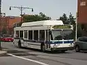 | |
|---|---|---|
| Current express routes | ||
| Former routes | ||