Balanga, Nigeria
Balanga is a Local Government Area in the southeast of Gombe State, Nigeria, bordering Adamawa State. Its headquarters are in the town of Tallase.the most populated of the area are Muslims who have 45% and the major sporking language is waja.
Balanga | |
|---|---|
LGA | |
 Balanga Location in Nigeria | |
| Coordinates: 9°58′N 11°41′E | |
| Country | |
| State | Gombe State |
| Headquarters | Talasse |
| Government | |
| • Local Government Chairman and the Head of the Local Government Council | Surveyor Bakari Keltuma |
| Area | |
| • Total | 1,626 km2 (628 sq mi) |
| Population (2006 census) | |
| • Total | 212,549 |
| Time zone | UTC+1 (WAT) |
| 3-digit postal code prefix | 761 |
| ISO 3166 code | NG.GO.BA |
It has an area of 1,626 km2 and a population of 212,549 at the 2006 census.
The postal code of the area is 761.[1]
The Loojaa settlement in Balanga Local Government Area is home to the endangered Jalaa language, (autonym bàsàrə̀n dà jàlààbè̩), a language isolate also known as Centúúm or Cen Tuum.[2]
References
- "Post Offices- with map of LGA". NIPOST. Archived from the original on 7 October 2009. Retrieved 20 October 2009.
- Centúúm at Ethnologue
State capital: Gombe | ||
| Local Government Areas | 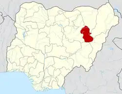 | |
This article is issued from Wikipedia. The text is licensed under Creative Commons - Attribution - Sharealike. Additional terms may apply for the media files.
