Kaltungo
Kaltungo is a Local Government Area of Gombe State, Nigeria. Its headquarters are in the town of Kaltungo in the west of the area on the A345 highway at 9°48′51″N 11°18′32″E.
Kaltungo | |
|---|---|
LGA and town | |
 Kaltungo Location in Nigeria | |
| Coordinates: 9°53′N 11°26′E | |
| Country | |
| State | Gombe State |
| Headquarters | Kaltungo |
| Government | |
| • Local Government Chairman and the Head of the Local Government Council | Musa Buba |
| • The Mai Kaltungo | Saleh Muhammed |
| Area | |
| • Total | 881 km2 (340 sq mi) |
| Population (2006 census) | |
| • Total | 149,805 |
| • Religions | Islam Christianity |
| Time zone | UTC+1 (WAT) |
| 3-digit postal code prefix | 770 |
| ISO 3166 code | NG.GO.KA |
It has an area of 881 km2 and a population of 149,805 at the 2006 census.
The postal code of the area is 770.[1]
The General Hospital in Kaltungo served snakebite victims from Duguri District, Alkaleri LGA, Bauchi State, after a flood along the River Benue in October 2012 resulted in a large increase in the population of venomous snakes. A July 2013 report indicated that over 200 people in Duguri District had died of snakebite; "whoever is lucky to make it to Kaltungo is treated in only two days and then they return home."[2]
References
- "Post Offices- with map of LGA". NIPOST. Archived from the original on 7 October 2009. Retrieved 20 October 2009.
- Agbo, Catherine (22 July 2013). "Nigeria: Snakes Kill 200 in Bauchi". allAfrica.com. Retrieved 11 May 2014.
State capital: Gombe | ||
| Local Government Areas | 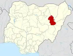 | |
This article is issued from Wikipedia. The text is licensed under Creative Commons - Attribution - Sharealike. Additional terms may apply for the media files.