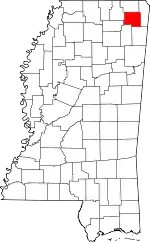
Baldwyn, Mississippi
Baldwyn is a city located in Lee and Prentiss counties, Mississippi, located in the northern part of the Tupelo micropolitan area.[5] The population was 3,297 at the 2010 census.[3]
Baldwyn, Mississippi | |
|---|---|
| City of Baldwyn | |
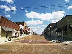 Downtown Baldwyn | |
| Motto(s): "Where Tradition Touches Tomorrow" | |
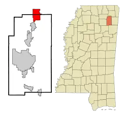 | |
 Baldwyn Location of Baldwyn in the US | |
| Coordinates: 34°30′32″N 88°38′22″W | |
| Country | |
| State | |
| Counties | |
| Incorporated | April 1, 1861 |
| Government | |
| • Type | Mayor–Council |
| • Mayor | Michael James (D) |
| • Board of Aldermen | Members
|
| Area | |
| • Total | 11.64 sq mi (30.15 km2) |
| • Land | 11.59 sq mi (30.03 km2) |
| • Water | 0.05 sq mi (0.12 km2) |
| Elevation | 404 ft (123 m) |
| Population | |
| • Total | 3,297 |
| • Estimate (2019)[4] | 3,268 |
| • Density | 281.87/sq mi (108.83/km2) |
| Time zone | UTC−06:00 (CST) |
| • Summer (DST) | UTC−05:00 (CDT) |
| ZIP code(s) | 38824, 38849 |
| Area code(s) | 662 |
| FIPS code | 28-02700 |
| GNIS feature ID | 666483 |
| Major airport | MEM |
| Website | baldwynliving |
History
Located five miles north of Guntown, the main street of Baldwyn runs along the county line of Lee and Prentiss counties. The city has the unusual distinction of having been incorporated in four counties. It was incorporated by an Act of the Legislature in Tishomingo and Itawamba counties on April 1, 1861. Tishomingo County was divided into Alcorn, Prentiss and Tishomingo in 1870, while Lee County was formed from parts of Itawamba and Pontotoc counties in 1866.[6]
Baldwyn is an outgrowth of the village of Carrollville: when the Mobile and Ohio Railroad was being built during the years of 1848 to 1861, it missed Carrollville by one and one-half miles and the citizens moved to the new town of Baldwyn, which was named for the civil engineer who surveyed the road through the town. Tishomingo, chief of the Chickasaw, lived at old Carrollville but died at Little Rock, Arkansas, in 1839 of smallpox while being moved west with his tribe.[6]
The population of Baldwyn was 3,304 in 2017.[7]
Geography
In the 2000 census, 1,892 of the city's 3,321 residents (57.0%) lived in Prentiss County and 1,429 (43.0%) in Lee County. According to the United States Census Bureau, the city has a total area of 11.6 square miles (30.0 km2), of which 11.5 square miles (29.9 km2) is land and 0.1 square mile (0.1 km2) (0.43%) is water.[8]
Demographics
| Historical population | |||
|---|---|---|---|
| Census | Pop. | %± | |
| 1870 | 133 | — | |
| 1880 | 477 | 258.6% | |
| 1900 | 560 | — | |
| 1910 | 787 | 40.5% | |
| 1920 | 922 | 17.2% | |
| 1930 | 1,106 | 20.0% | |
| 1940 | 1,279 | 15.6% | |
| 1950 | 1,567 | 22.5% | |
| 1960 | 2,023 | 29.1% | |
| 1970 | 2,366 | 17.0% | |
| 1980 | 3,427 | 44.8% | |
| 1990 | 3,204 | −6.5% | |
| 2000 | 3,321 | 3.7% | |
| 2010 | 3,297 | −0.7% | |
| 2019 (est.) | 3,268 | [4] | −0.9% |
| U.S. Decennial Census[9] | |||
As of the census[10] of 2000, there were 3,321 people, 1,331 households, and 886 families residing in the city. The population density was 287.9 sq mi). There were 1,472 housing units at an average density of 127.6 per square mile. The racial makeup of the city was 54.53% White, 43.87% African American, 0.24% Native American, 0.30% from other races, and 1.05% from two or more races. Hispanic or Latino of any race were 0.99% of the population.
There were 1,331 households, out of which 33.1% had children under the age of 18 living with them, 42.2% were married couples living together, 20.2% had a female householder with no husband present, and 33.4% were non-families. 31.5% of all households were made up of individuals, and 15.7% had someone living alone who was 65 years of age or older. The average household size was 2.42 and the average family size was 3.02.
In the city, the population was spread out, with 26.8% under the age of 18, 9.7% from 18 to 24, 24.1% from 25 to 44, 21.4% from 45 to 64, and 18.0% who were 65 years of age or older. The median age was 36 years. For every 100 females, there were 79.9 males. For every 100 females age 18 and over, there were 73.5 males.
The median income for a household in the city was $26,016, and the median income for a family was $37,598. Males had a median income of $27,162 versus $21,174 for females. The per capita income for the city was $15,430. About 19.9% of families and 24.0% of the population were below the poverty line, including 32.9% of those under age 18 and 23.3% of those age 65 or over.
Education
Baldwyn is served by the Baldwyn School District.
Baldwyn is the home of the Battle of Brices Cross Roads Mississippi's Final Stands Interpretive Center
Infrastructure
The Booneville/Baldwyn Airport is owned by the cities of Booneville and Baldwyn. It is located in Prentiss County, six nautical miles (7 mi, 11 km) southwest of Booneville's central business district.[11]
Notable people
- Tim Ford (1951-2015), Speaker of the Mississippi House of Representatives from 1988 to 2004
- Babe McCarthy (October 1, 1923 – March 17, 1975), was an American professional and collegiate basketball coach
- Laura Pendergest-Holt (born 1973), convicted Ponzi scheme artist, financier, and former Chief Investment Officer of Stanford Financial Group
- Elijah Pierce (1892-1984), American woodcarver
See also
References
- "Baldwyn: General Information". Baldwyn, Mississippi. Jeff McDaniel Marketing. n.d. Retrieved May 12, 2017.
- "2019 U.S. Gazetteer Files". United States Census Bureau. Retrieved July 26, 2020.
- "2010 City Population and Housing Occupancy Status". U.S. Census Bureau. Retrieved May 14, 2012.
- "Population and Housing Unit Estimates". United States Census Bureau. May 24, 2020. Retrieved May 27, 2020.
- U.S. Geological Survey Geographic Names Information System: Baldwyn
- Brieger, James F., ed. (1980). Hometown Mississippi. Historical and Genealogical Association of Mississippi. p. 291.
- http://worldpopulationreview.com/us-cities/baldwyn-ms-population/. Retrieved May 11, 2019. Missing or empty
|title=(help) - "Subcounty population estimates: Mississippi 2000-2006". United States Census Bureau, Population Division. June 28, 2007. Archived from the original (CSV) on November 26, 2007. Retrieved July 21, 2007.
- "Census of Population and Housing". Census.gov. Retrieved June 4, 2015.
- "U.S. Census website". United States Census Bureau. Retrieved 2008-01-31.
- FAA Airport Form 5010 for 8M1 PDF. Federal Aviation Administration. Effective 30 June 2011.
External links
- Government
- General information
- Anne Spencer Cox Library at Northeast Regional Library (nereg.lib.ms.us)
 Geographic data related to Baldwyn, Mississippi at OpenStreetMap
Municipalities and communities of Lee County, Mississippi, United States | ||
|---|---|---|
| Cities | 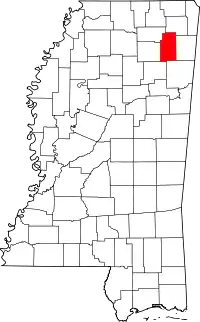 Map of Mississippi highlighting Lee County | |
| Towns | ||
| CDP | ||
Unincorporated communities | ||
| Ghost town | ||
| Footnotes | ‡This populated place also has portions in an adjacent county or counties | |
| ||
| |||||||||||||||||||||||||||||||||||||||||