Booneville, Mississippi
Booneville /ˈbuːnvɪl/ is a city in the U.S. state of Mississippi and is the county seat of Prentiss County.[5] It is located in the hilly North Mississippi region, and ecologically is part of the Southeastern Plains region.[6]
Booneville, Mississippi | |
|---|---|
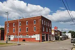 South Main Street | |
| Nickname(s): The City of Hospitality | |
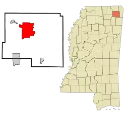 Location in Prentiss County and Mississippi | |
 Booneville Location within Mississippi  Booneville Location within the United States  Booneville Booneville (North America) | |
| Coordinates: 34°39′40″N 88°33′41″W[1] | |
| Country | |
| State | |
| County | Prentiss |
| Settled | 1858 |
| Incorporated (city) | 1861 |
| Government | |
| • Mayor | Chris Lindley |
| Area | |
| • Total | 25.79 sq mi (66.79 km2) |
| • Land | 25.75 sq mi (66.70 km2) |
| • Water | 0.03 sq mi (0.09 km2) |
| Elevation | 518 ft (158 m) |
| Population (2010) | |
| • Total | 8,743 |
| • Estimate (2019)[4] | 8,497 |
| • Density | 329.94/sq mi (127.39/km2) |
| Demonym(s) | Boonevillian |
| Time zone | UTC-6 (CST) |
| • Summer (DST) | UTC-5 (CDT) |
| ZIP code | 38829 |
| Area code(s) | 662 |
| FIPS code | 28-07780 |
| GNIS feature ID | 0667440 |
| U.S. Routes | |
| Website | www |
The city of Booneville is nicknamed "the City of Hospitality," in reference to the town's southern hospitality. The city flag, welcome sign, and city website bear the image of a magnolia blossom, a symbol of hospitality as well as the state flower of Mississippi. Booneville was incorporated in 1861[7] and named after R.H. Boone, a relative of Daniel Boone. The population was 8,743 at the 2010 census.[8] It is one of 21 certified Mississippi retirement cities.[9]
Booneville is home to Northeast Mississippi Community College, the tenth-largest community college by enrollment in the state.
History
The land of Booneville was bought by B.B. Boone, G.W. Williams, and W.P. Curlee from the Chickasaw tribesman Le-Ho-Yea. The community was named for settler Colonel Reuben Holman Boone, a relative of Daniel Boone, the early American pioneer.[10] The city was initially planned in 1848 as part of the construction on the Mobile and Ohio Railroad.[11] While the settlement grew rapidly in its early years, the American Civil War began just as the city incorporated in 1861 and slowed the city's progress.
Civil War
The Mobile and Ohio Railroad that ran through Booneville was completed shortly before the Civil War began. It was converted to military use and became a critical military target. 184 miles of the line from Union City, Tennessee to Okolona, Mississippi would be totally destroyed by 1866, causing severe financial strain for the railroad even after it was eventually rebuilt.[12]
On May 30, 1862, Col. Washington Lafayette Elliott of the 2nd Iowa Cavalry Regiment led a Union brigade to Booneville, where they destroyed the local depot and a large train loaded with munitions and captured 2,000 sick and wounded Confederates.[13]
On June 28, 1862, Col. Philip Sheridan of the Union fortified a position in Booneville after hearing that the Confederates intended to move from Tupelo to Corinth in an attempt to recapture the rail junction there. Brig. Gen. James R. Chalmers of the Confederacy led 4,700 troops in an assault that pushed the Union troops to withdraw to a backup position 2 miles (3.2 km) closer to the town. The bulk of the Union force stayed on the defensive while Sheridan sent the 2nd Michigan Cavalry under Capt. Russell Alexander and the 2nd Iowa Cavalry under Lt. Col. Edward Hatch to attack the Confederate rear and left flank. It is estimated 65 of Chalmers' men were killed; Federal casualties were one dead, 24 wounded, and 16 missing.
Korean War
On December 22, 1950, an explosion and fire at the Booneville Armory killed seven members of Company B, 198th Tank Battalion, a Mississippi Army National Guard unit. Their deaths are considered the first domestic casualties of the Korean War.
Geography
According to the United States Census Bureau, the city has a total area of 25.7 square miles (67 km2), of which 25.7 square miles (67 km2) is land and 0.04 square miles (0.10 km2) (0.16%) is water. The city is concentrated along Mississippi Highway 145 between its intersections with Mississippi Highway 30 to the south and Mississippi Highway 4 to the north. U.S. Route 45 passes through western Booneville, connecting the city with Corinth and Tupelo.
Climate
Climate is characterized by relatively high temperatures and evenly distributed precipitation throughout the year. The Köppen Climate Classification subtype for this climate is "Cfa" (Humid Subtropical Climate).[14]
| Climate data for Booneville, Mississippi | |||||||||||||
|---|---|---|---|---|---|---|---|---|---|---|---|---|---|
| Month | Jan | Feb | Mar | Apr | May | Jun | Jul | Aug | Sep | Oct | Nov | Dec | Year |
| Average high °C (°F) | 10 (50) |
12 (53) |
17 (63) |
22 (72) |
27 (80) |
31 (87) |
32 (90) |
32 (90) |
29 (85) |
23 (74) |
17 (62) |
11 (52) |
22 (71) |
| Average low °C (°F) | −1 (31) |
1 (33) |
5 (41) |
10 (50) |
14 (58) |
19 (66) |
21 (69) |
20 (68) |
17 (62) |
10 (50) |
4 (40) |
1 (33) |
10 (50) |
| Average precipitation mm (inches) | 130 (5.2) |
120 (4.9) |
150 (5.9) |
130 (5) |
130 (5) |
99 (3.9) |
100 (4) |
86 (3.4) |
86 (3.4) |
84 (3.3) |
120 (4.6) |
150 (5.8) |
1,380 (54.5) |
| Source: Weatherbase [15] | |||||||||||||
Demographics
| Historical population | |||
|---|---|---|---|
| Census | Pop. | %± | |
| 1870 | 458 | — | |
| 1880 | 603 | 31.7% | |
| 1890 | 748 | 24.0% | |
| 1900 | 1,050 | 40.4% | |
| 1910 | 1,337 | 27.3% | |
| 1920 | 1,495 | 11.8% | |
| 1930 | 1,703 | 13.9% | |
| 1940 | 1,893 | 11.2% | |
| 1950 | 3,295 | 74.1% | |
| 1960 | 3,480 | 5.6% | |
| 1970 | 5,895 | 69.4% | |
| 1980 | 6,199 | 5.2% | |
| 1990 | 7,955 | 28.3% | |
| 2000 | 8,625 | 8.4% | |
| 2010 | 8,743 | 1.4% | |
| 2019 (est.) | 8,497 | [4] | −2.8% |
| U.S. Decennial Census[16] | |||
As of the census[17] of 2000, there were 8,625 people, 3,302 households, and 2,205 families residing in the city. The population density was 335.8 people per square mile (129.6/km2). There were 3,625 housing units at an average density of 141.1 per square mile (54.5/km2). The racial makeup of the city was 79.88% White, 18.49% African American, 0.30% Native American, 0.31% Asian, 0.15% from other races, and 0.86% from two or more races. Hispanic or Latino of any race were 0.71% of the population.
There were 3,302 households, out of which 30.4% had children under the age of 18 living with them, 47.8% were married couples living together, 14.7% had a female householder with no husband present, and 33.2% were non-families. 30.7% of all households were made up of individuals, and 16.1% had someone living alone who was 65 years of age or older. The average household size was 2.35 and the average family size was 2.93.
In the city, the population was spread out, with 22.2% under the age of 18, 16.6% from 18 to 24, 23.8% from 25 to 44, 20.1% from 45 to 64, and 17.3% who were 65 years of age or older. The median age was 35 years. For every 100 females, there were 87.6 males. For every 100 females age 18 and over, there were 81.6 males.
The median income for a household in the city was $28,361, and the median income for a family was $38,918. Males had a median income of $29,667 versus $19,821 for females. The per capita income for the city was $15,128. About 11.2% of families and 15.2% of the population were below the poverty line, including 16.2% of those under age 18 and 17.6% of those age 65 or over.
As of the 2010 census, the population was 8,743.[18]
Education
- The City of Booneville is served by two public school districts - Booneville and Prentiss County.
- Booneville is home to Northeast Mississippi Community College, which has an annual enrollment in excess of 6,000 students. The community college serves five counties: Prentiss, Tippah, Alcorn, Union, and Tishomingo.[8]
Media
Newspapers
- Banner Independent
- Prentiss County Progress
Radio stations
- WBIP AM 1400 Hometown Radio
Infrastructure
Transportation
Booneville/Baldwyn Airport, located 6 mi (9.7 km) southwest of Booneville, is owned by the cities of Booneville and Baldwyn.[19]
Notable people
- Cecil Bolton, Major League Baseball first baseman for the Cleveland Indians
- George E. Allen, American political figure and head football coach for 1 game at Cumberland University
- Harold Bishop, Jr., professional football player
- Travis Childers, former congressman
- Jamie Davis, Southern rock musician
- Gene Kelton, singer-songwriter, blues musician, and band leader of Mean Gene Kelton & The Die Hards
- Hayden Thompson, is an American singer, songwriter, and rockabilly musician He is a member of the Rockabilly Hall of Fame
- Asya Branch, Miss Mississippi 2018, Miss Mississippi USA 2020, and Miss USA 2020
References
- "US Gazetteer files: 2019". United States Census Bureau. August 6, 2019. Retrieved December 12, 2020.
- "Booneville city officials sworn in". WTVA News. 2017. Retrieved July 21, 2017.
- "2019 U.S. Gazetteer Files". United States Census Bureau. Retrieved July 26, 2020.
- "Population and Housing Unit Estimates". United States Census Bureau. May 24, 2020. Retrieved May 27, 2020.
- "Find a County". National Association of Counties. Retrieved 2011-06-07.
- "Southeastern Plains". bplant.org. Retrieved 13 December 2020.
- "Booneville History". boonevillehigh.com. Retrieved 2 May 2017.
- "About Booneville". Cityofbooneville.org. Retrieved 2 May 2017.
- "Archived copy". Archived from the original on 2009-04-20. Retrieved 2009-04-07.CS1 maint: archived copy as title (link)
- "Booneville MS Historical Markers & Points of Interest - StoppingPoints.com". Stoppingpoints.com. Retrieved 2 May 2017.
- "Booneville Historic District". boonevillehistoricdistrict.com. Retrieved 12 December 2020.
- "The Mobile & Ohio Railroad & The Mississippi River". columbusky.com. Retrieved 13 December 2020.
- "Second Regiment Iowa Volunteer Cavalry". usgwarchives.net. Retrieved 13 December 2020.
- "Booneville, Mississippi Köppen Climate Classification (Weatherbase)". Weatherbase. Retrieved 2 May 2017.
- "Weatherbase.com". Weatherbase. 2013. Retrieved on August 16, 2013.
- "Census of Population and Housing". Census.gov. Retrieved June 4, 2015.
- "U.S. Census website". United States Census Bureau. Retrieved 2008-01-31.
- "Booneville, MS Population - Census 2010 and 2000 Interactive Map, Demographics, Statistics, Quick Facts - CensusViewer". censusviewer.com. Retrieved 2 May 2017.
- FAA Airport Form 5010 for 8M1 PDF. Federal Aviation Administration. Effective 30 June 2011.
External links
| Wikimedia Commons has media related to Booneville, Mississippi. |
Municipalities and communities of Prentiss County, Mississippi, United States | ||
|---|---|---|
| Cities | 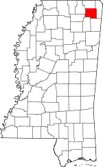 Map of Mississippi highlighting Prentiss County | |
| Towns | ||
| Unincorporated communities | ||
| Footnotes | ‡This populated place also has portions in an adjacent county or counties | |
| ||