Bangli Regency
Bangli is a regency (kabupaten) of Bali, Indonesia. It has an area of 520.81 km2 and population of 197,210 (2004). Its regency seat is Bangli.
Bangli Regency
Kabupaten Bangliᬓᬩᬸᬧᬢᬾᬦ᭄ᬩᬂᬮᬶ | |
|---|---|
 Seal | |
| Motto(s): Bhukti Mukti Bhakti | |
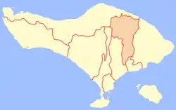 Location of Bangli Regency | |
| Coordinates: 8°17′0″S 115°20′0″E | |
| Country | |
| Province | |
| Capital | Bangli |
| Government | |
| • Regent | I Made Gianyar |
| Area | |
| • Total | 520.81 km2 (201.09 sq mi) |
| Population (2010) | |
| • Total | 213,808 |
| • Density | 410/km2 (1,100/sq mi) |
| Time zone | UTC+8 (WITA) |
| Area code(s) | +62 366 |
| Website | banglikab.go.id |

Up until 1907, Bangli was one of the nine kingdoms of Bali.[1] The capital has a famous Hindu temple, the Pura Kehen, which dates from the 11th century. Bangli also has one village, lies surround a hill, Demulih.
The northern part of the district includes the main road to the north coast passing through Kintamani and around the crater in which Gunung Batur sits.[2]
From the Demulih hill, Bali Island, particularly its southern part can be seen – Kuta, Nusa Dua, Gianyar and a part of Klungkung.
Bangli is the only regency in Bali which is landlocked.
Administration
The regency is divided into four districts (kecamatan):
- Susut
- Bangli
- Tembuku
- Kintamani
Climate
Bangli has a tropical monsoon climate (Af) with moderate rainfall from April to October and heavy rainfall from November to March.
| Climate data for Bangli | |||||||||||||
|---|---|---|---|---|---|---|---|---|---|---|---|---|---|
| Month | Jan | Feb | Mar | Apr | May | Jun | Jul | Aug | Sep | Oct | Nov | Dec | Year |
| Average high °C (°F) | 28.4 (83.1) |
28.5 (83.3) |
28.6 (83.5) |
29.2 (84.6) |
28.8 (83.8) |
28.1 (82.6) |
27.5 (81.5) |
27.8 (82.0) |
28.4 (83.1) |
29.3 (84.7) |
29.1 (84.4) |
28.8 (83.8) |
28.5 (83.4) |
| Daily mean °C (°F) | 24.4 (75.9) |
24.4 (75.9) |
24.3 (75.7) |
24.4 (75.9) |
24.0 (75.2) |
23.2 (73.8) |
22.8 (73.0) |
23.1 (73.6) |
23.6 (74.5) |
24.4 (75.9) |
24.5 (76.1) |
24.5 (76.1) |
24.0 (75.1) |
| Average low °C (°F) | 20.4 (68.7) |
20.4 (68.7) |
20.1 (68.2) |
19.6 (67.3) |
19.3 (66.7) |
18.4 (65.1) |
18.2 (64.8) |
18.4 (65.1) |
18.9 (66.0) |
19.5 (67.1) |
20.0 (68.0) |
20.3 (68.5) |
19.5 (67.0) |
| Average rainfall mm (inches) | 305 (12.0) |
331 (13.0) |
208 (8.2) |
113 (4.4) |
119 (4.7) |
110 (4.3) |
128 (5.0) |
65 (2.6) |
98 (3.9) |
123 (4.8) |
176 (6.9) |
275 (10.8) |
2,051 (80.6) |
| Source: Climate-Data.org[3] | |||||||||||||
Notes
- The nine kingdoms were Gelgel (the original kingdom, based near present-day Klungkung), Klungkung, Karangasem, Gianyar, Badung, Bangli, Buleleng Mengwi and Tabanan. For details, see Adrian Vickers, 2012, Bali, A Paradise Created, Tuttle publishing.
- p.435 of Dalton, Bill 1988 Indonesia Handbook 4th edition
- "Climate: Bangli". Climate-Data.org. Retrieved 17 November 2020.
External links
![]() East Bali travel guide from Wikivoyage
East Bali travel guide from Wikivoyage
| Wikimedia Commons has media related to Bangli Regency. |
| Districts |
| |
|---|---|---|