Bargara, Queensland
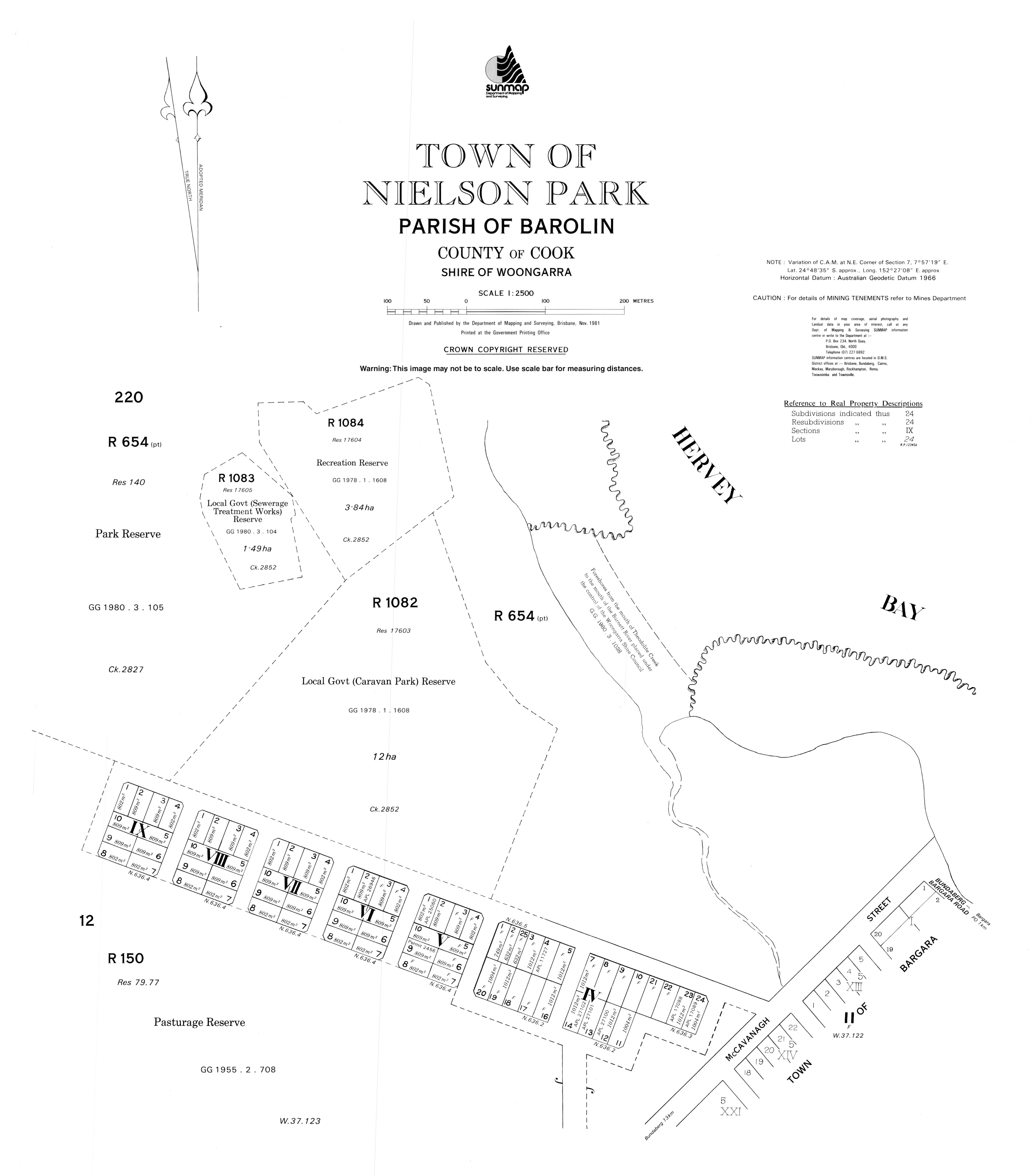
Bargara /bəˈɡɑːrə/[2] is a coastal town and locality in the Bundaberg Region, Queensland, Australia.[3][4] The town of Bargara lies 384 kilometres (239 mi) north of the state capital Brisbane and just 13 kilometres (8 mi) east of Bundaberg. Bargara is considered to be a satellite suburb of Bundaberg, with only sugar cane fields separating the two centres. Nielson Park is a town in the north of the locality (24.8075°S 152.4567°E), only 1.5 kilometres (0.93 mi) from the town of Bargara (24.8206°S 152.4625°E).[5]
| Bargara Queensland | |||||||||||||||
|---|---|---|---|---|---|---|---|---|---|---|---|---|---|---|---|
 | |||||||||||||||
 Bargara | |||||||||||||||
| Coordinates | 24.8261°S 152.4614°E | ||||||||||||||
| Population | 7,485 (2016 census)[1] | ||||||||||||||
| • Density | 805/km2 (2,085/sq mi) | ||||||||||||||
| Postcode(s) | 4670 | ||||||||||||||
| Elevation | 0–10 m (0–33 ft) | ||||||||||||||
| Area | 9.3 km2 (3.6 sq mi) | ||||||||||||||
| Location | |||||||||||||||
| LGA(s) | Bundaberg Region | ||||||||||||||
| State electorate(s) | Burnett | ||||||||||||||
| Federal Division(s) | Hinkler | ||||||||||||||
| |||||||||||||||
Geography
Bargara has grown significantly over the last decade, becoming a popular tourist and retirement destination. The main streets of Bargara are The Esplanade and Bauer Street. The Esplanade runs along the Bargara Beach foreshore, and is lined with several modern holiday homes and units. Bauer Street contains several hotels, restaurants and clothing shops. Bargara is also a popular fishing, swimming and surfing location.
The Mon Repos turtle rookery is located just north of Bargara. A wall in the reserve dating back to the very early days of settlement was constructed using Kanaka labour and rocks taken from the nearby sugarcane fields. Most of the coastline of Mon Repos is part of the Mon Repos Conservation Park, established to protect the nesting areas of sea turtles. Inland of the conversation park, much of the land is state reserves or subject to other restrictions designed to support the wildlife objectives of the conversation park.
Although officially separate towns, Nielson Park and Bargara are effectively a continuous urban area,[6] and Nielson Park is generally regarded just as a picnic ground and beach area of Bargara.[7]
History
Prior to 1913, Bargara was officially known as Sandhills. The Sandhills Provisional School opened in 1893,[8] and was renamed Bargara State School in 1921. The name Bargara is derived from the names of two adjacent localities, Barolin and Woongarra.[3][9]
Between 1912 and 1948, the Woongarra (Pemberton) railway line connected Bargara to Bundaberg.[10]
In January 1922 the Methodist Church at Sandhlls was relocated to Bargara.[11]
Bargara Post Office opened by 1923 (a receiving office had been open since 1912).[12]
In August 1945 the Anglican residents decided to erect a church.[13] St Peter's Anglican Church was dedicated in 1951.[14]
At the 2011 census, Bargara had a population of 6,893.
On Australia Day 2013, Bargara was struck by a tornado spawned by ex-Tropical Cyclone Oswald. The tornado damaged over 150 properties, and injured up to 17 people, 2 seriously.[15]
Demographics
According to the 2016 census, there were 7,485 people living in Bargara.
- Aboriginal and Torres Strait Islander people made up 2.7% of the population.
- 76.3% of people were born in Australia. The next most common countries of birth were England 6.4%, New Zealand 3.2% and South Africa 1.6%.
- 90.8% of people only spoke English at home.
- The most common responses for religion were No Religion 25.3%, Anglican 21.3%, Catholic 19.9% and Uniting Church 7.6%.[1]
Retirement resorts
Bargara is serviced by two major retirement resorts that cater to a predominantly older demographic: Palm Lake Resort and Carlyle Gardens Retirement Village.
Commerce
The main commercial precincts are the strips on Bauer Street between See Street and The Esplanade, and the section of See Street south of Bauer Street.
Bargara Central Shopping Centre located at the corner of Davidson Street and Bargara Road is the main large-scale shopping centre servicing the town. It has two supermarkets, Woolworths and Aldi. There are several restaurants and fast food stores.
Three other plazas lie adjacent to the Bauer Street commercial precincts, namely Coral Coast Plaza, Bargara Beach Plaza. One more small shopping complex exists at the entrance to the Carlyle Gardens Retirement Village on Woongarra Scenic Drive.
Religion
- St Peter's Anglican Church, 21 Bauer Street (corner of Tanner Street, 24.8163°S 152.4614°E)[16]
- Bargara Uniting Church, corner of Hughes Road and Blain Street
- St James’ Church, 38 See Street, Bargara
Education
Despite being a medium town, Bargara does not have an educational institution within its boundary. The nearest school located on the outskirts of the town, Bargara State School, actually lies in the nearby locality of Mon Repos.
Transport
The town is serviced by the main roads of Bargara Road, Bauer Street, See Street, The Esplanade, Miller Street and Woongarra Scenic Drive.
Bus route no. 4 connects Bargara with the City and Sugarland Shopping Centre, running 7 days a week via Bauer Street, The Esplanade, Miller Street and Innes Park North.
Parks and open spaces
- Bargara Esplanade
- Nielson Park (24.8091°S 152.4583°E)[17]
- Bell Fritz Park
- Mary Kinross Memorial Park
- Bargara Rotary Park
- Kelly's Beach Park
- Barolin Nature Reserve - It is filled with grassy plains and wetlands and has a sizeable population of birds. Earlier known as Pasturage Reserve, it was primarily used for cattle grazing. However, grazing has been reduced significantly to save the forest.[18]
Sport
- Bargara Golf Club
- Sandhills Sports Club
- Bundaberg Surf Lifesaving Club
- Bargara Football Club
Gallery
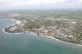
 View from the Hummock
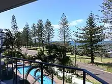
 Bus stop on The Esplanade
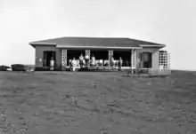
 Bargara Golf Club, c. 1931
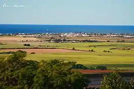
 Kelly's Beach Sunrise
References
- Australian Bureau of Statistics (27 June 2017). "Bargara (State Suburb)". 2016 Census QuickStats. Retrieved 11 March 2018.

- Macquarie Dictionary, Fourth Edition (2005). Melbourne, The Macquarie Library Pty Ltd. ISBN 1-876429-14-3
- "Bargara – town (entry 40971)". Queensland Place Names. Queensland Government. Retrieved 14 March 2014.
- "Bargara – locality (entry 44684)". Queensland Place Names. Queensland Government. Retrieved 12 September 2016.
- "Nielson Park – town in Bundaberg Region (entry 48151)". Queensland Place Names. Queensland Government. Retrieved 10 June 2019.
- "Queensland Globe". State of Queensland. Retrieved 20 October 2019.
- "Bargara". Queensland Places. Centre for the Government of Queensland, University of Queensland. Retrieved 20 October 2019.
- "Opening and closing dates of Queensland Schools". Queensland Government. Retrieved 18 April 2019.
- "Bargara State School". Queensland Government. Archived from the original on 6 July 2011. Retrieved 28 January 2010.
- Australian Railway Historical Society Bulletin, November 1964, pp. 210–217
- "Bargara Methodist Church". The Bundaberg Mail. 52 (7, 979). Queensland, Australia. 27 January 1922. p. 2. Retrieved 23 September 2020 – via National Library of Australia.
- Premier Postal History. "Post Office List". Premier Postal Auctions. Retrieved 10 May 2014.
- "Transcontinental news round-up". Guinea Gold (Australian edition). 3 (266). 12 August 1945. p. 2. Retrieved 23 September 2020 – via National Library of Australia.
- "Year Book" (PDF). Anglican Archdiocese of Brisbane. 2019. p. 135. Archived (PDF) from the original on 15 September 2020. Retrieved 15 September 2020.
- Marsh, Vanessa (26 January 2013). "Tornado couple transferred to Brisbane hospital". NewsMail. Bundaberg. Archived from the original on 6 January 2014. Retrieved 14 March 2014.
- "21 Bauer Street, Bargara". Google Maps. Retrieved 23 September 2020.
- "Land for public recreation - Queensland". Queensland Open Data. Queensland Government. 20 November 2020. Archived from the original on 22 November 2020. Retrieved 22 November 2020.
- "Barolin Nature Reserve". Bundaberg Regional Council.
External links
| Wikimedia Commons has media related to Bargara, Queensland. |