Bataraza
Bataraza, officially the Municipality of Bataraza (Tagalog: Bayan ng Bataraza), is a 1st class municipality in the province of Palawan, Philippines. According to the 2015 census, it has a population of 75,468 people. [3]
Bataraza
Bayan ng Bataraza | |
|---|---|
| Municipality of Bataraza | |
 Seal | |
| Nickname(s): Pineapple Capital of Palawan | |
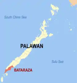
 Map of Palawan with Bataraza highlighted | |
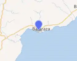
OpenStreetMap 
| |
.svg.png.webp) Bataraza Location within the Philippines | |
| Coordinates: 8°40′N 117°37′E | |
| Country | |
| Region | Mimaropa (Region IV-B) |
| Province | Palawan |
| District | 2nd district |
| Founded | January 1, 1964 |
| Named for | Bataraza Narrazid |
| Barangays | 23 (see Barangays) |
| Government | |
| • Type | Sangguniang Bayan |
| • Mayor | Abraham M. Ibba |
| • Vice Mayor | Kennedy A. Jaafar |
| • Representative | Cyrille F. Abueg-Zaldivar |
| • Electorate | 45,705 voters (2019) |
| Area | |
| • Total | 726.20 km2 (280.39 sq mi) |
| Elevation | 55 m (180 ft) |
| Highest elevation | 614 m (2,014 ft) |
| Lowest elevation | 0 m (0 ft) |
| Population | |
| • Total | 75,468 |
| • Density | 100/km2 (270/sq mi) |
| • Households | 17,923 |
| Economy | |
| • Income class | 1st municipal income class |
| • Poverty incidence | 40.34% (2015)[4] |
| • Revenue | ₱174,584,940.17 (2016) |
| Service provider | |
| • Electricity | Palawan Electric Cooperative |
| Time zone | UTC+8 (PST) |
| ZIP code | 5306 |
| PSGC | |
| IDD : area code | +63 (0)48 |
| Climate type | tropical climate |
| Native languages | Molbog Palawano Tagalog |
The municipality was named after Datu Bataraza Narrazid, a locally influential Muslim chieftain and father of the town's first mayor and former mayor of Brooke's Point, then Datu Sapiodin Narrazid. Bataraza was part of the municipality of Brooke's Point until 1964 by the virtue of Philippine RA 3425.[5]
Main industries of Bataraza includes farming, fishing, and nickel mining and processing.
Geography
Bataraza is located on the southernmost tip of Palawan Island, approximately 225 kilometres (140 mi) from Puerto Princesa City and about five to six hours by land. It has total land area of 957 km².
Bataraza is situated some 775 km (480 mi) south-west of Manila, between roughly 8.3 and 8.75 degrees latitude north of the equator. It stretches approximately 80 kilometres (50 mi) in north-easterly to south-westerly direction along the Sulu Sea, from the Malis River to Cape Buliluyan in the south. On the western side, it extends up to Wangly River.
It is bounded in the east by the Sulu Sea, in the west by a great mountain range, extending from Mount Mantalingahan (the highest peak in the province) to Mount Malitub, which serves as the divider between Bataraza and Rizal, and in the south-west by the South China Sea. Two large crocodiles were recovered here and were taken to Crocodile Farm in Puerto Princesa City.
Barangays
Bataraza is politically subdivided into 23 barangays:
Rio Tuba is one of the populated barangays of Bataraza and known for its nickel mineral reserves. The primary mine site of Rio Tuba Nickel Mining Corporation is located within its jurisdiction.
Climate
| Climate data for Bataraza, Palawan | |||||||||||||
|---|---|---|---|---|---|---|---|---|---|---|---|---|---|
| Month | Jan | Feb | Mar | Apr | May | Jun | Jul | Aug | Sep | Oct | Nov | Dec | Year |
| Average high °C (°F) | 30 (86) |
31 (88) |
31 (88) |
31 (88) |
30 (86) |
30 (86) |
30 (86) |
29 (84) |
29 (84) |
29 (84) |
29 (84) |
30 (86) |
30 (86) |
| Average low °C (°F) | 23 (73) |
23 (73) |
23 (73) |
24 (75) |
25 (77) |
25 (77) |
25 (77) |
25 (77) |
25 (77) |
25 (77) |
24 (75) |
24 (75) |
24 (76) |
| Average precipitation mm (inches) | 64 (2.5) |
55 (2.2) |
90 (3.5) |
93 (3.7) |
169 (6.7) |
215 (8.5) |
206 (8.1) |
181 (7.1) |
190 (7.5) |
219 (8.6) |
182 (7.2) |
115 (4.5) |
1,779 (70.1) |
| Average rainy days | 13.1 | 15.1 | 17.3 | 19.4 | 26.8 | 26.8 | 27.8 | 26.9 | 27.1 | 28.3 | 25.4 | 20.1 | 274.1 |
| Source: Meteoblue [6] | |||||||||||||
Demographics
|
| |||||||||||||||||||||||||||||||||
| Source: Philippine Statistics Authority [3] [7] [8][9] | ||||||||||||||||||||||||||||||||||
In the 2015 census, the population of Bataraza was 75,468 people, [3] with a density of 100 inhabitants per square kilometre or 260 inhabitants per square mile.
Economy
| Poverty Incidence of Bataraza | |
| Source: Philippine Statistics Authority[10][11][12][13][14][15] | |
Culture
The Molbog people dominate the municipality of Bataraza, as well as the municipality of Balabac in the south. The area constitute the homeland of the Molbog people since the classical era prior to Spanish colonization. The Molbog are known to have a strong connection with the natural world, especially with the sacred pilandok (Philippine mouse-deer), which can only be found in the Balabac islands. A Muslim tale tells the Philippine mouse-deer once tricked a prince into giving up his bag of gold and facing a hive of angry bees.[16] Another tale depicts him as a clever guardian of the environment, using his wisdom as an advantage against those who destroy forests, seas, and wildlife.[17] The coconut is especially important in Molbog culture at it is their most prized agricultural crop.[18]
References
- Municipality of Bataraza | (DILG)
- "Province: Palawan". PSGC Interactive. Quezon City, Philippines: Philippine Statistics Authority. Retrieved 12 November 2016.
- Census of Population (2015). "Region IV-B (Mimaropa)". Total Population by Province, City, Municipality and Barangay. PSA. Retrieved 20 June 2016.
- https://psa.gov.ph/sites/default/files/City%20and%20Municipal-level%20Small%20Area%20Poverty%20Estimates_%202009%2C%202012%20and%202015_0.xlsx; publication date: 10 July 2019; publisher: Philippine Statistics Authority.
- "Bataraza" (PDF). Provincial Government of Palawan. Archived from the original (PDF) on 17 April 2012. Retrieved 22 November 2012.
- "Bataraza: Average Temperatures and Rainfall". Meteoblue. Retrieved 17 November 2019.
- Census of Population and Housing (2010). "Region IV-B (Mimaropa)". Total Population by Province, City, Municipality and Barangay. NSO. Retrieved 29 June 2016.
- Censuses of Population (1903–2007). "Region IV-B (Mimaropa)". Table 1. Population Enumerated in Various Censuses by Province/Highly Urbanized City: 1903 to 2007. NSO.
- "Province of Palawan". Municipality Population Data. Local Water Utilities Administration Research Division. Retrieved 17 December 2016.
- "Poverty incidence (PI):". Philippine Statistics Authority. Retrieved 28 December 2020.
- https://psa.gov.ph/sites/default/files/NSCB_LocalPovertyPhilippines_0.pdf; publication date: 29 November 2005; publisher: Philippine Statistics Authority.
- https://psa.gov.ph/sites/default/files/2003%20SAE%20of%20poverty%20%28Full%20Report%29_1.pdf; publication date: 23 March 2009; publisher: Philippine Statistics Authority.
- https://psa.gov.ph/sites/default/files/2006%20and%202009%20City%20and%20Municipal%20Level%20Poverty%20Estimates_0_1.pdf; publication date: 3 August 2012; publisher: Philippine Statistics Authority.
- https://psa.gov.ph/sites/default/files/2012%20Municipal%20and%20City%20Level%20Poverty%20Estima7tes%20Publication%20%281%29.pdf; publication date: 31 May 2016; publisher: Philippine Statistics Authority.
- https://psa.gov.ph/sites/default/files/City%20and%20Municipal-level%20Small%20Area%20Poverty%20Estimates_%202009%2C%202012%20and%202015_0.xlsx; publication date: 10 July 2019; publisher: Philippine Statistics Authority.
- "Tales of Laughter - Pilandok and the Sumusong-sa-Alongan". Archived from the original on 2011-07-26. Retrieved 2019-02-09.
- https://www.goodreads.com/series/214755-pilandok
- http://ncca.gov.ph/about-culture-and-arts/culture-profile/glimpses-peoples-of-the-philippines/molbog/