Bay View, New Zealand
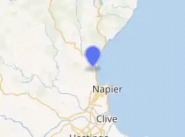
Bay View is a settlement in the Hawke's Bay region of the eastern North Island of New Zealand. It lies on State Highway 2, nine kilometres north of the city centre of Napier. The Esk River flows into the sea just to the north. Hawke's Bay Airport and the Napier suburb of Westshore lie just to the south. Bay View has been administered by the Napier City Council since the 1989 local government reforms.[2]
Bay View | |
|---|---|
| |
| Coordinates: 39.428°S 176.857°E | |
| Country | New Zealand |
| Region | Hawke's Bay |
| Territorial authority | Napier City |
| Ward | Ahuriri |
| Population (2018)[1] | |
| • Total | 2,238 |
William Colenso of the Church Missionary Society established a mission outstation named Bethany here. Māori transliterated Bethany as Pētane and this became the name of the area.[2] Pētane was seized by Maori in the early 1860s with the idea of attacking Napier.[3] The name of the area was changed to Bay View in 1924 to avoid confusion with Petone in the Wellington region.[2]
Hawke's Bay Airport is at the southern end of Bay View.
Demographics
| Year | Pop. | ±% p.a. |
|---|---|---|
| 2006 | 1,773 | — |
| 2013 | 1,920 | +1.14% |
| 2018 | 2,238 | +3.11% |
| Source: [1] | ||
Bay View had a population of 2,238 at the 2018 New Zealand census, an increase of 318 people (16.6%) since the 2013 census, and an increase of 465 people (26.2%) since the 2006 census. There were 762 households. There were 1,122 males and 1,119 females, giving a sex ratio of 1.0 males per female. The median age was 46 years (compared with 37.4 years nationally), with 444 people (19.8%) aged under 15 years, 294 (13.1%) aged 15 to 29, 1,122 (50.1%) aged 30 to 64, and 381 (17.0%) aged 65 or older.
Ethnicities were 90.8% European/Pākehā, 17.0% Māori, 0.9% Pacific peoples, 2.3% Asian, and 1.5% other ethnicities (totals add to more than 100% since people could identify with multiple ethnicities).
The proportion of people born overseas was 13.1%, compared with 27.1% nationally.
Although some people objected to giving their religion, 60.6% had no religion, 30.2% were Christian, 0.3% were Hindu, 0.3% were Buddhist and 2.8% had other religions.
Of those at least 15 years old, 324 (18.1%) people had a bachelor or higher degree, and 300 (16.7%) people had no formal qualifications. The median income was $36,500, compared with $31,800 nationally. The employment status of those at least 15 was that 939 (52.3%) people were employed full-time, 294 (16.4%) were part-time, and 33 (1.8%) were unemployed.[1]
Marae
Petane Marae is located in Bay View. It is a meeting ground for the iwi (tribe) of Ngāti Kahungunu and its hapū (sub-tribes) of Ngāti Matepu and Ngāti Whakaari, and includes the wharenui (meeting house) of Te Amiki.[4][5]
In October 2020, the Government committed $6,020,910 from the Provincial Growth Fund to upgrade a group of 18 marae, including Petane Marae. The funding was expected to create 39 jobs.[6]
References
- "Statistical area 1 dataset for 2018 Census". Statistics New Zealand. March 2020. Bay View (212300). 2018 Census place summary: Bay View
- "Coastal Hazards Social Impact Assessment & Valuation for Ahuriri/Pandora, Westshore, Bay View and Whirinaki" (PDF). 2017. p. 16. Retrieved 2 January 2020.
- The Cyclopedia of New Zealand Taranaki, Hawke's Bay & Wellington Provincial Districts. Christchurch: Printed Horace J. Weeks, Ltd. 1908.
- "Te Kāhui Māngai directory". tkm.govt.nz. Te Puni Kōkiri.
- "Māori Maps". maorimaps.com. Te Potiki National Trust.
- "Marae Announcements" (Excel). growregions.govt.nz. Provincial Growth Fund. 9 October 2020.